• English
  • Español
  • Français

United
Nations


Office for Outer Space Affairs
UN-SPIDER Knowledge Portal

  • Inicio
  • Sobre nosotros
    • Sobre ONU-SPIDER
    • Acerca de UNOOSA
    • Publicaciones
    • Ofertas de trabajo
    • Conozca el Equipo
    • Contacto
  • Aplicación Espacial
    • Guías Tecnológicas
    • Mecanismos de Emergencia
    • Mecanismos de Recuperación
    • Red Internacional de Alerta de Asteroides
    • Grupo Asesor para la Planificación de Misiones Espaciales
    • Iniciativa Internacional sobre Meteorología Espacial
    • Tecnologías Espaciales en la ONU
    • Historias de Usuarios
  • Enlaces y Recursos
    • Aplicación de datos del mes
      • Disaster Recovery
    • Fuentes de Datos
    • SIG y Software de Percepción Remota
    • Recursos de capacitación en línea
    • Instituciones
  • Riesgos y Desastres
    • Gestión del Riesgo de Desastres
    • Alerta temprana
    • Gestión de Desastres y Emergencias
    • Amenazas Naturales
    • El Proceso de la Reducción de Desastres Post-2015
    • La ONU y la Gestión del Riesgo de Desastres
    • La ONU y Alerta Temprana
    • La ONU y la Gestión de Desastres
  • Asesoría
    • Misiones de Asesoría
    • Apoyo en caso de Emergencia
    • Asesoría Virtual
    • Prácticas Recomendadas
    • Actividades de Entrenamiento
    • Usos Prácticos
  • Redes
    • Oficinas Regionales de Apoyo
    • GP-STAR
    • IN-MHEWS
    • IWG-SEM
  • Proyectos
    • SPEAR
    • FOSAT-S
    • EvIDENz
    • Flood GUIDE
  • Noticias y Eventos
    • Noticias
    • Eventos
    • Eventos pasados

Breadcrumb

  • Home
  • Mexico: Coral Reef Protection With Satellite Technology
  • Mexico: Coral reef protection with satellite technology

Mexico: Coral reef protection with satellite technology

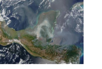
MODIS image a smoke cloud over Yucatan Peninsula, MexicoCloud of smoke over Yucatan Peninsula

The Mexican National Commission for Knowledge and Use of Bioiversity (CONABIO) contracted a provider of satellite data EOMAP to deliver high resolution environmental information of the Maya Coast, Yucatan peninsula, the Mexican Caribbean sea coast.

More than 5000 sq km of the marine environment, including ecosystems such as corals were mapped in water depths to 25m. The CEO of EOMAP, Dr. Thomas Heege, hopes that the gathered imagery will serve the authorities as a first baseline dataset for preservation of the vulnerable ecosystems. Traditional surveys of the coastline were too expensive and time consuming, while the new highest spatial multi-spectral resolution satellite data used for the Bathymetry and Seafloor EOMAP survey was easier to access by CONABIO. The scientists of the Mexican Agency assert the high value of the satellite data for the short and long term assessment of the climate, disaster and human-made impacts to the ecosystems.
The American Surveyor
Wed, 15 Jan 2014 - 11:29
Mexico

Footer menu

  • Contact
  • Terms of Use

User account menu

  • Log in