UN-SPIDER's network of Regional Support Offices is currently developing Recommended Practices on the use of space-based information for disaster risk management and emergency response. The practices deal with a variety of topics such as droughts, floods, agricultural monitoring or land degradation and include detailed information on the data and methodologies used as well as step-by-step instructions.
Six practices have already been submitted by Regional Support Office with others to follow. These practices will be discussed at the upcoming 5th UN-SPIDER RSO-Meeting on 13 and 14 February 2014 in Vienna, Austria, and will be disseminated through the UN-SPIDER Knowledge Portal once final.
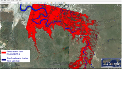
Flood Mapping: This practice is devoted to the use of SAR satellite imagery for flood mapping. The practice shows the use of ESA NEST software for pre-processing and processing of SAR imagery using a threshold method for deriving the flood extent. QuantumGIS is used as a software to visualize the results of image processing. This practice was developed by the Space Research Institute NASU-SSAU, Ukraine.
Crop Yield Forecasting: This practice is focused on using NDVI (Normalized Difference Vegetation Index) values derived from MODIS to build a linear regression model for crop yield forecasting. It is shown how QuantumGIS software can be used to extract average NDVI values over administrative regions. This data is further integrated with official statistics on crop yield to build a regression model. For this purpose, any statistical package can be used. This practice was developed by the Space Research Institute NASU-SSAU, Ukraine.
Flood risk management and response: This practice presents three examples of using satellite data in the context of floods. Two are focusing on risk management through flood plain delineation using topographic analysis based on free SRTM elevation data. The third practice is looking at water body detection for rapid flood mapping in emergency situations using SAR data. This practice was developed by the National Space Research and Development Agency (NASRDA), Nigeria and the National Space Activities Commission (CONAE), Argentina. The Agustin Codazzi Geographic Institute (IGAC) developed an additional practice on flood susceptibility based on Radarsat 2 and CosmoSkyMed data, Ultracam D, RapidEye and SPOT 5 data, SRTM digital elevation model and high resolution digital terrain model as well as field data. The final susceptibility map contains information on geology, geomorphology, soils, and land use and land cover.
Drought Monitoring and Assessment: This practice explains the creation of multi-temporal drought severity maps based on MODIS satellite data using different satellite based vegetation Indices, such as NDVI, NDVI-Dev, VHI, VCI, TCI and WSVI. Based on the most appropriate selected Index, a variation matrix for certain months in particular region(s) is obtained. This practice was developed by the Iranian Space Agency (ISA), Iran.
Land Degradation Montoring: This practice is demontrating a modelling approach for land degradation monitoring. Input data include free satellite based rainfall, slope, and vegetation data plus popultaion, soil and various baseline datasets. The resulting potential and actual land degradation index map, change map, and land degradation hotspots can be used to support policy decisions for combating land degradation and appropriate planning of natural resources. This practice is developed by the Regional Centre for Mapping of Resources for Development (RCMRD) in Kenya based on results of the AMESD project.
Further Regional Support Offices are currently working on additional recommended practices.
The Recommended Practices are complementing a similar effort of Regional Support Offices on documenting lessons learned on the use of Space-based information in the case of a particular disaster in the country of the RSO. In the context of these booklets, the Space and Upper Atmosphere Research Commission (SUPARCO) of Pakistan focused on floods, the Iranian Space Agency on drought and the Indonesian National Institute of Aeronautics and Space (LAPAN) focused on forest fires. The documents are still being reviewed and will be made available on the UN-SPIDER Knowledge Portal.


