![]()
United
Nations
Space-based Measurement, Mapping, and Modeling of Surface Water (DFO)
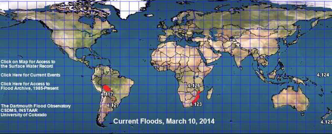
| Data provided by: | Dartmouth Flood Observatory (DFO) |
| Data accessibility: | Exportar datos, Exportar mapa, Datos estadísticos (ej. gráficos), Visualización de datos (ej. web SIG o monitoreo en tiempo real) |
| Link to the data: | |
| Data type: | Datos sobre amenazas específicas |
| Hazard: | Flood, Severe Storm |
| Disaster cycle phase: | Gestión des Riesgo por Desastres, Respuesta, Recuperación |
| Space-based Information: | MODIS, LANDSAT 8, Sentinel 1 - SAR Dataset |
| Spatial coverage: | Global, Latin America and the Caribbean, United States of America |
| Spatial resolution: | 10.00 |
| Content dates: | 1985-present |
| Technical Specifications: | |
| Costs: | Gratis |
| Contact: | Staff |
| Tutorials on the use of data: | Record Guide (Check for the related PPT link on Technical Notes for The Surface… |
| Restrictions/ Citation of the dataset: |
![]()