![]()
United
Nations
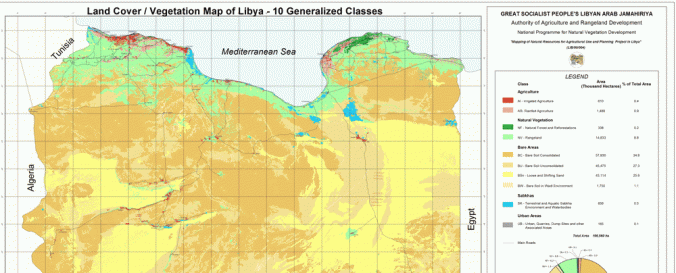
Land Cover, Libya (Africover, FAO)
| Data provided by: | Food and Agriculture Organization of the United Nations (FAO) |
| Data accessibility: | Exportar datos |
| Data type: | Datos sobre el use suelo, cobertura del terreno |
| Disaster cycle phase: | Gestión des Riesgo por Desastres |
| Satellites and Sensors: | Landsat 4 |
| Spatial coverage: | Libya |
| Spatial resolution: | 100.00 - 1000.00 |
| Temporal coverage: | Archivado |
| Content dates: | 2001-2002 |
| Technical Specifications: | |
| Costs: | Gratis |
| Contact: | GIS-Manager@fao.org |
| Restrictions/ Citation of the dataset: | Restriction: Withheld from general circulation or disclosure. |
Provider
![]()