• English
  • Español
  • Français

United
Nations


Office for Outer Space Affairs
UN-SPIDER Knowledge Portal

  • Inicio
  • Sobre nosotros
    • Sobre ONU-SPIDER
    • Acerca de UNOOSA
    • Publicaciones
    • Ofertas de trabajo
    • Conozca el Equipo
    • Contacto
  • Aplicación Espacial
    • Guías Tecnológicas
    • Mecanismos de Emergencia
    • Mecanismos de Recuperación
    • Red Internacional de Alerta de Asteroides
    • Grupo Asesor para la Planificación de Misiones Espaciales
    • Iniciativa Internacional sobre Meteorología Espacial
    • Tecnologías Espaciales en la ONU
    • Historias de Usuarios
  • Enlaces y Recursos
    • Aplicación de datos del mes
      • Disaster Recovery
    • Fuentes de Datos
    • SIG y Software de Percepción Remota
    • Recursos de capacitación en línea
    • Instituciones
  • Riesgos y Desastres
    • Gestión del Riesgo de Desastres
    • Alerta temprana
    • Gestión de Desastres y Emergencias
    • Amenazas Naturales
    • El Proceso de la Reducción de Desastres Post-2015
    • La ONU y la Gestión del Riesgo de Desastres
    • La ONU y Alerta Temprana
    • La ONU y la Gestión de Desastres
  • Asesoría
    • Misiones de Asesoría
    • Apoyo en caso de Emergencia
    • Asesoría Virtual
    • Prácticas Recomendadas
    • Actividades de Entrenamiento
    • Usos Prácticos
  • Redes
    • Oficinas Regionales de Apoyo
    • GP-STAR
    • IN-MHEWS
    • IWG-SEM
  • Proyectos
    • SPEAR
    • FOSAT-S
    • EvIDENz
    • Flood GUIDE
  • Noticias y Eventos
    • Noticias
    • Eventos
    • Eventos pasados

Breadcrumb

  • Home
  • Malawi: International Charter Activated For Storm
  • Malawi: International Charter activated for storm

Malawi: International Charter activated for storm

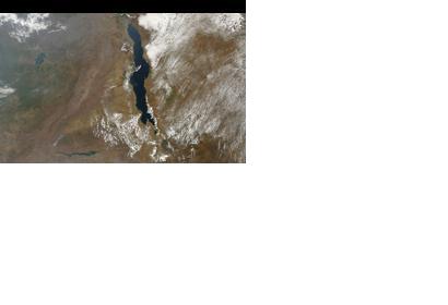
Malawi seen from spaceMalawi seen from space (Image: NASA)

The International Charter: Space and Major Disasters was triggered to provide satellite-based emergency maps in response to a major storm in Lilongwe district, Malawi on 2 January 2015. The mechanism was activated by the US Geological Survey on behalf of Dept of Disaster Management Affairs, Malawi.

The International Charter reported: "The unexpectedly heavy rain and hail destroyed over 200 homes in Lilongwe, leaving dozens of people without homes. One person was also killed during the storm. Lilongwe district is located in the centre of Malawi, and the capital city (which bears the same name), as well as villages in the area suffered the most damage from the storm."

The satellite-based maps will be uploaded to the International Charter's website as soon as they become available.
International Charter
Tue, 6 Jan 2015 - 12:53

Footer menu

  • Contact
  • Terms of Use

User account menu

  • Log in