  • English
  • Español
  • Français

United
Nations


Office for Outer Space Affairs
UN-SPIDER Knowledge Portal

  • Inicio
  • Sobre nosotros
    • Sobre ONU-SPIDER
    • Acerca de UNOOSA
    • Publicaciones
    • Ofertas de trabajo
    • Conozca el Equipo
    • Contacto
  • Aplicación Espacial
    • Guías Tecnológicas
    • Mecanismos de Emergencia
    • Mecanismos de Recuperación
    • Red Internacional de Alerta de Asteroides
    • Grupo Asesor para la Planificación de Misiones Espaciales
    • Iniciativa Internacional sobre Meteorología Espacial
    • Tecnologías Espaciales en la ONU
    • Historias de Usuarios
  • Enlaces y Recursos
    • Aplicación de datos del mes
      • Disaster Recovery
    • Fuentes de Datos
    • SIG y Software de Percepción Remota
    • Recursos de capacitación en línea
    • Instituciones
  • Riesgos y Desastres
    • Gestión del Riesgo de Desastres
    • Alerta temprana
    • Gestión de Desastres y Emergencias
    • Amenazas Naturales
    • El Proceso de la Reducción de Desastres Post-2015
    • La ONU y la Gestión del Riesgo de Desastres
    • La ONU y Alerta Temprana
    • La ONU y la Gestión de Desastres
  • Asesoría
    • Misiones de Asesoría
    • Apoyo en caso de Emergencia
    • Asesoría Virtual
    • Prácticas Recomendadas
    • Actividades de Entrenamiento
    • Usos Prácticos
  • Redes
    • Oficinas Regionales de Apoyo
    • GP-STAR
    • IN-MHEWS
    • IWG-SEM
  • Proyectos
    • SPEAR
    • FOSAT-S
    • EvIDENz
    • Flood GUIDE
    • CommonSpace Initiative
    • Tonga Pilot Project
  • Noticias y Eventos
    • Noticias
    • Eventos
    • Eventos pasados

Breadcrumb

  • Home
  • Proba-V
  • Proba-V

Proba-V

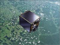
The Proba-V satellite may only be slightly larger than a washing machine, but it is tasked with a full-scale mission. This miniature satellite is designed to map land cover and vegetation growth across the entire globe every two days. Over the last decade 'Proba' has become synonymous with small high-performance satellites, designed around innovation. The two previous satellites in the series were demonstration missions to give promising technologies an early chance to fly in space. They were overseen by ESA’s Directorate of Technical and Quality Management. Although designed as a demonstration mission, the success of the first Proba satellite led to it being operated as an Earth observation Third Party Mission. Proba-1 carries a high-resolution imaging spectrometer. 

The 'V' stands for Vegetation – a lighter but fully functional redesign of the ‘Vegetation’ imaging instrument previously flown on France’s full-sized Spot-4 and Spot-5 satellites.

Launched on 7 May 2013, Proba-V has been designed to continue the supply of this much needed imagery for applications such as climate impact assessments, water resource management, agricultural monitoring and food security estimates.

Instrument: Vegetation
- swath width: 2250km (global coverage every 2 days)
- 4 spectral bands: blue, red, near-infrared and mid-infrared
- ground resolution of 350m

7 May 2013
5years
Sun synchronous
VEGETATION
ESA
General land use in relation to vegetation cover and its changes; vegetation behavior to strong meteorological events and climate changes; disaster management; biophysical parameters for model input devoted to water budgets and primary productivity
Sequía
Desborde de lago glaciar
Floración de Algas Nocivas
Temperature extrema
Inundación
Incendio
No
Information about Proba-V on ESA web page

Footer menu

  • Contact
  • Terms of Use

User account menu

  • Log in