![]()
United
Nations
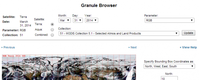
MODIS Level 1, Atmosphere and Land data products (NASA)
| Data provided by: | National Aeronautics and Space Administration (NASA) |
| Data accessibility: | export data, export map, visualization of data (e.g. web GIS or real time monitoring), web processing/cloud computing |
| Link to the data: | |
| Requirements: | Linux, IRIX, Solaris, Windows, and Mac |
| Data type: | land use, land cover data, satellite data or aerial image |
| Hazard: | Drought, Tsunami, Volcanic Eruption, Flood, Extreme Temperature |
| Disaster cycle phase: | Disaster Risk Management |
| Spatial coverage: | Global |
| Spatial resolution: | 250.00 |
| Temporal coverage: | Archive, Near-real time |
| Content dates: | 2000 - 2014 |
| Technical Specifications: | |
| Costs: | free |
| Contact: | Contact |
| Tutorials on the use of data: | Quick Start Guide of MODIS Webservice |
| Restrictions/ Citation of the dataset: |
Provider
![]()