![]()
United
Nations
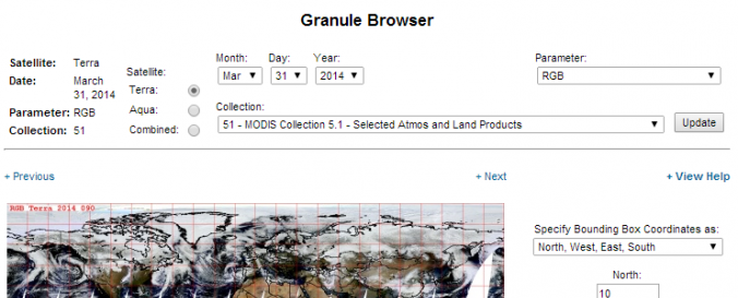
MODIS Level 1, Atmosphere and Land data products (NASA)
| Data provided by: | National Aeronautics and Space Administration (NASA) |
| Data accessibility: | Exportar datos, Exportar mapa, Visualización de datos (ej. web SIG o monitoreo en tiempo real), Procesamiento web/computación en la nube |
| Link to the data: | |
| Requirements: | Linux, IRIX, Solaris, Windows, and Mac |
| Data type: | Datos sobre el use suelo, cobertura del terreno, Datos satelitales o imágenes aéreas |
| Hazard: | Drought, Tsunami, Volcanic Eruption, Flood, Extreme Temperature |
| Disaster cycle phase: | Gestión des Riesgo por Desastres |
| Spatial coverage: | Global |
| Spatial resolution: | 250.00 |
| Temporal coverage: | Archivado, Casi en tiempo real |
| Content dates: | 2000 - 2014 |
| Technical Specifications: | |
| Costs: | Gratis |
| Contact: | Contact |
| Tutorials on the use of data: | Quick Start Guide of MODIS Webservice |
| Restrictions/ Citation of the dataset: |
Provider
![]()