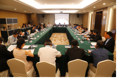
From 2 to 5 June 2015 UN-SPIDER, the National Disaster Reduction Centre of China (NDRCC), and UNESCAP jointly organized the four-day workshop of East Asia Summit (EAS) workshop on ‘Applications of Space Information Technology in Major Natural Disaster Monitoring and Assessment’ and 2nd ASEAN workshop on ‘Development of mechanisms for acquisition and utilisation of space-based information during emergency response. Nearly 50 government representatives and experts from 11 countries, 7 regional and international organizations and 14 research institutes attended the workshop to share experiences on applications of space-based information in major natural disaster monitoring and assessment. Both events took place in Hangzhou, China.
The EAS workshop included sessions on advance remote sensing technologies as well as the service of space based information for space-based disaster risk reduction. A special focus was placed on technology and applications using multi-source and multi-scale imagery for disaster management, acquisition mechanisms and networks, platforms for disaster management, a well as public-private partnerships.
The ASEAN workshop continued to advocate the development of a mechanism build on the outcomes of the 1st ASEAN workshop on ‘Development of mechanisms for acquisition and utilization of space-based information during emergency response’ which was co-organized by AHA Centre, UN-SPIDER, LAPAN, and ESCAP in Yogyakarta from 15 to 16 April 2014. In the 2nd ASEAN workshop, the guideline document of acquisition and utilization of space-based information for emergency response together with the Standard Operating Procedures (SOPs) document for ‘requesting space-based information during emergency response from national disaster management authorities’ were discussed and got proposals of modification based on the result of the discussion.
Additionally, group exercises based on the scenario of preparedness for effective emergency response, major disasters, and small-scale disasters were carried out, as well as a group discussion on rapid mapping products for end users. All exercises generated awareness and mobilized initiatives to utilize space-based information for disaster risk reduction in the disaster management organizations represented at the event.

