In Detail: Angular Normalization of Daily Night-time Light Data
Satellite-observed night-time light (NTL) data is a widely utilized proxy for human activity and economic health. Following rapid-onset natural disasters such as hurricanes and earthquakes, disaster-affected regions often experience severe power outages, resulting in a sharp decline in NTL. While monthly or annual NTL composites obscure the chronological dynamics of disaster impact and recovery, daily NTL data offers the high temporal frequency necessary to track these rapid changes. However, daily data incorporates strong uncertainty—primarily the angular effect caused by variations in the satellite's viewing zenith angle (VZA)—which hinders accurate time-series analysis. This recommended practice introduces an angular normalization algorithm to generate a highly stable NTL time series, enabling highly accurate estimations of post-disaster power outages and their corresponding economic losses.
Background
Evaluating the progress of United Nations Sustainable Development Goals (SDGs), particularly Goal 11 (sustainable cities and communities) and Goal 13 (climate action), requires accurate measurements of disaster-induced economic losses and infrastructure disruptions. Traditional in-situ investigations for statistical damage data are difficult, time-consuming, and sometimes impossible immediately following a severe disaster.
Compared to day-time remote sensing imagery, which struggles to directly capture socioeconomic dimensions like power outages and GDP , NTL remote sensing has a unique advantage in recording human activities. By utilizing the daily Black Marble product suite (VNP46A1 and VNP46A2) from the Suomi-NPP VIIRS sensor , this practice establishes a robust methodology to evaluate community resilience and recovery speeds based on electricity restoration.
Assessing Economic Impact via Night-time Light
Disasters generate significant economic impacts extending far beyond physical, structural damage. Damaged electrical infrastructure forces residents to reduce or entirely halt industrial production and service activities, directly leading to a decline in Gross Domestic Product (GDP). This practice operates on the assumption that the loss rate of GDP in the industry and services sectors is strongly correlated to the loss rate of power supply. By quantifying the total night-time light loss rate, stakeholders can mathematically estimate the regional GDP loss rate.
This practice is globally applicable for monitoring power disruptions and tracking the recovery phases following major natural disasters, such as hurricanes, typhoons, and earthquakes. It provides vital decision-making evidence for authorities to allocate rescue resources prioritize infrastructure repairs in heavily affected municipalities, and evaluate a region's overall adaptive capacity to climate-related hazards.
Advantages
- High Temporal Resolution: Utilizing daily NTL data captures precise and timely information on sudden electricity demand changes and the immediate impact of natural disasters, which monthly composites would obscure.
- High Accuracy: The improved time series achieves a high Pearson correlation coefficient with official power authority reports, proving it to be a highly reliable reflection of true power restoration.
- Economic Proxy: Demonstrates a strong correlation between NTL loss and GDP loss in service and industry sectors.
Disadvantages
- Assumption of Unchanged Land Cover: The angular normalization algorithm operates on the hypothesis that the region's land use does not change during the short observation period.
- Resolution Limits: Currently evaluated at the regional/municipal scale; further optimization is needed to accurately assess disaster impacts at the micro/community scale.
GitHub repository
https://github.com/UN-SPIDER-Wuhan/ntl_angle_normalization.git
- Li, X., Ma, R., Zhang, Q., Li, D., Liu, S., He, T., Zhao, L., 2019. Anisotropic characteristic of artificial light at night—Systematic investigation with VIIRS DNB multi-temporal observations. Remote Sens. Environ. 233, 111357.
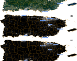
- Román, M.O., Stokes, E.C., Shrestha, R., Wang, Z., ... & Enenkel, M., 2019. Satellite-based assessment of electricity restoration efforts in Puerto Rico after Hurricane Maria. PLoS One 14 (6), e218883.
- Wang, Z., Román, M.O., Kalb, V.L., Miller, S.D., Zhang, J., Shrestha, R.M., 2021. Quantifying uncertainties in nighttime light retrievals from Suomi-NPP and NOAA-20 VIIRS Day/Night Band data. Remote Sens. Environ. 263, 112557.
- Jia, M., Li, X., Gong, Y., Belabbes, S., Dell'Oro, L., 2023. Estimating natural disaster loss using improved daily night-time light data. International Journal of Applied Earth Observation and Geoinformation, 120, 103359.


")

