  • English
  • Español
  • Français

United
Nations


Office for Outer Space Affairs
UN-SPIDER Knowledge Portal

  • Home
  • About Us
    • What is UN-SPIDER?
    • About UNOOSA
    • Publications
    • Jobs
    • Meet the Team
    • Contact
  • Space Application
    • Satellite Technology
    • Emergency Mechanisms
    • Recovery Mechanisms
    • International Asteroid Warning Network
    • Space Mission Planning Advisory Group
    • International Space Weather Initiative
    • Space Technologies in the UN
    • User Stories
  • Links & Resources
    • Data Applications
      • Disaster Recovery
    • Data Sources
    • GIS and Remote Sensing Software
    • Online Learning Resources
    • Institutions
  • Risks & Disasters
    • Disaster Risk Management
    • Early Warning Systems
    • Emergency and Disaster Management
    • Natural Hazards
    • Sendai Framework
    • The UN and Disaster Risk Management
    • The UN and Early Warning
    • The UN and Disaster Management
  • Advisory Support
    • Advisory Missions
    • Emergency Support
    • Virtual Advisory Support
    • Recommended Practices
    • Training Activities
    • Practical Uses
  • Network
    • Regional Support Offices
    • GP-STAR
    • MHEWS
    • IWG-SEM
  • Projects
    • SPEAR
    • SEWS-D
    • EvIDENz
    • Flood GUIDE
  • News & Events
    • News
    • Events Calendar
    • UN-SPIDER Events Archive
  • Admin
    • SAM Items

Breadcrumb

  • Home
  • Space Application
  • Satellite Technology
  • Cartosat-3
  • Cartosat-3

Cartosat-3

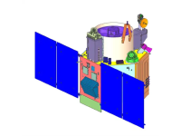
Cartosat-3 satellite is a third generation agile advanced satellite having high resolution imaging capability. Cartosat-3 will address the increased user’s demands for large scale urban planning, rural resource and infrastructure development, coastal land use and land cover etc.

27 Nov 2019
0years
Sun synchronous
Multispectral Imaging Spectrometer
ISRO
Cadastral and infrastructure mapping and analysis.
Drought
Glacial Lake Outburst
Forest Fire
Tsunami
Earthquake
Volcanic Eruption
Mass Movement
Landslide
Flood
VIS
NIR
PAN
No
https://www.isro.gov.in/Cartosat_3.html

Footer menu

  • Contact
  • Terms of Use

User account menu

  • Log in