Bolivia (Plurinational State of)

country taxonomy block

The International Charter Space and Major Disasters has been activated for floods in Argentina and Bolivia.

River burst its banks in Salta Province

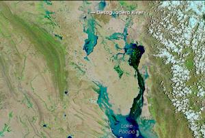
Heavy rains in the region caused the Pilcomayo river to overflow, leading to displacement of the local population and widespread damages. The river rises in the Andes in Bolivia and flows along the border between Argentina and Paraguay before joining the Paraguay river opposite Asunción.

The activation has been requested by the National Civil Protection Directorate of Argentina. The National Space Activities Commission (CONAE), a UN-SPIDER Regional Support Office, acts as the project manager for this activation.

Record rains cause flooding in several departments of Bolivia

Local authorities in Bolivia have declared a state of emergency for several departments affected by heavy rains. Disaster response teams indicated that around 50,000 citizens are being reallocated to shelters.

The overflow of…

more
Publishing date 08/02/2018
Regional Support Offices mentioned:

On 21 November 2016 president Evo Morales declared a national emergency due to a severe and extended drought intensified by El Nino. The reservoirs providing water to the Bolivian capital, La Paz, are almost dry, provoking water rationing in that city. There are no rains forecasted till early December, informed the country’s weather services. 

The Pan American Health Organisation report that 70% of the inhabitants in the Corque municipality suffer from water shortage. The scarcity has caused protest among the population of different cities, informed Aljazeera. More information on this network can be accessed here.

President Morales recommended the local governments to drill wells and transport…

more
Publishing date 25/11/2016

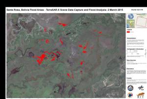
A Recommended Practice elaborated by UN-SPIDER's Regional Support Office in Ukraine, was used by to create maps in a recent activation of the International Charter: Space and Major Disasters for the Plurinational State of Bolivia.

The mechanism was triggered on 25 February 2015 after heavy floods started affecting the northern part of the country. The flooding had been caused by accumulating rainfall since January, causing the River Acre to overflow.

The call for activation was issued by SIFEM-DNPC on behalf of SINAGER - VIDECI. The United States Geological Survey (USGS) was the project manager for the activation. The Rochester Institute of Technology was requested to create the maps based on satellite radar data obtained from the German Aerospace Center's Terra-SAR-X satellite. The expert applied the flood mapping procedure of the…

more
Publishing date 27/03/2015
Regional Support Offices mentioned:

The International Charter: Space and Major Disasters was activated for floods in northern Bolivia after heavy rain caused the River Acre to overflow on 24 February 2015. The mechanism will provide up-to-date satellite-based information products and maps. The activation was triggered by SIFEM-DNPC on behalf of SINAGER - VIDECI. USGS will handle the project management for this activation.

The International Charter reported: "Bolivia has been experiencing heavy rain since January, and the accumulating rainfall has been causing floods and landslides in the country. When the River Acre burst its banks, the water level in the river had risen to 14 m above normal, and the surging waters swept through the area. In Cojiba, the capital city of the Pando Department, four thousand people were left homeless by the floods. It is expected that other residents near the river will also need to be relocated to avoid any potential risks."

Publishing date 27/02/2015

The International Charter: Space and Major Disasters was activated yesterday, on request of UNITAR/UNOSAT on behalf of UNOCHA, due to heavy rainfall, floods, and landslides in the departments of La Paz, Beni and Pando, Bolivia.

Almost 40 people have been killed and hundreds of homes affected due to extensive rainfall since the end of January. The Bolivian authorities assume that more than 50,000 people have been affected.

21,000 people have lost their homes and are being placed in evacuation centers at the moment. Over 6000 hectares of crops have been destroyed.

more
Publishing date 13/02/2014

On 20 December 2013, Bolivia watched its first telecommunications satellite head into space. Tupak Katari (TKSat-1), named after an indigenous hero who fought Spanish colonial rule, was launched by a Chinese Long March 3B/E rocket from the Xichang Satellite Launch Center in the province of Sichuan.

TKSat-1 will offer communications and broadcasting services to Bolivia as well as other support for health-related data, governmental civil projects, and remote education services using its 26 Ku, 2 C and 2 Ka-band transponders. The satellite has an expected lifespan of 15 years, as Satnews reported.

According to BBC, President Evo Morales, said that Tupak Katari would end Bolivia's dependence on foreign powers for its communications. "This will be our light, after living for so many years in the obscurity, the suffering and the domination of the empires," said Mr Morales.

more
Publishing date 23/12/2013

The director of the Bolivian Space Agency, Ivan Zambrana, has confirmed that the Chinese-funded communications satellite Tupac Katari will be launched into space on 20 December 2013. Satellite Tupac Katari will reduce the cost of telecommunications not only in Bolivia but additionally in other Latin American countries that will have access to it. Mr. Zambrana recognized the relevance of the telecommunications sector to the national GDP stating that "last year the turnover of telecommunications companies exceeded USD 1.5 trn in a single year" during a press conference.

The construction of the satellite is a joint project between the Bolivian government and Chinese company Great Wall that was signed as a bilateral trade agreement in December 2010 with a total cost of USD 300 million. Over 60 Bolivian nationals are currently being trained in China, learning how to operate the earth station of the satellite located in the city of El Alto in Bolivia’s Amachuma…

more
Publishing date 14/08/2013

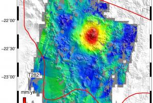
In the central Andes mountains, satellites have detected ground deformation under way above a major subterranean magma body. The Altiplano–Puna volcanic province is part of an active volcanic arc in South America’s central Andes. Extending through Peru, southwestern Bolivia, Chile and northwestern Argentina, it is home to a number of large calderas formed following catastrophic eruptions. Beneath the surface of Altiplano–Puna, about 17–19 km deep, lies the largest known active magma body in Earth’s continental crust.

In a study published on 12 October 2012 in Science, scientists used radar data from the ERS and Envisat missions to study an unusual uplift near the Uturuncu volcano, which had been dormant for 270 000 years. The satellites show that the ground in this area has been rising by about 10 mm per year over the past 20…

more
Publishing date 16/10/2012

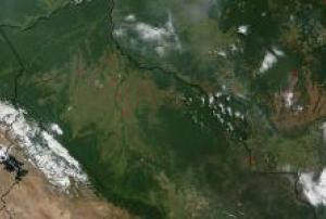
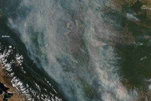
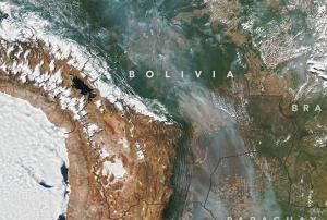
Fires burned throughout Bolivia in early September 2011. The Moderate Resolution Imaging Spectroradiometer (MODIS) on NASA’s Aqua satellite captured this natural-color image on September 2, 2011.

Red outlines indicate areas where MODIS has detected high surface temperatures associated with actively burning fires. In many places, the smoke from these blazes is thick enough to completely hide the land surface below from the satellite sensor’s view. In general, the smoke plumes blow toward the west and northwest.

Wildfires can occur naturally in Bolivia, but the widespread burning evident in this image likely results from agricultural fires aimed at clearing brush or crop residue. Some agricultural fires can burn out of control.


more
Publishing date 08/09/2011

Viceministerio de Defensa Civil

Contact Person
Mr Carlos Caly Mariaca Cerball
Tel: 59122610557
Email: c_mariaca [at] hotmail.com
Web: http://bolivia.georiesgo.net


Other Contacts:
Mr Julio Fernandez Vasquez
Tel: +591-726 12002
Email: juliofernandez777 [at] hotmail.com

Viceministerio de Defensa Civil

Persona de Contacto:
Sr. Carlos Caly Mariaca Cerball
Teléfono: 59122610557
E-mail: c_mariaca [at] hotmail.com
Web: http://bolivia.georiesgo.net


Otros Contactos:
Sr. Julio Fernandez Vasquez
Teléfono: +591-726 12002
E-mail: juliofernandez777 [at] hotmail.com