United States of America

country taxonomy block

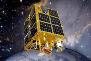
A new report by the international consulting firm Northern Sky Research (NSR) forecasts a boom for nano and microsatellites by 2024, which would lead to a significant diversification of the satellite industry. The report, entitled “Nano and Microsatellite Markets, 2nd Edition”, states that the market for sub-100 kg space artifacts has nearly doubled between 2013 and 2014, and operators have multiplied by three in just five years.

The developers of these nano and microsatellites are mainly universities, start-ups, small government agencies and military forces with low budget and limited time and expertise but who also participate in Earth Observation, science and risk awareness.

However, this sector also faces challenges, as the shortage of affordable launch vehicles, more efficient rideshares and limited orbital diversity. Therefore, the availability of venture capital and support from national agencies will be crucial for securing investment.

more
Publishing date 25/06/2015

The foundation of the Gulf of Mexico Coastal Ocean Observing System (GCOOS) has provided new tools helping to predict storms and enhance ship navigation. Texas, Louisiana, Mississippi, Alabama and Florida will be covered with more accurate information thanks to the GPS Continually Operating Reference Systems (CORS) and Physical Oceanographic Real-Time System (PORTS®) tools that are being implemented through local, state and federal partnerships.

The new CORS provide location data at centimeter-level accuracy, which allows improving the accuracy of coastal mapping, surveying and restoration and flood protection as well as developing better coastal models for hurricanes and flooding.

"This system will help local and regional leaders plan for improved resilience to any impacts of sea level rise or subsidence and coastal storm surge flooding. The project will assist development of long-term strategies to address coastal change impacts along the northern Gulf of…

more
Publishing date 17/06/2015

The National Aeronautics and Space Administration (NASA) and Indian Space Research Organisation (ISRO) are working together on a project to monitor earth changes in high detail.

The project is called NASA-ISRO Synthetic Aperture Radar (Nisar) mission and will be launch into Earth’s orbit in 2020. The mission will study the consequences of climate change by continuously monitoring changes occurring on the Earth’s surface, even ice-sheet movements, said Dr Mylswami Annadurai, director of ISRO's satellite centre in Bengaluru in India.

At the same time the mission is expected to support India’s earthquake early warning system. Therefore India is also developing the Indian Regional Satellite Navigation System (IRNSS), a regional navigation system in order to replace the Global Positioning System (GPS), which is a space-…

more
Publishing date 03/06/2015

The world’s first Emergency Readiness and Response Experience Center has been opened in Washington, D.C., USA by high-tech development company McMurdo.

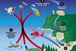
The centre will show the latest innovations and technology developments for search and rescue (SAR), offer real time demonstrations in different scenarios or the possibility to sit at the control of missions. The whole SAR process will be covered in the centre, from distress beacon activation to  emergency response coordination through satellite-based location detection.

Furthermore, this new facility will feature a working MEOSAR (Medium Earth Orbit Search and Rescue) satellite-based search and rescue system, the next generation version of the current Cospas-Sarsat satellite system that will largely influence the existing SAR process with global coverage, near-instantaneous distress beacon detection and a unique Return Link…

more
Publishing date 19/05/2015

The Imaging and Geospatial Technology Forum (IGTF) is took place from 4 to 8 May 2015 in Florida, USA, to present new trends, products and general enhancements related to imaging and geospatial data.  

The conference had already been held in past years but under the name of ASPRS annual conferences. This former denomination referred to the event organizer, the American Society for Photogrammetry and Remote Sensing (ASPRS).

Geospatial information improvements, new trends in remote sensing systems and geological resource applications were some of the main topics to be presented in the IGTF 2015. Within the programme of the conference, the JACIE Workshop highlighted combining a general session and special technical sessions throughout the week and focusing on the synergy of high, medium and low resolution imagery and remote sensing technologies used by the US Government.

Among the participants were international mid- and upper-level imaging and geospatial…

more
Publishing date 06/05/2015

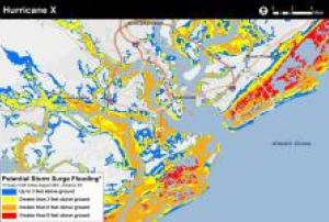
The National Oceanic and Atmospheric Administration (NOAA) is preparing a new application to help people determine at a street-level where water could rise in a storm surge.

This experimental storm surge simulator will let people get a look at what kind of storm surges can take place in their surroundings and which can be the possible damages. The preliminary model is based on Charleston (South Carolina), USA.

"Surveys of the public show there is still a consistent misunderstanding of what the storm surge is, and how deadly it can be. In part this is due to the challenge scientists encounter in trying to simplify the complex physics of hurricanes for the public, and in part this is due to poor misunderstanding of flood zone maps that represent the flooding scenario as it might be viewed from above," reads the introduction to the app, according to

more
Publishing date 13/04/2015

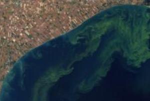
NASA has joined forces with the U.S. Environmental Protection Agency, National Oceanic and Atmospheric Administration and U.S. Geological Survey (USGS) to use ocean color satellite data to develop an early warning indicator for toxic and nuisance algal blooms in freshwater systems and an information distribution system to aid expedient public health advisories.

Algal blooms are a worldwide environmental problem causing human and animal health risks, fish kills, and taste and odor in drinking water. In the United States, the cost of freshwater degraded by harmful algal blooms is estimated at $64 million annually.

Satellites allow for more frequent observations over broader areas than present water sampling. "Observations from space-based instruments are an ideal way to tackle this type of public health hazard because of their global coverage and ability to provide detailed information on material in the water, including algal blooms," said Paula Bontempi of the…

more
Publishing date 09/04/2015

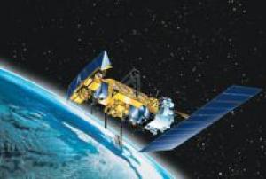
The National Oceanic and Atmospheric Administration (NOAA) reported that its constellation of weather satellites helped save 240 people during 2014 from potentially life-threatening situations throughout the United States and its territorial waters. The statement indicates the importance of satellite-based services as a way to further humanitarian assistance operations when a natural disaster occurs.

Satellites can detect distress signals from emergency beacons carried by downed pilots, shipwrecked boaters, and stranded hikers. Information captured from these satellites, including location, are then relayed to first responders on the ground who assist with search and rescue efforts.Besides the weather satellites, NOAA features polar-orbiting and geostationary satellites that can detect distress signals from emergency warnings carried by downed pilots and shipwrecked boaters, in order to provide location information to facilitate rescue efforts.

NOAA satellites are part…

more
Publishing date 02/02/2015

The United States Geological Survey (USGS) announced that improved global topographic data are now publicly available for most of Asia (India, China, southern Siberia, Japan, Indonesia), Oceania (Australia, New Zealand), and western Pacific Islands.

Elevation data were collected through the Shuttle Radar Topography Mission (SRTM) to deliver precise baseline information that help to better understand the impacts of climate change on specific geographic areas.

The project is the result of the collaborative efforts of the National Aeronautics and Space Administration (NASA) and the National Geospatial-Intelligence Agency (NGA).

The USGS had previously released elevation data for many countries in…

more
Publishing date 27/01/2015

In order to simplify and economize the storage and processing of large-scale raster data, the United States National Geospatial-Intelligence Agency recently made available the new MapReduce Geo (MrGeo) application.

This geospatial toolkit will allow users to benefit from the agency’s collaboration with DigitalGlobe, by decreasing the time needed to search, download, process and format data for analysis.

The main goal is to innovation in the process of storing and analyzing huge amounts of raster data by sharing the open source application with the community and, thereby, accelerating its potential.

Chris Rasmussen, NGA’s public software development lead, stated: “Sharing it with the public gives users at all levels another tool to help solve geospatial problems. For example, first responders could use it to plan the best ways in and out of dangerous areas taking into account terrain, land use, and changes in weather.”

MapReduce Geo will enhance the use of…

more
Publishing date 21/01/2015

Acknowledging that technology can play a key role in enhancing preparedness and raising awareness for natural hazards, the United States White House Office of Science and Technology Police (OSTP) organised the Innovation for Disaster Response and Recovery Initiative Demo Day, featuring disaster-related datasets, tools, and updates.

On this occasion, the portal disaster.data.gov was launched in order to compile open data, tools and other disaster-related resources and make them easily accessible to the public.

The portal includes 114 datasets, from various US organizations, such as the Federal Emergency Management Agency, the National Oceanic and Atmospheric Administration, the National Weather Service and the U.S. Geological Survey.

The resources are divided into six categories, according to the type of disaster, namely: earthquakes, floods, hurricanes, severe winter weather, tornadoes, wildfires.

more
Publishing date 05/01/2015

On 25 November 2014, the Third Hemispheric Meeting of the Inter-American Network for Disaster Mitigation took place at the headquarters of the Organization of American States (OAS) in Washington DC.

The representatives of member states gathered with the purpose of sharing good practices and lessons learnt on the best ways to address the impacts of natural hazards and other emergencies.

The dialogue's theme "Integrating Disaster Risk Management and Adaptation to Climate Change in the Development Agenda" emphasized possibilities for horizontal cooperation and stronger collaboration between the OAS member states, the agencies of the Inter-American Network and the United Nations.

The event was coordinated by the Department of Sustainable Development of the OAS and was divided into three discussions panels, where specialists of risk management, mitigation and prevention phases exchanged opinions and ideas on the topic.

The first panel focused on…

more
Publishing date 27/11/2014

The National Oceanic and Atmospheric Administration (NOAA) will ensure 15.9 million US dollars to a variety of programmes aimed at increasing resilience for coastal communities in the United States.

The NOAA Sea Grant was announced on 8 October 2014 and will involve over 300 Sea Grant projects, which seek to enhance the long-term vitality of coastal communities and their preparedness to natural hazards, severe weather and climate change unheaven consequences.

Among the Sea Grant's diverse activities, some projects will employ real time satellite remote sensing observation of the Center for Remote Sensing (CRS) for coastal ocean observing systems (COOS) as well as high resolution data gathered from the Synthetic Aperture Radar (SAR).

Visit the Sea Grant Projects section of NOOA's website for further information.

more
Publishing date 04/11/2014

CASIS, the nonprofit organization managing research in the U.S. National Laboratory aboard the International Space Station (ISS), has issued a request for proposals in the field of remote sensing until 21 February 2014.

The request specifies: "CASIS is confident that this Request for Proposals will attract both experienced and new-to-space investigators for the development and deployment for testing (for 90 days or less) of sensors or instrumentation for remote sensing or for the utilization of existing hardware for remote sensing on the ISS U.S. National Laboratory. Proposals should seek to use the National Lab for development of sensors and/or use of existing hardware for studies of Earth, Earth’s atmosphere, and astronomy and planetary science with the goal of benefiting…

more
Publishing date 14/01/2014

The International Conference on Flood Management (ICFM) offers an international conference platform, hosted every 3 years, to discuss a range of flood related issues and realize significant change in a multidisciplinary, multi-sectoral area. ICFM8 aims at providing a unique opportunity to exchange ideas and experiences on a range of issues that affect flood management, particularly the need to build resilience into future planning.  The conference will identify key concerns and significant challenges of the future as currently perceived by researchers, industry, policymakers and other flood management stakeholders.

Main Conference Themes

  • Science & Technology for Flood Risk Management
  • Handling Data and Information for Flood Risk Management
  • Flood Disaster Prevention, Mitigation, and Adaptation
  • Flood Preparedness, Response, and Recovery
  • Flood Decision-making, Policy, and Governance
  • Flood Resilience…
more

Convened by the President of the General Assembly, the High-Level Meeting of the General Assembly on the Midterm Review of the implementation of the Sendai Framework for Disaster Risk Reduction 2015-2030 (HLM) will take place from 18-19 May 2023 at the United Nations Headquarters in New York.

The HLM provides a platform for Member States, the United Nations system partners and other stakeholders to reflect on the findings and recommendations of the Midterm Review, to examine context shifts and emerging issues since 2015, and identify course corrections and new initiatives to more effectively address the systemic nature of risk, and realize the outcomes and goals of the Sendai Framework, the 2030 Agenda for Sustainable Development, the Paris Agreement and other agreements, frameworks and conventions.

High-Level Meeting Objectives

The HLM is expected to:

  • Raise global awareness and generate political will and momentum to…
more

Text taken from Google's event page:

"Our Geo for Good Summit is an annual conference intended for nonprofits, scientists and other changemakers who want to leverage technology and use mapping tools (such as Google Earth, Earth Engine, Environmental Insights Explorer, and My Maps) for positive impact in the world.

This year, we are planning to return to an in-person format, but with plenty of online, livestream and virtual elements to allow people not there in-person to connect and learn.

When: October 4-6, 2022
Where: Mountain View, CA, USA (with virtual events too!)

The application deadline to attend the summit in person has already passed, but you can still attend virtually. If you already submitted an application to attend in person, you will be notified of your application decision by July 20, 2022.

If you have any questions, please reach out to…

more

The twelfth session of the United Nations Committee of Experts on Global Geospatial Information Management (UN-GGIM) will be held from 3 - 5 August 2022 at the United Nations Headquarters in New York. UN-GGIM, comprising experts designated by the Governments of Member States, seeks to promote international cooperation in global geospatial information management and provide a forum for coordination and dialogue among Member States, and between Member States and relevant international organizations. As the relevant inter-governmental body on geospatial information in the United Nations, UN-GGIM reports on all matters relating to geography, geospatial information and related topics to the United Nations Economic and Social Council (ECOSOC).

More information here.

The ACM SIGSPATIAL International Conference on Advances in Geographic Information Systems 2019 (ACM SIGSPATIAL 2019), the twenty seventh edition, will be held in Chicago, November 5-8, 2019. It began as a series of symposia and workshops starting in 1993 with, the aim of bringing together researchers, developers, users, and practitioners in relation to novel systems based on geo- spatial data and knowledge, and fostering interdisciplinary discussions and research in all aspects of geographic information systems. The conference provides a forum for original research contributions covering all conceptual, design, and implementation aspects of geospatial data ranging from applications, user interfaces, and visualization to data storage and query processing and indexing. The conference is the premier annual event of the ACM Special Interest Group on Spatial Information (ACM SIGSPATIAL). Researchers, students, and practitioners are invited to submit…

more

Consists of:

  • Heat & Fire Expo
    • "The Heat & Fire USA is the leading wildfire prep, management, and recovery event, showcasing the latest tools, strategies, and insights among investment and global industry leaders."
  • Earthquake Expo
    • "The Earthquake Expo USA is the leading seismic prep, management, and recovery event, showcasing the latest tools, strategies, and insights among investment and global industry leaders."
  • Flood Expo
    • "The Flood Expo USA is the leading flood prep, management, and recovery event, showcasing the latest tools, strategies, and insights among investment and global industry leaders."
more

The Summit is a high-level event, bringing world leaders together to forge a new international consensus on how we deliver a better present and safeguard the future.

Effective global cooperation is increasingly critical to our survival but difficult to achieve in an atmosphere of mistrust, using outdated structures that no longer reflect today’s political and economic realities.

This once-in-a-generation opportunity serves as a moment to mend eroded trust and demonstrate that international cooperation can effectively achieve agreed goals and tackle emerging threats and opportunities.

In September, world leaders will convene at the United Nations to adopt the Pact for the Future, which will include a Global Digital Compact and a…

more

The 77th session of the UN General Assembly (UNGA 77) will open on Tuesday, 13 September 2022. The first day of the high-level General Debate will be Tuesday, 20 September 2022.

More information will be added as soon as they are available.

The Center for Interdisciplinary Geospatial Information Technologies at Delta State University (CIGIT), the Mississippi Emergency Management Agency (MEMA), the Secure World Foundation, GITA, and the United Nations Platform for Space-based Information for Disaster Management and Emergency Response (UN-SPIDER) will host a workshop about application of geographic information systems (GPS) and remote sensing technologies to disaster preparedness, response, and recovery. Special focus will be given to how developing nations may use these powerful technologies to reduce the risk of disaster, more effectively respond to crisis when it occurs, and recover from disasters. Limited financial assistance is available for attendees from developing countries. Attendees will be provided with hands-on software learning opportunities, seminars about best practices, guides for the creation of policy, and round-…

more

The world of 2050 will be radically different. It is not at all clear how we will get there from here or how we should navigate through the uncharted waters of the future. Climate change, urbanization, rapid expansion of the Internet and the availability and use of information, the continued evolution of human identity, and changing modes of commerce, cooperation, and conflict from local to global scales are just some of the many trends influencing the future. Each poses many challenges and opportunities for how we perceive and shape our world’s geography now and in coming decades.

To help lay the foundation for exploring these local, regional and global challenges—and the investments in technology, data, laws, policies, and capacities needed to improve our ability to navigate through them—the American Geographical Society is collaborating with the Earth Institute, Columbia University to organize an Expedition to the Future.


more

The International Conference of Crisis Mappers (ICCM) is the leading humanitarian technology event of the year, bringing together the most important humanitarian, human rights, development and media organizations with the world's best technology companies, software developers and academics. As thus one of the few neutral spaces where such important conversations can take place, the annual ICCM conference brings together a wide range of diverse actors for important conversations that lead to concrete new projects and deliverables across a variety of diverse domains. As a community of practice, the ICCM thus helps facilitate new projects and catalyzes innovation in the area of humanitarian technology.

The theme for this year's event, Affected Communities in Spotlight, will focus on better engaging and understanding populations as the primary referent during a disaster.

more