Volcanic Eruption
Definition
Facts and figures
Further information
UN-SPIDER Regional Support Offices with hazard-specific expertise
Related content on the Knowledge Portal
CEMS is a core service of the European Union’s Earth Observation programme Copernicus. It supports all phases of the disaster management cycle by delivering warnings and risk assessments of floods and forest fires and by providing geospatial information derived from satellite images on the impact of natural and man-made disasters all over the world (before, during or after a crisis). The two Mapping services of CEMS (Rapid Mapping, Risk and Recovery Mapping) are delivering products since April 2012. The Risk & Recovery Mapping provided for example information for preparedness, disaster risk assessment and risk reduction related to earthquakes in Nepal, several post-disaster assessments for flood and fire events, reconstruction and recovery monitoring in Haiti, and multi-risk assessments for the Azores Islands in Portugal.
CEMS is coordinated by the European Commission (joint coordination between the Directorate Generals ECHO, JRC, GROW). Activation requests…
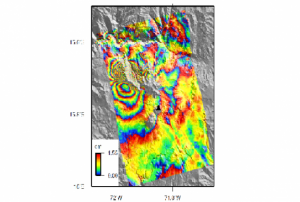
read morePublishing institution:CEOS Disasters Working Group Space agencies organised in the Committee on Earth Observation Satellites (CEOS) formed a permanent Working Group in 2013. Together with volcanologists and Remote Sensing specialists, a Volcano Pilot activity was started with the following aims:
- Demonstrate the utility of integrated, systematic space-based EO as a volcano monitoring tool on a regional basis and for specific case studies
- Provide space-based EO products to the existing operational community (such as volcano observatories and VAACs) that can be used for better understanding volcanic activity and reducing impact and risk from eruptions
- Build the capacity for use of EO data at the majority of the world‘s volcanoes (particularly those that are not monitored by other means)
After further specification, the main objective of the pilot activity consists of a regional study of volcanic unrest and eruptions in the Latin American volcanic arc (from…
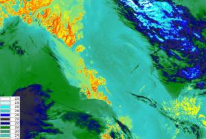
read morePublishing institution:- The main objective of the SENTINEL-3 mission is to monitor sea and land surface
temperature, sea surface topography and ocean and land surface colour with high accuracy and reliability. The high resolution data is meant to support ocean forecasting systems, environmental monitoring and climate monitoring.
ESA and EUMETSAT will jointly operate the SENTINEL-3 mission and bothy institutions provide access to the processed data.
Sentinel 3 carries four main instruments: the OLCI, SLSTR, Altimetry and a MWR Microwave Radiometer.
Publishing institution: .tableizer-table { font-size: 12px; border: 1px solid #CCC; font-family: Arial, Helvetica, sans-serif; table-layout: fixed; } .tableizer-table td { padding: 7px; margin: 3px; border: 1px solid #CCC; overflow: hidden; } .tableizer-table th { padding: 7px; margin: 3px; background-color: #104E8B; color: #FFF; font-weight: bold; align-content: center; }
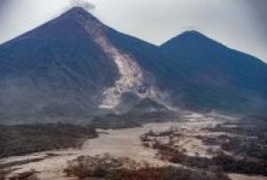
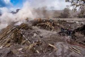
On 3 June 2018, the Fuego volcano erupted violently sending ash clouds up to six thousand meters above sea level and triggering pyroclastic flows that descended through some of its flanks. These pyroclastic flows left more than one hundred dead, nearly 200 persons missing, and more than 60 injured. More than 3,600 persons have been evacuated to temporary shelters, and nearly 1.7 million inhabitants have been affected to a lesser degree according to…
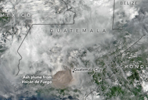
read moreSatellites from NASA and the US National Oceanic and Atmospheric Administration (NOAA) are monitoring the eruption of Volcan de Fuego (Volcano of Fire) in Guatemala that has killed at least 69 people since it started erupting on 3 June 2018.
The Visible Infrared Imaging Radiometer Suite (VIIRS) onboard the joint NOAA/NASA Suomi National Polar-orbiting Partnership (Suomi-NPP) satellite captured an imagery) of the eruption and resulting ash plume emitted by the volcano.
Such satellite images can be utilised by civil authorities, scientists and the local population to understand where pyroclastic flows, a high-density mix of hot lava blocks, pumice, ash and volcanic gas, are moving in order to avoid disaster.
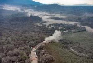
Just before noon on 3 June, the Volcan de Fuego, which is located approximately 50 kilometres southwest of Guatemala City, produced an explosive eruption that sent ash billowing thousands of metres into the air. A deadly…
read more06/06/2018The International Charter “Space and Major Disasters” has been activated for Guatemala’s Fuego volcano on 5 June.
Guatemala’s most powerful eruption in 100 years has killed at least 69 people with many more missing, according to local reports.
A state of emergency has been declared with the eruption, which started on Sunday, cascaded vast clouds of volcanic ash, rocks and toxic gas into the atmosphere. 3,000 local residents have been evacuated into temporary shelters as pyroclastic flows threaten to engulf villages surrounding the volcano.
Fuego is situated 40km south-west of the capital Guatemala City and the eruption closed the city’s La Aurora International Airport as the clouds of volcanic ash and gases rose 10 km into the air.
Emergency responders are working alongside soldiers and firefighters to search for missing people in the dense covering of ash, mud and volcanic rock…
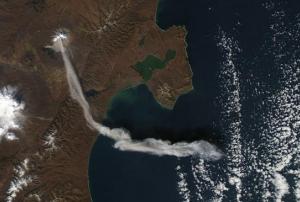
read more05/06/2018- Significant activity from volcanoes in the Russian Federation have been observed from space in recent months. The Kamchatka and Kuril Islands volcanoes, located in the fact east of the country, are being monitored by satellites in order to avert the hazards caused by their regular eruptions to air travel and to local populations. These volcanoes are among the most active in the world, generally erupting between three and seven times every year. As of 4 May 2018, two volcanoes in Kamchatka - Karymysky and Sheveluch - are [subject](http://www.kscnet.ru/ivs/kvert/index_eng.php) to an orange [aviation colour code](http://www.wovo.org/aviation-colour-codes.html) meaning that a volcano is exhibiting heightened unrest with increased likelihood of eruption or that a volcanic eruption is underway with no or minor ash emission. The Ebeko volcano located in the Kuril Islands is also subject to the same warning. When volcanoes in the region erupt, they tend to produce large ash clouds that… read more16/05/2018
- NASA satellites are closely monitoring Kilauea volcano in Hawaii, United States of America amid fears that the ongoing eruption could cause further evacuation of the local population.On 30 April 2018, the floor of Kilauea’s crater began to collapse. Earthquakes followed, including one that measured magnitude 6.9, and lava was pushed into new underground areas that eventually broke through the ground in areas such as Leilani Estates. The fissures and high levels of sulphur dioxide gas prompted the authorities to order nearly 2,000 residents to evacuate Lanipuna Gardens and the neighbouring…read more13/05/2018
The International Charter Space and Major Disasters has been activated for an earthquake and eruption of the Kilauea Volcano in Hawaii, USA on Monday.
The volcano erupted on 4 May alongside a 6.9 magnitude earthquake, spraying lava up to 70 metres and causing the evacuation of 2000 individuals, in addition to the destruction of several buildings. Dangerous levels of toxic sulfur dioxide from the lava flows also present a hazard. Residents are urged not to return to hazardous areas until the risk has subsided.
This activation was requested by the US Geological Survey on behalf of USGS Hawaii Volcano Observatory/Cascades Volcano Observatory. This project was also managed by the USGS.
11/05/2018

