Azerbaijan

country taxonomy block

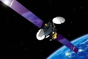
The first telecommunication satellite Azerspace-1 will monitor the seismologic situation of Azerbaijan, which is located in a highly seismically active zone.

Azerspace-1, launched in February 2013, covers Eastern Europe, the Caucasus, Central Asia and North Africa and offers digital broadcasting services, internet access and data transmission for disaster monitoring and communication exchange between the stations of the monitoring system.

Resources of the satellite will be used to exchange data between different stations of the monitoring system for the diagnosis and management Robust Noise Monitoring, designed for seismic research, as the Control Systems Institute of the Azerbaijani National Academy of Sciences reported.

The exchange of seismic information will involve 35 monitoring stations located in the country and the system will be equipped with a special software, which transfers seismic acoustic signals directly to the server of the Institute, developed...

more
Publishing date 12/01/2015

Azerbaijan and the French company Airbus Defence & Space have signed an agreement to transfer the management of SPOT-7 satellite to Azeri specialists.

The SPOT-7 is a low-orbit satellite, designed for remote sensing of the Earth's surface. According to the Minister of Communications and High Technologies of Azerbaijan, Ali Abbasov, the satellite will be used for various purposes, including in emergencies, for the needs of agriculture, and cartography.

The agreement was signed on 2 December as a part of the 20th Azerbaijan International Exhibition "Telecommunications and Information Technology" BakuTel 2014, in Baku, Azerbaijan.

more
Publishing date 03/12/2014

Azerbaijan's first satellite Azerspace/Africasat-1a will be launched on 7 February 2013 with the Ariane 5 rocket from the spaceport in French Guiana. The pre-launch checkout is underway, as Satnews reported.

Azerspace/Africasat-1a was designed and built by Orbital Sciences Corporation based on its STAR-2 platform, under contract to the Republic of Azerbaijan's Ministry of Communications and Information Technologies—which is the sole shareholder in the country's national satellite operator, Azercosmos.

Carrying 36 active C- and Ku-band transponders, the spacecraft is to provide communications services to Azerbaijan, Central Asia, Europe and Africa from an orbital location of 46 deg. East. Azerspace/Africasat-1 will weigh approximately 3,250kg...

more
Publishing date 16/01/2013

The Institute of Cybernetics of the National Academy of Sciences of Azerbaijan intends to create a system of forecasting the earthquake sources. Institute’s head Telman Aliyev says that in the last two years it has been established five seismic telemetry stations for forecasting earthquakes.

He reveals that the institute of Cybernetics of the National Academy of Sciences of Azerbaijan together with the seismic experts from 17 countries has been worked on establishing five seismic telemetry stations for forecasting earthquakes for the last two years. With these stations, it is possible to predict an earthquake 15-20 hours before it starts through the stations operating in Gum Adasi, Siyazan, Neftchala, Shirvan and Naftalan.

In addition, the institute has created a new system model to identify the location of earthquakes. Nonetheless, the model needs time to develop to reality and the institute will implement this project in collaboration with the Ministry of...

more
Publishing date 19/09/2012

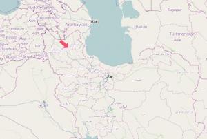
UNOOSA/UN-SPIDER has activated the International Charter: Space and Major Disaster to provide satellite imagery for the two strong earthquakes that occurred in Iran on 11 August 2012. This international mechanism was activated on behalf of the Iranian Space Agency, host of UN-SPIDER's Regional Support Office in Iran. The German Aerospace Center (DLR) is the project manager for this activation.

The two strong earthquakes in north-west Iran had been followed by multiple aftershocks. 300 people were killed, more than 3000 victims had been injured and 16,000 people were left homeless. The quakes measured on Richter scales of 6.4 and 6.3, damaging rural villages in Ahar, Varzgahan and Harees, in the city of Tabriz. Some 20 villages in mountainous areas had been completely destroyed whilst hundreds had been damaged.

Search and rescue operations came to a close on Sunday, 12 August, since most residents had been accounted for. Officials confirm that residents of affected...

more
Publishing date 16/08/2012
Regional Support Offices mentioned:

Introduction

Globally there is growing interest in better understanding solar-terrestrial interactions, particularly patterns and trends in space weather. This is not only for scientific reasons, but also because the reliable operation of ground-based and space-based assets and infrastructures is increasingly dependent on their robustness against the detrimental effects of space weather.

The International Space Weather Initiative (ISWI) is a program of international cooperation to advance space weather science by a combination of instrument deployment, analysis and interpretation of space weather data from these instruments in conjunction with space data, and the communication of the results to the public.

The further goal of ISWI is to develop the scientific insights necessary to understand the science, and to reconstruct and forecast near-Earth space weather. This includes instrumentation, data analysis, modelling, education, training, and public...

more

The United Nations, through its Programme on Space Applications implemented by the United Nations Office for Outer Space Affairs (UNOOSA), and the International Astronautical Federation (IAF) co-organize the Workshop on Space Technology for Socio-Economic Benefits on the theme "Challenges and Capacity-building Opportunities for Emerging Space Nations".

The purpose of this workshop is to bring together people conducting capacity-building activities from government, space agencies, research institutes, academia, non-governmental organizations, and those interested in building partnerships to accelerate capacity-building in developing nations about using space technologies and applications for sustainable economic, social and environmental development.

The workshop will provide a platform for discussion about how to increase capabilities in space technologies and space applications...

more