Denmark

country taxonomy block

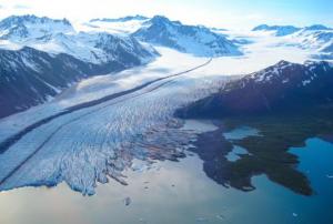
Scientists from 50 scientific institutions, led by the National Aeronautics and Space Administration (NASA) and the European Space Agency (ESA) combined 26 independent satellite datasets to show that the Greenland Ice Sheet melt is increasing. The group studied data from 1992 to 2018, taking direct measurements of the continent-sized glacier. The study found that decade averages for ice melt has increased sevenfold from the 1990s. 

The report shows that 1992 to 2002 averaged 1mm/decade in melt, 2008 to 2018 increased to a 7mm/decade loss. The research pulled from USGS’s Landsat mission, the oldest open-access Earth observation data. The total was also calculated using space-based gravity measurements - which measures total mass on the world’s largest island - integrated with remotely sensed height...

more
Publishing date 03/02/2020

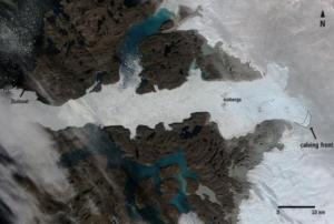
The European Space Agency’s (ESA) Sentinel-1A satellite captured the Jakobshavn glacier´s calving process, one of the biggest iceberg breaking phenomena on record. By comparing images before and after the event, scientists found that it has lost a total area of 12.5 km2, equivalent to a volume of 17.5 km3, which could cover the Island of Manhattan by a 300 m thick layer of ice.

The Jakobshavn Glacier is a vast outlet glacier located in Western Greenland and produces around 100% of Greenland’s icebergs. Each year, 35 billion tones of icebergs calve off and pass out of the fjord. However, sometimes they are so large that they cannot float away easily and remain stuck on the bottom in shallower regions until they manage to melt.

It has been tracked for over 250 years in order to get a better insight into the role of ice streams in climate change, icecap glaciology and its impact on the sea level.

The Sentinel-1A is an Earth...

more
Publishing date 27/08/2015

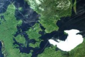
In order to monitor and map the spatial extent of the flooding caused by two storms passing over Denmark the weekend of 9 to 11 January 2015, radar images from TerraSAR-X satellite were employed.

The analysis and mapping of the flooded area was conducted by Airbus Defence and Space on behalf of DHI GRAS, a worldwide provider of remote sensing and GIS services for hydrology, water quality, environmental assessment and land cover mapping.

The use of TerraSAR-X radar satellite images in Limfjorden in Northern Jutland (Denmark) enabled the acquisition of data independent of weather and light conditions and enhanced the accuracy of disaster management and response operations.

The great advantage of radar satellite imagery in case of natural hazards such as flooding and storms is the possibility to collect information during the maximum extent of the water level.


Publishing date 26/01/2015

During the INSPIRE 2014 conference in Aalborg, Denmark, INSPIRE and the Geospatial World Forum announced plans to co-host the 2015 INSPIRE  and Geospatial World Forum scheduled for 24 to 29 May 2015 in Lisbon, as directionsmag reported.

The theme of the 2015 joint conference will be Convergence: Policies + Practices + People (PPP) addressing the need for synergy between policy makers, technology providers and end users highlighting workflow in order to facilitate more informed decision making from stakeholders.

According to Sanjay Kumar, Chief Executive Officer of Geospatial Media and Communications and organizer of Geospatial World Forum, “this partnership intends to facilitate and harness the value of geospatial towards improved living standard by converging policies, practices and people. Through combined efforts, both INSPIRE...

more
Publishing date 26/06/2014

The NEEDS conference aims to explore the status quo of disaster research and management. The conference wishes to harness its broad, interdisciplinary expertise by gathering disaster researchers from academic institutions and practitioners from the disaster management community (European and beyond) to build networks and to discuss the most pressing issues in disaster research across the academic and practical disciplines. The conference focuses on the following topics: Disasters in Europe, Emerging Actors and Networks in Disasters, Disaster Capitalism and Vulnerability, Assessing the Impacts of Disasters, Technology in Disasters, Historical Disasters, Disaster Ethics, The Role of Religion in Disasters, Global Pandemics, and Global Disasters.

Effective disaster management and response demand rapid utilization of information and data from many sources. Visualization and spatial applications are critical during pre and post-disaster management and response. The ability to seamlessly integrate and distribute digital data into spatially explicit forms for situation, rapid assessment and analysis during and after a disaster remains a challenge.

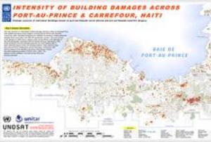
To meet this challenge UNOSAT and the University of Copenhagen are offering a course that presents an integrated approach to how info management and sharing is enhanced by use of geo-information systems (GIS) tools in disaster situations. The GIS database can be accessed for damage assessment or to locate critical infrastructure. To get an overview of the disaster situation it is crucial for disaster managers to be equipped with these basic tools.

On completion of the course, students will be able to critically analyze the prerequisites and challenges for effective...

more
Polar regions have experienced the most rapid rates of warming in recent years and its expected impacts will exceed those forecasted for many other regions in the planet resulting in local, regional and globally significant consequences affecting natural ecosystems and human activities.
 
This workshop aims at assessing the latest advancement in the use of EO technology for Polar science, exploring the main challenges and opportunities for the coming decade and consulting with the community to contribute to define a common scientific agenda for the future.
 
Workshop Objectives:
  • Reviewing the progress and latest results in polar science with major focus on EO- advances in the domain of polar research and applications
  • Identifying the major Polar scientific challenges, observation gaps and research needs for the coming years
  • Exploring effective mechanisms to promote networking and...
more