Global
country taxonomy block
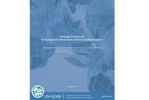
The Working Group on Geospatial Information and Services for Disasters (WG-GISD) of the United Nations Committee of Experts on Global Geospatial Information Management (UN-GGIM) has published a "Strategic Framework on Geospatial Information and Services for Disaster" to guide all stakeholders and partners in the management of geospatial information and services in all phases of disaster risk management.
The role of geospatial information has been widely recognized as an important aspect of all phases of disaster risk management (DRM). While calling on Member States to find solutions to improve availability and accessibility of geospatial information and services, the strategy document highlights the need for strengthening coordination and communication among stakeholders to ensure they are not collecting concurrent or inconsistent data.
The framework emphasizes sustainability, accessibility, complementarity and interoperability of geospatial information and aims to...
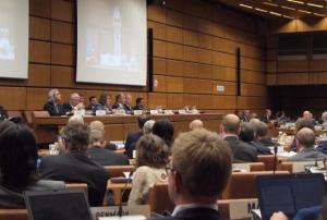
moreThe 60th session of the Committee on the Peaceful Uses of Outer Space will take place in Vienna from 7-16 June 2017. COPUOS was set up by the General Assembly in 1959 to govern the exploration and use of space for the benefit of all humanity: for peace, security and development. The Committee has since been tasked with reviewing international cooperation in peaceful uses of outer space, studying space-related activities that could be undertaken by the United Nations, encouraging space research programmes, and studying legal problems arising from the exploration of outer space.
International cooperation in space exploration and the use of space technology applications to meet global development goals are discussed in the Committee every year. Owing to rapid advances in space technology, the space agenda is constantly...
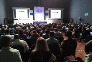
moreThe United Nations Office for Outer Space Affairs (UNOOSA), through its UN-SPIDER programme, co-chairs the working session on Science and Technology for Disaster Risk Reduction at the 2017 Global Platform on Disaster Risk Reduction, which started on 22 May 2017 in Cancun, Mexico. The session focuses on the contribution of science and technology to achieving the 2020 Sendai target on national and sub-national DRR strategies and takes place on Thursday 25 May 2017, 11:15-12:45, at Arena E.
UNOOSA has a long-standing engagement in promoting science and technology for disaster risk reduction. At the ground-breaking Third United Nations World Conference on Disaster Risk Reduction in Sendai in March 2015, UNOOSA took a lead in organizing a working session on “Earth Observation and High Technology to Reduce Risks”. The...
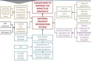
moreUNOOSA teamed up with FAO to host a side event, on behalf of eight additional partners, during the afternoon session of the first day of the Multi-Hazard Early Warning Conference in Cancun, Mexico. The keynote presentations addressed the topic of “Strengthening drought early warning systems” (UNOOSA) and FAO’s Agricultural Stress Index System (ASIS), followed by a panel discussion.
The devastation of droughts can be far-reaching. Regions in Africa, Asia and the American Hemisphere are facing more frequent and severe droughts, which are worsened when El Niño (ENSO) events manifest themselves. In extreme cases, such droughts lead to famine and food insecurity, forcing governments to decree national states of calamity. In recent years, FAO and other agencies have begun to make use of vegetation indexes derived from satellite imagery, such as the Normalised Difference Vegetation Index (NDVI) and the Enhance Vegetation Index (EVI). A project, established in 2015, has already begun...
moreThe highly anticipated 2017 Multi-Hazard Early Warning Conference kicked off today in Cancun, Mexico. The Conference will take place over the course of the next two days and is being hosted by the Government of Mexico. It will be held in conjunction with the 2017 Global Platform for Disaster Risk Reduction of the United Nations Office for Disaster Risk Reduction (UNISDR), which will be running right through until the end of the week.
The MHEWC will be looking to focus on how countries can improve the availability of and access to multi-hazard early warnings as well as risk information and assessments. This directly aligns with the Sendai Framework’s Seventh Global Target - “Substantially increase the availability of and access to multi-hazard early warning systems and disaster risk information and assessments to the people by 2030.” The event will mark the first opportunity for the international community to review global progress in the implementation of this goal, which was...
moreThe issue of early warning systems in case of extreme weather events is currently being discussed at the 69th Session of the World Meteorological Organization (WMO) Executive Council in Geneva, which will run till 17 May.
The principal topic of this session is strengthening weather and climate services to protect lives, property and economies from extreme weather. WMO Secretary General, Petteri Taalas, highlighted enhanced partnership and cooperation between UN agencies to meet the needs of development and humanitarian agencies in times of increased extreme weather events, exacerbated by climate change. Over the last 40 years, extreme weather events, such as severe storms, floods, heatwaves and drought, have doubled. Early warning systems as well as effective national weather services link predictable weather and climate events to provide warning that are crucial for saving lives and property in case of a natural disaster. Recent improvements in early warning systems, such as...
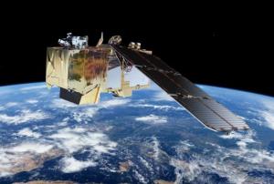
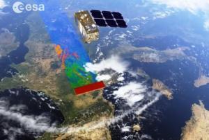
moreOn 7 March 2017 ESA launched the new Sentinel-2B satellite from the Kourou spatial station in French Guyana as a twin to the Sentinel-2A which has been in orbit since June 2015. Together, the two Sentinel satellites will cover the surface of the Earth every five days. This improved coverage will be of extreme value to those involved in disaster risk reduction and emergency response efforts as the satellites will reduce the re-visit time to areas affected by disasters worldwide.
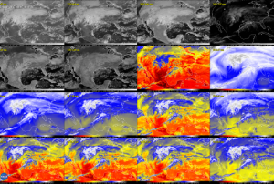
GOES-16 is the first spacecraft of NOAA’s (National Oceanic and Atmospheric Administration) next-generation geostationary satellites. NASA informed on 23 January 2017 that it had sent the first high-resolution images. This incredibly sharp imagery now opens new weather forecasting possibilities, as it provides more detailed view of hazardous weather and reveals features that previous instruments might have missed. The forecast can thus be more accurate and provide better information to emergency managers.
To see GOES-16’s first images, visit NOAA’s Satellite and Information Service website: http://www.nesdis.noaa.gov/content/goes-16-image-gallery
more
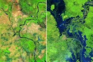
NASA’s platform Images of Change has added new series of images that show how the mankind has changed the planet. The images were being captured over time and then compared; the changes can be seen clearly. They show e.g. shrinking glaciers, deforestation, urbanization, lake level fluctuations and other phenomenon. To see the changes, click here: http://climate.nasa.gov/images-of-change?id=372#372-urban-growth-tucson,-arizona. According to NASA these images serve as a source for studying the planet Earth’s transformation as well as for creating necessary policy measures.
Read more at: http://www.lemonde.fr/planete/video/2017/01/26/avant-apres-des-images-aeriennes-montrent-l-impact-de-l-homme-sur-la-...
moreThe 2017 Global Platform for Disaster Risk Reduction will be held in Cancun, Mexico on 22-26 May. It is the first time that the Global Platform Session is hosted outside Geneva. There are more than 5,000 participants expected, including policy makers and disaster risk managers.
The Global Platform is being held biennially since 2007 and it is one of the world’s biggest gatherings of disaster risk reduction stakeholders. It brings together government officials as well as leaders from the private sector, science and civil society and it facilitates the dialogue among them. The Platform also aims to establish a stronger and more sustainable movement towards disaster risk reduction and create new alliances for the investment, development and use of tools applied in disaster risk reduction.
UN-SPIDER will take part in the Global Platform Session as it has done in previous occasions, and is working with the partners of the Global Partnership using Space Technology...
moreScientists from the Join Research Center collaborating with Google have quantified changes in global water surface which are documented in interactive maps they created for the modifications happening over the past three decades.
They created the Global Surface Water Explorer using more than three million satellite scenes collected between 1984 and 2015 and produced using 10000 computers running at the same time. Each individual image was converted into a set of global maps with a resolution of 30 meters allowing the users to assess changes in the location and persistence of surface water at the local, regional and global levels.
The Explorer shows that water surface have increased during the considered time period. While some 90000 km2 of permanent surface water is disappearing, 180000 km2 of new permanent water bodies are forming in some regions of the world. The decrease is related to drought and human action including river diversion, damming and...
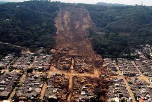
moreExtreme events like heavy rainfall, storms or hurricane activate landslides. Unstable soil surface conditions can make heavy rains act as the triggering point for mud, rocks and/or debris to move down from mountains and hillsides. These mass movements cause unexpected human and economical losses. Heavy rainfall is the most common cause for landslides although earthquakes, volcanic eruptions, erosion, collapse of groundwater reservoirs, ice melt can also cause them.
NASA developed the Global Landslide Catalog (GLC) to indentify rainfall-triggered landslides incidents in the planet, no matter the size, impact or location. The GLC collects information from media, disaster databases, scientific reports and other sources. The Catalog has been gathered since 2007 at NASA Goddard Space Flight Center. For more information on the GLC please click here.
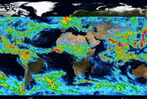
The Integrated Multi-satellitE Retrievals for Global Precipitation Measurment or IMERG released through NASA GES DISC, is a global rainfall dataset providing precipitation rates for the whole planet every half hour. Estimating the amount of accumulated rainfall for any region over a period of time is possible using IMERG. The NASA Scientific Visualization Studio site offers an animation that shows an example of rainfall in the planet during a week in August, 2014 and can be accessed here.
The World Science Day for Peace and Development established by UNESCO in 2001 is commemorated every year on 10 November. It is not only a symbolic but essential celebration considering that Science is at the center to reach the goals of the 2030 Agenda for Sustainable Development, the Sendai Framework for Action and the Paris Agreement on Climate Change. The peaceful use of Space science and technology is vital for economic and social development in different fields like agriculture, global health, environment, sustainable development, education, Humanitarian assistance among others. In the case of Disaster Management, the use of technology helps to reduce the impact of disasters both at the human and material level. During the last two centuries natural disasters, like hurricanes, floods, earthquakes, landslides and wildfires have become more frequent, unpredictable and intense. Before a storm, for example, remote sensing information provides with systems and models to...
moreOn Tuesday 08 November 2016, UNFCCC organized the “Earth Info Day” during CoP 22 as part of the SBSTA activities. The event was used to showcase the benefits of Earth observation to track the manifestations of climate change in the atmosphere, in the oceans, and the polar caps. The opportunity was used to make participants attending this event aware of the strengths of Earth observation technologies to track the uneven manifestation of sea-level rise in different regions of the world, the melting of ice in the polar caps, in Greenland and in glaciers, the changes in concentration of greenhouse gases in the atmosphere in recent decades, and of the changes in temperature and salinity that the oceans are experiences as a result of the absorption of heat and CO2. The Global Climate Observing System (GCOS) took the opportunity to present information on the GCOS Implementation Plan that has been presented to the CoP for consideration; as well as...
moreWith the entry into force of the Paris climate change agreement on 04 November 2016; the Conference of Parties to the Climate Change Convention (CoP) in Marrakesh is essentially the first conference of parties dealing with its implementation. As in previous CoPs, delegations from many Member States are meeting to agree on the ways in which the Paris agreement will be implemented.
UNOOSA is participating in various events including the special meeting of Heads of Space Agencies, to be attended by the Director of the Office, the 45th SBSTA session, the Earth Information Day organized by UNFCCC under SBSTA, and the session of the Nairobi Work Programme (NWP). The opportunity has been used to make delegations attending the SBSTA session aware of the UNISPACE+50 process launched by the Committee on the Peaceful Uses of Outer Space and UNOOSA since last year, that is aimed to...
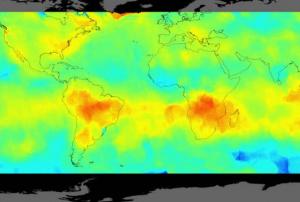
moreScientists from the Finnish Meteorological Institute, Helsinki, produced three maps of carbon dioxide emissions based on satellite observations from NASA’s Orbiting Carbon Observatory-2 (OCO-2) and combining it with an innovative data-processing method.
This is the first time a satellite measures carbon dioxide with extreme precision permitting the creation of maps based exclusively on the data it provides. Three highest-emitting areas of the planet: eastern United States, Central Europe and East Asia are the focus of the mapping. The complete results were published on 1 November 2016 in the paper “Direct Space-Based Observations of Anthropogenic CO2 Emission Areas from OCO-2” that appears on the journal Geophysical Research Letters.
One of the key points of the OCO-2 mission that was launched on July 1st 2014, is to be an innovative tool for...
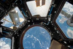
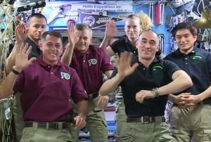
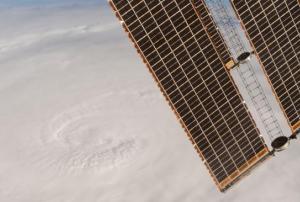
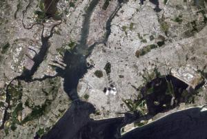
moreThe International Space Station (ISS) is celebrating 16 years of space living. The station was built with the contribution of space agencies from 15 countries between 1998 and 2011. The first crew from the Russian Federation and the United States arrived in the station on 02 November 2000. According to ESA, the station weights almost 400 tonnes and has more than 820 cubic metres of pressurised space - enough room for its crew of six persons and a vast array of scientific experiments. More information from ESA about ISS here. The station orbits around the Earth roughly every 90 minutes. In recent years the Space Station has been fitted with high definition cameras that provide images of Earth. Crews in orbit can collect images of specific events on the planet as they unfold, which can contribute to...
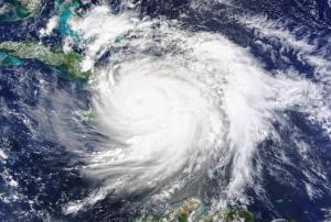
moreSatellites improvements are an important contribution to the monitoring and forecasting of future storms. NASA is managing a new group of eight economical microsatellite observatories, called the Cyclone Global Navigation Satellite System (CYGNSS) that will be orbiting the Earth at low level. Each observatory will be evenly placed around the world. The mission’s launch is expected for 12 December 2016 from Cape Canaveral in Florida and it will start operating at the beginning of the 2017 hurricane season in the Atlantic.
The goal is to measure areas within a storm that were out of reach to space observation in the past like strong inner rain-bands and superficial winds close to the eyewall of hurricanes. The measurement will be done with GPS signals and technology on a small scale, which means that there is no need for active devices like radars or lasers. This technology is essential for emergency management...
Monitoring the soil after seismic activity is fundamental to understand the small but significant modifications on the soil. Thanks to the merge of satellite imagery and computing is possible to do it automatically nowadays. The Copernicus Sentinel-1 twin radar satellite takes consecutive pictures of the same place and the imagery is then combined with cloud computing to unveil millimeter variations.
This well-known practice was developed in the 80’s using GPS centimeter measurements.
The on-line and cloud-based Geohazards Exploitation Platform allows the processing of large amount of satellite information covering vast geographic regions, showing the benefits of ICT when applied to earth observation.
In the nearest future the plan is to cover all tectonic plates in the world contributing to the preparedness and risk reduction in case of volcanic hazards or tremors....
moreThe relevance of Satellite images to estimate the number of people living in urban or rural areas was presented on 18 October 2016 by the European Commission’s Joint Research Centre (JRC) at the United Nations Conference on Housing and Sustainable Urban Development (Habitat III) held in Quito, Ecuador from 17 to 20 October 2016.
This vital information is presented in the Global Human Settlement Layer (GHSL), a new, open and free tool that is also the most complete and reliable of its kind. Besides providing information on where people live, it is also an evaluation instrument when it comes to determine which urban centers are exposed to disasters.
The GHSL shows the growth in population and of built up areas over the last 40 decades. The world urban population living in coastal regions has duplicated, from 45 million people on 1975 to 88 million people on 2015, reported EARSC. This expansion also increases...
moreOn 20 October 2016 the Ocean and Land Colour Instrument released its first imagery. The tool is the most new of the Copernicus Sentinel-3A satellite, operated and managed in collaboration between the European Space Agency (ESA) and the European Organization for the Exploitation of Meteorological Satellites (Eumetsat). The data it will provide includes among others: information on oceans, continental water, events like el Niño and la Niña and changes in weather, which contribute to examine how healthy the planet is.
