Incendio
Definition
Facts and figures
Further information
UN-SPIDER Regional Support Offices with hazard-specific expertise
Related content on the Knowledge Portal
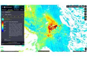
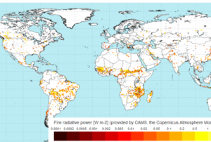
- The Copernicus Atmosphere Monitoring Service (CAMS) uses near-real-time observations of the location and intensity of active wildfires to estimate the emissions of pollutants. This is done through its Global Fire Assimilation System (GFAS). This allows active fires to be monitored and their estimated emissions to be used in the CAMS forecasts to predict the transport of the resulting smoke in the atmosphere. The forecasts are used in air quality apps, to help people limit their exposure to pollution, and by policymakers and local authorities to manage the impact of fires.Publishing institution:
- The Copernicus Atmosphere Monitoring Service (CAMS) uses near-real-time observations of the location and intensity of active wildfires to estimate the emissions of pollutants. This is done through its Global Fire Assimilation System (GFAS). This allows active fires to be monitored and their estimated emissions to be used in the CAMS forecasts to predict the transport of the resulting smoke in the atmosphere. The forecasts are used in air quality apps, to help people limit their exposure to pollution, and by policymakers and local authorities to manage the impact of fires.Publishing institution:
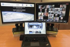
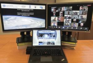
In order to discuss and promote the use of space technologies in addressing natural hazards such as forest fires and landslides in Latin America, UN-SPIDER conducted a virtual regional expert meeting on the topic of “Space-based Solutions for Disaster Risk Reduction and Emergency Response in Latin America” from 22 to 24 September 2020. The meeting was jointly organized with UN-SPIDER Regional Support Offices from Argentina (National Space Activities Commission, CONAE), Brazil (Federal University of Santa Maria, UFSM), Colombia (Geographic Institute Agustin Condazzi, IGAC), and Mexico (Mexican Space Agency, AEM).
In Latin America, UN-SPIDER and its Regional Support Offices have regularly carried out regional expert meetings, training courses and other joint efforts since 2011. The last Regional Expert Meeting took place in 2017 in Mexico.
The meeting, which consisted of three two-hour-long sessions, brought together a total of over 200 disaster management stakeholders...
read moreRegional Support Offices mentioned:28/09/2020En décadas recientes muchas comunidades en América Latina y el Caribe han experimentado desastres ocasionados por inundaciones, sequías, deslizamientos, terremotos, erupciones volcánicas y maremotos o tsunamis que han erosionado los logros asociados a procesos de desarrollo. Además, en este año 2020 la pandemia ocasionada por el virus COVID-19 ha impactado a muchos países del mundo, forzando a los gobiernos, al sector privado, a la sociedad civil y a organismos regionales e internacionales a modificar sus planes de trabajo. De manera paralela, varios países del Este de África, del Sudoeste de Asia y de América Latina están experimentando los impactos de la plaga de langosta.
Convencidos que las tecnologías espaciales pueden jugar un papel preponderante en apoyar los esfuerzos que llevan a cabo las instituciones en materia de gestión para la reducción de riesgos, la preparación, la respuesta y la recuperación en caso de desastres; la Asamblea General de las...
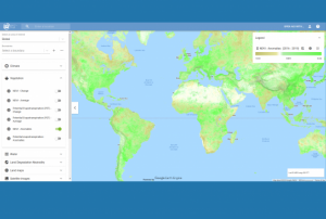
read moreRegional Support Offices mentioned:Google and the Food and Agriculture Organization (FAO) of the United Nations have launched a new tool that provides access to multidimensional maps and statistics showing key climate and environmental trends. Earth Map draws on the processing power of Google Earth Engine and aims to help develop insights based on satellite and FAO’s agriculturally-relevant data alike. It follows the joint development by Google and FAO of the Collect Earth platform for forest and land cover assessments, and integrates with the recently launched FAO Hand-in-Hand geospatial platform.
Tapping into the wide range of multi-temporal and quasi real-time satellite data available through Google Earth Engine, Earth Map provides...
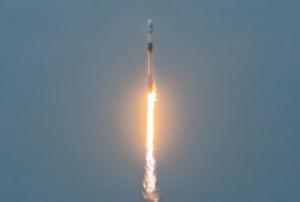
read more18/09/2020- The Argentinean SAOCOM 1B satellite [was successfully launched](https://www.argentina.gob.ar/noticias/argentina-lanzo-el-satelite-saocom-1b-y-completo-la-mision-espacial-mas-importante-del-pais) into orbit on 30 August 2020. Developed by the National Argentinean Space Commission (CONAE), this new satellite will join SAOCOM 1A and four Italian COSMO-SkyMed to complete the joint Italian-Argentinean Satellite System for Emergency Management (SIASGE). Like its predecessor, SAOCOM 1B was built in Argentina through a joint effort with private companies and universities. It will operate at an elevation of 620 kilometers above the surface of the Earth. A SpaceX Falcon 9 booster launched the satellite from Space Launch Complex 40 at Cape Canaveral Air Force Station in Florida, United States of America. The SAOCOM 1B satellite has been fitted with a Synthetic Aperture Radar (SAR) sensor that makes use of microwaves in the electromagnetic L-band, which goes through clouds and works without... read moreRegional Support Offices mentioned:14/09/2020
Upon the request of the National Office for Civil Protection (ONPC) of Tunisia, the UN-SPIDER programme produced and provided a map with fires detected during the 2020 fire season. The active fire data was obtained from the Fire Information for Resource Management System (FIRMS), which provides MODIS Collection 6 (1km resolution) and VIIRS (375m resolution) active fire/hotspot information.
Besides a map, UN-SPIDER also provided the project files for import into the free and open source GIS application QGIS. During a subsequent call with stakeholders in Tunisia, UN-SPIDER explainted the space-based data and methdology used for the production of the map.
According to the latest issue of an annual disaster statistics report, floods were the deadliest type of disasters in 2019, followed by extreme temperature, while storms affected the highest number of people. Published by the Centre for Research on the Epidemiology of Disasters (CRED), “Natural disasters 2019 - Now is the time to not give up” draws on data recorded in the Emergency Events Database (EM-DAT), which saw the addition of 396 disasters that affected a total of 95 million and caused $103 billion in economic losses around the world.
Accounting for 40 per cent of disaster events, Asia suffered the highest impact with 45 per cent of deaths and 74 per cent of total affected. India, which saw cyclone Fani cause destruction in 2019, was the country most...
read more20/08/2020On 22 July 2020, UN-SPIDER and the Central American Coordination Centre for Natural Disaster Prevention (CEPREDENAC) joined forces to conduct a webinar on the use of novel space-based products and services to monitor forest fires that took place during the spring of 2020 in Honduras. The webinar included high ranking authorities and participants from several institutions of Honduras such as the Ministry of Environment (MiAmbiente), the National Forestry Conservation Institute (ICF), the Permanent Contingencies Commission (COPECO), the National Fire Brigade and the Humanitarian Rescue Unit (UHR), alongside participants from CEPREDENAC and UN-SPIDER.
Alexander Ariza, an expert on the use of Earth observation to monitor forest fires, and currently a Visiting Scientist with UN-SPIDER, made a presentation on novel products and services developed by the space community that can be used to track forest fires and associated smoke plums, and to assess the burn severity of forest fires...
read more27/07/2020


![Contains modified Copernicus Sentinel data [2020] processed by Sentinel Hub. Contains modified Copernicus Sentinel data [2020] processed by Sentinel Hub.](/sites/default/files/styles/w300_h202_covid_19_detail/public/2020-08-16-Sentinel-2_L2A_True_color_1.jpg?itok=kbFLX9Aa)
