![]()
United
Nations
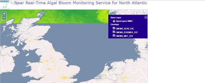
Near Real-Time Algal Bloom Monitoring Service for North Atlantic (Copernicus)
| Data provided by: | Copernicus |
| Data accessibility: | Exportar datos |
| Link to the data: | |
| Data type: | Datos sobre amenazas específicas |
| Hazard: | Harmful Algal Bloom |
| Disaster cycle phase: | Gestión des Riesgo por Desastres, Respuesta, Recuperación |
| Space-based Information: | The map indicates chlorophyll-A and sea surface temperatures in the North Atlantic based on data. The products can be downloaded from the CMEMS catalogue using different protocol (ftp, wms...): NEAR REAL TIME (DAILY UPDATED) BASED ON SINGLE SENSOR (OLCI-A) AND MERGED SENSORS (MODIS-A & VIIRS-N): Global level-3 Daily: OCEANCOLOUR_GLO_CHL_L3_NRT_OBSERVATIONS_009_032 Global level-4 Climatology, Monthly, 8-days products and daily-Optimal-Interpolation: OCEANCOLOUR_GLO_CHL_L4_NRT_OBSERVATIONS_009_033 Atlantic level-4 Daily-Optimal-Interpolation: OCEANCOLOUR_ATL_CHL_L4_NRT_OBSERVATIONS_009_037 REPROCESSED TIME-SERIES BASED ON MERGED SENSORS (SeaWifs, MERIS, MODIS-A & VIIRS-N): Global level-3 Daily products: OCEANCOLOUR_GLO_CHL_L3_REP_OBSERVATIONS_009_085 Global level-4 Monthly, 8-days and Daily-Optimal-Interpolation: OCEANCOLOUR_GLO_CHL_L4_REP_OBSERVATIONS_009_082 Atlantic level-4 Daily-Optimal-Interpolation: OCEANCOLOUR_ATL_CHL_L4_REP_OBSERVATIONS_009_098 ACRI-ST ALSO PROVIDES COMPLEMENTARY PRODUCTS REFERENCED AS GLOBAL LEVEL-3 AND LEVEL-4 OPTICS PRODUCST (reflectances, KD, CDM, BBP, SPM) |
| Satellites and Sensors: | Aqua, Sentinel-3A, OrbView-2 (SeaWiFS), Suomi NPP |
| Spatial coverage: | Europe |
| Temporal coverage: | Casi en tiempo real |
| Technical Specifications: | |
| Costs: | Gratis |
| Contact: | Lasse Peterson |
| Tutorials on the use of data: | Use Case |
Provider
![]()