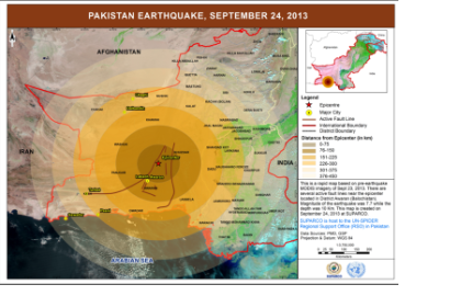
An earthquake measuring 7.7 Richter scale struck Pakistan's South Western region in Balochistan province at 16:30 hours on 24 September 2013. The epicenter of earthquake was 10 km deep and 120 kilometers south-west of Khuzdar district. The tremors of the earthquake were felt across the country, seriously affecting Awaran and Kech Districts of Balochistan. According to National Disaster Management Authority about 375 individuals were confirmed deaths and 815 injured.
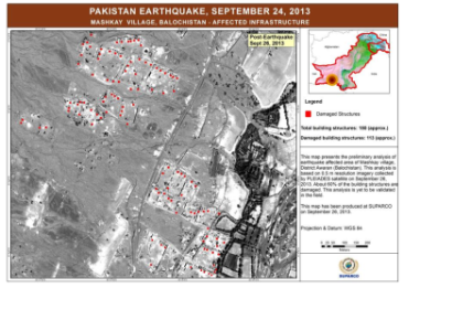
SUPARCO, host of UN-SPIDER's Regional Support Office in Pakistan, immediately requested for tasking of Pleiades satellite to capture images of the affected target areas. Additionally, the International Charter: Space and Major Disasters was activated by UNICEF. This effort made available very high resolution images within just two days after the earthquake which greatly helped in identifying the most affected areas and estimating the extent of damages to the building structures. The affected villages and towns were in remote areas and population spread at distant location with difficult road access, therefore ground information was not immediately available. Space-based information greatly helped disaster management authorities in planning the rescue and relief work.


