Sri Lanka

country taxonomy block

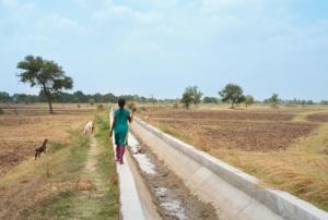
Excerpt from article by Giriraj Amarnath, IWMI

Experts at COP 27 have made apocalyptic forecasts of weather under climate change if urgent action is not taken. In South Asia, the anticipated ‘climate chaos’ is already a reality for many, with extreme droughts and floods increasingly affecting the region. According to the World Bank, losses will average USD 160 billion per year by the end of this decade if current trends continue. If South Asian nations and communities are to cope as climate change progresses, they need advance warning of extreme events, so they can put mitigation plans into action, and avoid climate hazards becoming major disasters.…

more
Publishing date 02/12/2022
Regional Support Offices mentioned:

The International Charter Space and Major Disasters has been activated for flooding in Djibouti on 20 May and Sri Lanka on 21 May 2018.

In Djibouti, tropical cyclone Sagar caused flash floods across the country, impacting up to 30,000 people according to authorities. The United Nations Institute for Training and Research's (UNITAR) Operational Satellite Applications Programme (UNOSAT) requested the activation on behalf of the United Nations Office for the Coordination of Humanitarian Affairs (UNOCHA). UNOSAT is acting as the project manager for the activation.

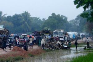
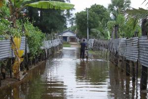
In Sri Lanka, monsoon rains have claimed the lives of eight people and have left a further 172 requiring emergency assistance. Rain and winds have closed roads, interrupted power lines and displaced many people. With the continuation of heavy rains, landslides also became an issue.

The activation…

more
Publishing date 22/05/2018

At the request of the Government of Sri Lanka, through the Ministry of Disaster Management (MoDM), UN-SPIDER carried out a Technical Advisory Mission (TAM) follow-up activity to Sri Lanka to understand long-term capacity building needs and discuss joint activities in next three to five years.

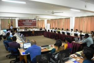
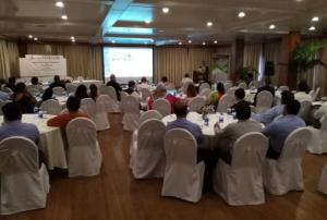
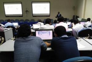
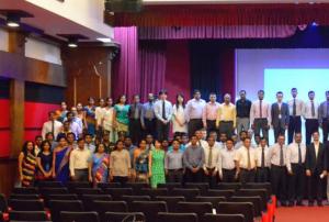
As a part of this TAM follow up mission, a one day workshop was organized under the guidance of MoDM on 22 March 2018. About 30 representatives (high-level officials) from the following stakeholder organisations attended the meeting: MoDM, Disaster Management Center (DMC), National Disaster Relief Services Center (NDRSC), Department of Meteorology (DoM), National Building Research Organisation (NBRO), Department of Census and Statistics, Department of Irrigation, Department of Survey, Ministry of Environment, National Disaster Reduction Center of China (NDRCC), Asian Disaster Preparedness Center (ADPC) and the International Water Management Institute (IWMI). The mission team also met…

more
Publishing date 09/04/2018

The Disaster Management Center (DMC) of Sri Lanka has become an Authorized User (AU) of the International Charter Space and Major Disasters.

In 2005, DMC was established to act as the main organization for planning, coordination, and execution of natural and other forms of disasters. Among the fundamental functions of DMC is to assist and take responsibility in planning and implementing the national disaster management plan and the national emergency operation plan.

The International Charter on Space and Major Disasters has been operating since 2000, supporting disaster response efforts through satellite-derived information. The Charter is a worldwide collaboration between space agencies. As an Authorized User (AU), DMC will be able to request activations in instances of fast-onset disasters of natural or technological origin.

The United Nations Platform for Space-based Information for Disaster Management and…

more
Publishing date 08/03/2018

UN-SPIDER has been invited to participate in a workshop and conference organized by the MOBILISE project in Colombo, Sri Lanka. The project, conducted in Sri Lanka, Pakistan and Malaysia, brings together academic institutions from the United Kingdom, Sri Lanka, Pakistan and Malaysia as well as government agencies involved in disaster risk reduction and emergency response efforts. More than fifty participants from a variety of institutions and universities where the project is being conducted, representatives of the United Nations and other international and regional organizations convene in Colombo for the events, which take place from 27 February to 1 March.

Under session 3 on "Applications of satellite technology in disaster risk reduction", which takes place on 28 February, UN-SPIDER will present on the role of satellite technology in disaster risk…

more
Publishing date 27/02/2018

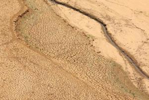
The ongoing drought in Sri Lanka, believed to be the worst in 40 years, began towards the end of 2016 and the beginning of 2017 with abnormally low soil moisture in Northern Sri Lanka and India’s Tamil Nadu state. At the beginning of this month, the number of people affected by the drought exceeded two million.

Drought is not a novel phenomenon in Sril Lanka, but what makes the current episode unique is its intensity, severity and persistence, similar to the drought episodes in 2012 and 2014. Kurunegala District in the North Western Province is one of the areas that has experienced devastating effects of drought ranging from reduction of water supplies for crop irrigation to nearly empty reservoirs, with significant impacts on livelihoods. The effects of the drought have also undermined the country’s rice- based food system.

Relevant and…

more
Publishing date 19/09/2017
Regional Support Offices mentioned:
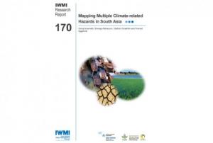
Countries experience multiple climate-related risks that vary spatially and in time, with the combined impact of such risks carrying severe consequences for the population. A new collaborative research study by the International Water Management Institute (IWMI), the United Nations University Institute for Water, Environment and Health (UNU-INWEH) and the CGIAR Research Program on Climate Change Agriculture and Food Security (CCAFS) identifies the need to carry out regional level assessments of these risks in South Asia. The IWMI Research Report 170 suggests methods for mapping such climate-related risks and estimating their subsequent impacts. Space-based information is a key component in this context and supports efforts to estimate the impact on people and agriculture in South Asia. Regional, national and sub-national assessments of five related risks - floods, droughts, extreme rainfall, extreme temperature and sea-level rise, were carried out in the region. The… more
Publishing date 04/07/2017
Regional Support Offices mentioned:

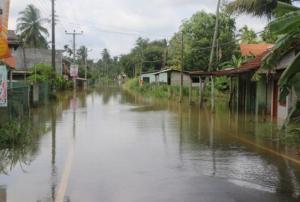
Due to the heavy monsoon rains that have plagued Sri Lanka over the past week, severe flooding and mudslides in the Western and Southern regions have claimed at least 188 lives, displacing a further 112,000 and directly affecting more than 500,000 according to the estimates of Disaster Management Centre of Sri Lanka (DMC). The International Disaster Charter was activated on 26 May 2017 by the United States Geological Survey (USGS) on behalf of the Disaster Management Centre of Sri Lanka. The International Water Management Institute (IWMI/CGIAR), a UN-SPIDER Regional Support Office (RSO), acts as project coordinator for this activation.

These monsoon rains are the worst to hit Sri Lanka since 2003. They follow two months of severe drought. The district of Matara has been particularly affected. Finance Minister Mangala Samaraweera said that there…

more
Publishing date 30/05/2017
Regional Support Offices mentioned:

The Disaster Management Centre of Sri Lanka and UN-SPIDER began a three-day training workshop in Colombo to enhance the use of the UN-SPIDER Knowledge Portal. The training workshop will cover different sections of the Portal and will include an in-depth training on the Recommended Practices developed for floods and droughts. The trianing workshop brings together professional staff from the Disaster Management Centre,Ministry of Health, the Survey Department, the Census and Statistics Department, the National Aquatic Resources Agency, the University of Colombo, University of Moratuwa, Sri Lankan Army. Navy and Air Force, the Mahaweli Authority, the Coast Conservation Department, and the Arthur C. Clarke Centre for Modern Technology.

The training workshop will support the efforts conducted by the Disaster Management Centre in the areas of flood rapid mapping and drought early warning. Furthermore, it will contribute to the implementation of the Virtual Mapping Unit that the DMC…

more
Publishing date 26/04/2017

Today, the Intergovernmental Oceanographic Commission of UNESCO (IOC-UNESCO) opened their training workshop "Coastal Hazard Assessment: Applications in Risk Assessment, Management and Mitigation" in Colombo, Sri Lanka, where the 2004 tsunami killed more than 35,000 people.The workshop, taking place from 2 to 5 June 2015, is bringing together 27 participants from 17 countries exposed to tsunamis here in the Indian Ocean.

Risk assessment and risk management are one of the three key areas of work of UNESCO-IOC. The workshop is part of the “Tsunami Risk Assessment and Mitigation for the Indian Ocean” project (TRATE), sponsored by UN ESCAP (United Nations Economic and Social Commission for Asia and the Pacific), and one of the activities of the recently established Working Group on Risk Assessment and Mitigation of the International Coordination Group of the Indian Ocean Tsunami Warning System. The project involved a revision of the Tsunami Risk Assessment guideline.…

more
Publishing date 02/06/2015

An agreement signed by all South Asian Association for Regional Cooperation (Saarc) states (Afghanistan, Bangladesh, Pakistan, Sri Lanka, Maldives, Nepal, Bhutan and India) is underway to promote a rapid response to natural disasters.

A Saarc monitoring system including tools for early warning system and risk mitigation could ease the humanitarian and technical assistance in member states when affected by natural disasters, facilitating for instance disaster relief or information on potential risks.

India is taking a leading role in setting up the system and is committed to provide technical assistance to all member states, besides manpower and financial support, as The Times of India informed.

"New Delhi was signatory to an agreement in Jakarta this January to develop a standard operating procedure for the region," said Santosh Kumar, director of Saarc Disaster Management Centre and executive director of the National Institute of Disaster Management.

more
Publishing date 29/04/2015

New Mobile Weather Stations, designed by scientists at the Sri Lanka-based International Water Management Institute, capture and transmit near real-time data on rainfall, helping raise the alarm when rains reach a certain level of intensity. The new Mobile Weather Stations are equipped with an atomic clock to give precise time and date readings, and a GPS sensor, which updates automatically if they are moved. A system is also being developed for connecting them to Sri Lanka’s mobile phone network to transfer the data.

Sri Lanka regularly experiences variations in weather – especially rainfall – over short distances. This makes it very difficult to accurately predict natural hazards like floods and landslides. To do so, one would have to significantly increase the number of weather stations, which would be very expensive (around USD$10,00 per station).

With the new Mobile Weather Stations this improvement could be achieved at much lower cost. Those…

more
Publishing date 24/02/2015
Regional Support Offices mentioned:

On 5 February 2015, on the occasion of the 6th annual meeting of UN-SPIDER's Regional Support Offices (RSOs) in Vienna, UNOOSA/UN-SPIDER and the International Water Management Institute (IWMI) based in Colombo, Sri Lanka, signed a memorandum of understanding, making IWMI the 17th member of UN-SPIDER's network of RSOs. The memorandum was signed by UNOOSA's director Simonetta Di Pippo on behalf of UNOOSA and Dr Giriraj Amarnath on behalf of IWMI.

Simonetta Di Pippo stressed the importance of the RSOs for UN-SPIDER's work: "I see the RSO network as a key component of the programme and even more so in the future." She also pointed out that she was hopeful that other organizations would join the network soon.

IWMI is a non-profit, scientific research organization focusing on the sustainable use of water and land resources in developing…

more
Publishing date 05/02/2015
Regional Support Offices mentioned:

As a follow up to the UN-SPIDER Technical Advisory Mission to Sri Lanka in 2011, a national workshop and training programme on “Earth Observation Technologies for Flood Risk Mapping, Modelling and Management” was held from 17 to 21 November 2014. The activity was jointly realised by UN-SPIDER, the International Water Management Institute (IWMI), the Disaster Management Centre (DMC) of the Ministry of Disaster Management (MoDM), and Postgraduate Institution of Science, University of Peradeniya.

The objective…

more
Publishing date 25/11/2014
Regional Support Offices mentioned:

The International Charter: Space and Major Disasters was activated on 30 October 2014 to provide satellite-based emergency maps in the context of a massive landslide in Sri Lanka. The mechanism was activated by the Asia Disaster Reduction Centre (ADRC). The project management will be handled by the Asian Institute of Technology.

Monsoon rains in Sri Lanka caused a landslide on 29 October 2014, which is believed to have killed over a hundred people. The landslide occurred near the town of Haldummulla and mud and debris buried approximately 150 houses, and potentially more than a hundred residents.

Sri Lanka has experienced other landslides in the past few months, due to further bouts of monsoon rain, but this latest incident has taken the highest toll in lives of the year.

Maps and other products generated through the International Charter will be published on their website as soon as they become available.

Publishing date 31/10/2014

As a follow up of the UN-SPIDER Technical Advisory Mission (TAM) to Sri Lanka in October 2011, UN-SPIDER organised the training “Space Technology for Improving Hazard Mapping in Sri Lanka” from 14 to 17 August 2012. A second follow up training programme is scheduled from 17 to 21 November 2014.

To support the implementation of recommendations of the TAM, UN-SPIDER has organized this national programme to move forward with the specific recommendations of the TAM. The workshop and training programme “Earth observation technologies for flood risk mapping, modelling and management” will be jointly conducted by UN-SPIDER, the Sri Lanka Disaster Management Centre DMC and the International Water Management…

more
Publishing date 29/09/2014

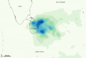
Data from NASA's Tropical Rainfall Measuring Mission (TRMM) revealed extraordinary flooding in Sri Lanka caused by unusually strong monsoonal rainfall over the period 31 May - 4 June 2014, as research at the International Water Management Institute (IWMI) shows.

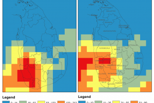
The heavy monsoon precipitation occurred mainly in the Western and Southern Province of Sri Lanka. Massive flooding was reported in the districts of Kalutara, Ratnapura and in parts of Colombo, Galle and Matara. The accumulated rainfall was about 4 to 6 times as high as compared to the rainfall in the same period in 2013. For example, the Kalutara district received an average accumulated rainfall of 303mm from 31 May to 4 June 2014 - compared to 56mm in 2013.

The International Water Management Institute responded promptly to the disaster by identifying extreme floods in the region using flood-mapping tools. Giriraj Amarnath, Researcher – Remote Sensing and Water Resources at IWMI, used Satellite-derived…

more
Publishing date 16/06/2014

Recognizing geospatial information as an essential resource that supports the economic, social and environmental interests, the Survey Department of Sri Lanka has recently received a Cabinet approval to build the National Spatial Data Infrastructure (NSDI). The goal is to provide and integrate geographically-referenced data and make it easily accessible in a user-friendly online portal.

An initial step is first to draft the policies, procedures and data standards necessary to foster the efficient use, management and production of geospatial information. “Once the policies are in place, we are looking at launching a geoportal so that citizens can easily access authoritative, consistent and updated maps online", told P.M.P Udayakantha, Senior Assistant Secretary and Senior Deputy Surveyor General at the Department of Survey the website FutureGov. “Furthermore, we are inspired by the journey undertaken by countries like Singapore, Malaysia and others. Everyone has the same…

more
Publishing date 12/12/2013

With the support of UNESCAP, UNESCO-IOC is carrying out a project entitled: “Enhancing Tsunami Risk Assessment and Management, Strengthening Policy Support and Developing Guidelines for Tsunami Exercises in Indian Ocean Countries”. This project will support the efforts of the ICG/IOTWS Working Group 1 on Tsunami Risk Assessment and Reduction and Working Group 3 on Tsunami Awareness and Response.

As part of the activities contemplated in this project, UN-SPIDER has been invited to contribute to the revision and update of the IOC Guidelines on “Tsunami Risk Assessment and Mitigation for the Indian Ocean: Knowing Your Tsunami Risk - and What to Do About it”, which were prepared by Working Group 1 with the support and cooperation of the UNDP Regional Centre in Bangkok (RCB) and published in June 2009 as IOC Manuals and Guides No.52.

The first meeting of the Task Team involved in this activity was held in the premises of the Sri Lanka Disaster…

more
Publishing date 01/03/2013

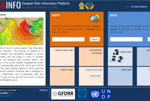
Sri Lanka is a country affected by a variety of hazards including Drought, Flood, Mass Movement, Severe Storm or Tsunami. In order to make information on disaster risks in Sri Lanka more easily available, the Disaster Management Center (DMC) in partnership with UNDP, NGOs and GDFRR Labs launched the Sri Lanka Disaster Risk Information Platform (RiskInfo).

The purpose of RiskInfo is to make disaster risk information available to all the stakeholders and the public in order to facilitate disaster risk reduction and recovery efforts. The data sharing platform is built using the open source software GeoNode that is designed to enable collaborative use of geospatial data and maps.

RiskInfo lets users compose and share maps. Users can create a map with a cartography tool, or explore maps shared by others. Additionally, RiskInfo allows for uploading, managing, and browsing of data. Users can search for data that is…

more
Publishing date 01/03/2013

From 14 to 17 of August 2012, UN-SPIDER conducted the Capacity Building Programme “Space Technology for Improving Hazard Mapping in Sri Lanka”, as a follow-up to the Technical Advisory Mission (TAM) that took place in Sri Lanka in October 2011. The expert team had enlisted in their TAM report a number of recommendations to the Government to strengthen disaster management using space-based information. One of the most important recommendations was to improve the capacity of national agencies in understanding the advances in space technology and its applications in hazard mapping.

The 4-days capacity building training course was jointly organised by UN-SPIDER and the Disaster Management Centre (DMC) in Sri Lanka with support from the Uva-Wellassa University of Sri Lanka, the United Nations Development Programme (UNDP) in Sri Lanka and the National Disaster Reduction Centre of China (NDRCC). 10 Experts from various national and international organizations…

more
Publishing date 24/08/2012

The Sri Lankan Disaster Management Centre (DMC) will release the latest hazard maps in December. This activity is carried out with the UNDP funding and implemented with the support of relevant technical agencies such as UN-SPIDER, which organizes a training program from the 14th till the 17th of August.

More details on the event: http://www.un-spider.org/event/5891/2012-08-14/space-technology-improving-hazard-mapping-sri-lanka

Publishing date 03/08/2012

As a follow-up to a UN-SPIDER Technical Advisory Mission to Sri Lanka in October 2011, UN-SPIDER and the Disaster Management Centre of Sri Lanka are organizing a Capacity Building event from 14-17 August 2012. Supported by the Uwa-Wellassa University of Sri Lanka, the United Nations Development Programme Sri Lanka and the National Disaster Reduction Centre of China, the event will focus on space technology and its applications to hazard mapping. 30 middle level managers and technical staff of various agencies involved in disaster management and hazard mapping in Sri Lanka will participate.

The broad objective of the training is to implement recommendations made by the UN-SPIDER Technical Advisory Mission in order to strengthen the capacity of the national agencies to use Geo-Spatial Technologies for Hazard Mapping, Hazard Monitoring and Risk Assessments. The training programme will cover Flood Hazard Mapping, Coastal Hazard Mapping, DEM and LiDAR Analysis and NSDI Initiatives…

more
Publishing date 24/07/2012

At the request of the Government of Sri Lanka, UN-SPIDER planned the Technical Advisory Mission (TAM) to Sri Lanka from 17 to 21 October 2011. A team of experts will meet with key disaster management authorities in the Government, UN agencies, regional and international organizations and initiatives, as well as private entrepreneurs to discuss, make recommendations and develop guidelines to improve the use of space-based information in disaster management.

Experts from a wide range of organizations will be joining the UN-SPIDER team to participate in the TAM, including representatives from a university, research institutions and space agencies. The National Disaster Reduction Centre of China (NDRCC), the Space and Upper Atmosphere Research Commission of Pakistan (SUPARCO, a Regional Support Office of UN-SPIDER), and the Iranian Space Agency K. N. Toosi University of Technology (facilitated by the Iranian Space Agency, also a Regional Support Office of UN-SPIDER), will join…

more
Publishing date 02/09/2011
Regional Support Offices mentioned: