  • English
  • Español
  • Français

United
Nations


Office for Outer Space Affairs
UN-SPIDER Knowledge Portal

  • Home
  • About Us
    • What is UN-SPIDER?
    • About UNOOSA
    • Publications
    • Jobs
    • Meet the Team
    • Contact
  • Space Application
    • Satellite Technology
    • Emergency Mechanisms
    • Recovery Mechanisms
    • International Asteroid Warning Network
    • Space Mission Planning Advisory Group
    • International Space Weather Initiative
    • Space Technologies in the UN
    • User Stories
  • Links & Resources
    • Data Applications
      • Disaster Recovery
    • Data Sources
    • GIS and Remote Sensing Software
    • Online Learning Resources
    • Institutions
  • Risks & Disasters
    • Disaster Risk Management
    • Early Warning Systems
    • Emergency and Disaster Management
    • Natural Hazards
    • Sendai Framework
    • The UN and Disaster Risk Management
    • The UN and Early Warning
    • The UN and Disaster Management
  • Advisory Support
    • Advisory Missions
    • Emergency Support
    • Virtual Advisory Support
    • Recommended Practices
    • Training Activities
    • Practical Uses
  • Network
    • Regional Support Offices
    • GP-STAR
    • MHEWS
    • IWG-SEM
  • Projects
    • SPEAR
    • SEWS-D
    • EvIDENz
    • Flood GUIDE
    • CommonSpace Initiative
    • Tonga Pilot Project
  • News & Events
    • News
    • Events Calendar
    • UN-SPIDER Events Archive

Breadcrumb

  • Home
  • Sentinel-2B
  • Sentinel-2B

Sentinel-2B

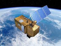
The Sentinels are a fleet of satellites designed specifically to deliver the wealth of data and imagery that are central to the European Commission’s Copernicus programme.
Sentinel-2 carries an innovative wide swath high-resolution multispectral imager with 13 spectral bands for a new perspective of our land and vegetation. The combination of high resolution, novel spectral capabilities, a swath width of 290 km and frequent revisit times provides unprecedented views of Earth.
The mission is based on a constellation of two identical satellites in the same orbit, 180° apart for optimal coverage and data delivery. Together they cover all Earth’s land surfaces, large islands, inland and coastal waters every five days at the equator. Sentinel-2B was launched on 7 March 2017.
As well as monitoring plant growth, Sentinel-2 can be used to map changes in land cover and to monitor the world’s forests. It also provides information on pollution in lakes and coastal waters. Images of floods, volcanic eruptions and landslides contribute to disaster mapping and help humanitarian relief efforts.

Instrument: MultiSpectral Instrument (MSI)

- push broom concept
- 13 spectral bands from VNIR to SWIRD
- includes 3 bands in the 'red edge', which provide key information on vegetation state
- 290km-swath
- 2 large visible near-infrared and shortwave infrared focal planes, each equipped with 12 detectors


7 Mar 2017
7years
Sun synchronous
100 minutes
Multispectral Imaging Spectrometer
ESA
providing information for agricultural and forestry practices and for helping manage food security; determining various plant indices such as leaf area chlorophyll and water content indexes; observation data for the next generation of operational products, such as land-cover maps, land-change detection maps and geophysical variables
Drought
Harmful Algal Bloom
Earthquake
Extreme Temperature
Flood
Forest Fire
Mass Movement
Pollution
Severe Storm
Tsunami
Volcanic Eruption
No
Information about Sentinel-2B on ESA web page

Footer menu

  • Contact
  • Terms of Use

User account menu

  • Log in