  • English
  • Español
  • Français

United
Nations


Office for Outer Space Affairs
UN-SPIDER Knowledge Portal

  • Home
  • About Us
    • What is UN-SPIDER?
    • About UNOOSA
    • Publications
    • Jobs
    • Meet the Team
    • Contact
  • Space Application
    • Satellite Technology
    • Emergency Mechanisms
    • Recovery Mechanisms
    • International Asteroid Warning Network
    • Space Mission Planning Advisory Group
    • International Space Weather Initiative
    • Space Technologies in the UN
    • User Stories
  • Links & Resources
    • Data Applications
      • Disaster Recovery
    • Data Sources
    • GIS and Remote Sensing Software
    • Online Learning Resources
    • Institutions
  • Risks & Disasters
    • Disaster Risk Management
    • Early Warning Systems
    • Emergency and Disaster Management
    • Natural Hazards
    • Sendai Framework
    • The UN and Disaster Risk Management
    • The UN and Early Warning
    • The UN and Disaster Management
  • Advisory Support
    • Advisory Missions
    • Emergency Support
    • Virtual Advisory Support
    • Recommended Practices
    • Training Activities
    • Practical Uses
  • Network
    • Regional Support Offices
    • GP-STAR
    • MHEWS
    • IWG-SEM
  • Projects
    • SPEAR
    • SEWS-D
    • EvIDENz
    • Flood GUIDE
    • CommonSpace Initiative
    • Tonga Pilot Project
  • News & Events
    • News
    • Events Calendar
    • UN-SPIDER Events Archive

Breadcrumb

  • Home
  • FY-3C / FengYun-3C
  • FY-3C / FengYun-3C

FY-3C / FengYun-3C

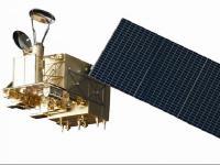
The FY-3 series of CMA/NSMC (China Meteorological Administration/National Satellite Meteorological Center) represents the second generation of Chinese polar-orbiting meteorological satellites (follow-on of FY-1 series). The FY-3 series represents a cooperative program between CMA and CNSA (China National Space Administration); it was initially approved in 1998 and entered full-scale development in 1999. Key aspects of the FY-3 satellite series include collecting atmospheric data for intermediate- and long-term weather forecasting and global climate research.
The FY-3 series satellites monitor large-scale meteorological disasters, weather-induced secondary natural hazards and environment changes, and provides geophysical parameters for scientific research in climate change and its variability, climate diagnosis, and predictions. The FY-3 series renders global and regional meteorological information for aviation, ocean navigation, agriculture, forestry, marine activities, hydrology, and many other economic sectors.

Instruments:
VIRR (Visible and Infrared Radiometer)
IRAS (Infrared Atmospheric Sounder)
MWTS (Microwave Temperature Sounder)
MWHS (Microwave Humidity Sounder)
MERSI (Medium Resolution Spectral Imager)
SBUS (Solar Backscattering UV Sounder)
TOU (Total Ozone Unit)
MWRI (Microwave Radiation Imager)
ASI (Atmospheric Sounding Interferometer)
ERM (Earth Radiation Measurement)
SEM (Space Environment Monitor)
SIM (Solar Irradiation Monitor)

23 Sep 2013
3years
Polar
Sun synchronous
101 minutes
Medium Resolution Imaging Specrometer
Microwave Humidity Sounder
Microwave Radiometer
Visible and Infrared Spin Scan Radiometer
NSMC-CMA
NRSCC
Meteorology and environmental monitoring; data collection and redistribution
Drought
Glacial Lake Outburst
Pollution
Severe Storm
Tsunami
Volcanic Eruption
No
Information about FY-3C

Footer menu

  • Contact
  • Terms of Use

User account menu

  • Log in