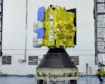
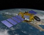
On Saturday, 17 February 2024, the Indian Space Research Organisation (ISRO) successfully launched a meteorological satellite into Geostationary Orbit. This satellite is designed to provide support, including disaster warnings, among other functions.
The INSAT-3DS satellite is a component of the GSLV-F14/INSAT-3DS mission and is funded by the Ministry of Earth Sciences (MoES). The mission aims to achieve enhanced meteorological observations and improve monitoring of land and ocean surfaces.
The NASA Disasters program seeks proposals for projects that expand the development and application of tools and capacities in the use of Earth science information for supporting decisions related to disaster risk reduction, recovery, or resilience. Proposals are required to address the linkages between natural or human-made hazards, exposure to these hazards, and the vulnerability of communities to these hazards for improved disaster management.
The coastlines of the world host a rich mix of dense populations, varying industries, and environmental characteristics that are collectively influenced by both land and sea. To facilitate the production of knowledge and data products regarding these complex coastal regions, the European Commission under the Copernicus program has developed a new online resource: The Copernicus Coastal Hub. The Coastal Hub offers a singular resource for data related to coastal regions including examples of use cases and an interactive data and map viewer.
This is event is available for participation on an ongoing basis
As in the case of other regions of the world, Latin America is exposed to various types of geological and hydro-meteorological hazards which trigger disasters. To contribute to strengthen the skills of professionals that contribute to disaster response efforts through the generation of space-based information, UN-SPIDER, ECLAC and the International Charter Space and Major Disasters organised the training course "Project Management using the ESA Charter Mapper". The training course brought together 15 professionals with skills in project management in case of activ
This is event is available for participation on an ongoing basis
Introduction
In recent decades, communities in Africa have experienced disasters triggered by floods, droughts, landslides, forest fires, Ebola pandemics, and locust plagues that have eroded hard-won development gains. Taking note of advances in space technologies and other technological innovations, the African Union indicated in its 2017 African Space Policy that space represented a unique opportunity for cooperation in using and sharing enabling infrastructure and data towards the proactive management of, inter alia, responses to natural hazards and disasters.
NASA's latest satellite mission, the Plankton, Aerosol, Climate, ocean Ecosystem (PACE), has been launched into orbit, marking a significant step in understanding crucial aspects of Earth's health and climate dynamics. PACE's primary objective is to examine the interplay between various components of Earth's systems, focusing on oceans, atmosphere, and climate.
This is event is available for participation on an ongoing basis
From 12-13 June 2024, the 3rd International Conference on Natural Hazards and Risks in a Changing World: Addressing Compound and Multi-Hazard Risk will take place in Amsterdam, the Netherlands. The conference is organised by MYRIAD-EU, Risk KAN and NatRiskChange.
The United Nations Office for Outer Space Affairs (UNOOSA), in collaboration with the Space Generation Advisory Council (SGAC), launched the fifth edition of the Space4Youth Essay Competition! The Competition targets students and young professionals with the aim to highlight governance practices and experiences on the sustainable use of outer space to address the needs of the present in a manner that protects the interests of future generations.
Scientists at the University of Glasgow have pioneered a method for monitoring river flows using satellite analysis, offering an advanced early warning system for flood risk. Current methods rely on expensive and challenging-to-install stream gauges, limiting coverage, especially in remote areas. The Glasgow researchers utilized video footage from a Chinese satellite to measure river discharge during a February 2022 flood along a 12-mile section of Australia's Darling River.