On 10 May 2022, the United Nations Office for Outer Space Affairs (UNOOSA), the University of Energy and Natural Resources of Ghana, and the Prince Sultan Bin Abdulaziz International Prize for Water (PSIPW) inaugurated the 5th International Conference on the Use of Space Technology for Water Resources Management. The conference, held in Accra from 10 to 13 May 2022, aims to promote the use of space technology in water management in developing countries.
The Asian Institute of Technology (AIT), headquartered in Thailand, is an international institute of higher learning. It is Asia’s pioneer institution established in 1959 to help meet the region’s growing needs for advanced learning in engineering, science, technology and management, research, and capacity building. AIT’s mission is to develop highly qualified and committed professionals who will play a leading role in the sustainable development of the region and its integration into the global economy.
The Asian Institute of Technology (AIT), Thailand, signed an agreement with the United Nations Office for Outer Space Affairs to become a Regional Support Office of the UN-SPIDER programme.
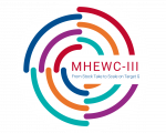
The MHEWC-III invites interested parties, particularly from the following entities, to submit posters on early warning systems that enable early action to save lives and livelihoods:
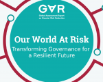
The UN Global Assessment Report on Disaster Risk Reduction (GAR) is the flagship report of the United Nations on worldwide efforts to reduce disaster risk. The GAR is published biennially by the UN Office for Disaster Risk Reduction (UNDRR), and is the product of the contributions of nations, public and private disaster risk-related science and research, amongst others.
Today, on 26 April 2022, UNDRR launched the 2022 GAR entitled "Our World at Risk: Transforming Governance for a Resilient Future".
This is event is available for participation on an ongoing basis
The Indian Space Research Organisation (ISRO) has invited applications from interested students and professionals for a free online course.
The course called “Artificial Intelligence (AI) for Earth Observation (EO) and geodata handling and processing” will be conducted from 2 to 13 May 2022.
ISRO free online course is often conducted by Indian Institute of Remote Sensing (IIRS), a unit under the Indian Space Research Organization (ISRO), Department of Space, Government of India.
Impact-based forecasts that inform the public of what the weather will do rather than what weather will be are vital to save lives and livelihoods. Yet one in three people are still not adequately covered by early warning systems. Being prepared and able to act at the right time, in the right place, can save many lives and protect the livelihoods of communities everywhere, both now and in the future.
From Stock Take to Scale on Sendai Framework Target G: Accelerating the Knowledge and Practice of MHEWS for Risk Informed Resilience
Please visit the Global Platform for Disaster Risk Reduction website for the most complete and up-to-date information on the preparatory events, such as the Third Multi-Hazard Early Warning Conference (MHEWC-III).
This is event is available for participation on an ongoing basis
From Stock Take to Scaling up Actions on Sendai Framework Target G: Accelerating the Knowledge and Practice of MHEWS for Risk-Informed Resilience
Please visit the Global Platform for Disaster Risk Reduction website for the most complete and up-to-date information on the preparatory events, such as the Third Multi-Hazard Early Warning Conference (MHEWC-III).
International Network for Multi-Hazard Early Warning Systems (IN-MHEWS)
World Meteorological Organization (WMO)
United Nations Office for Disaster Risk Reduction (UNDRR)
United Nations Office for Outer Space Affairs and its Platform for Space-based Information for Disaster Management and Emergency Response (UNOOSA/UN-SPIDER)