"We must rise higher to rescue the Sustainable Development Goals – and stay true to our promise of a world of peace, dignity and prosperity on a healthy planet." (António Guterres, Secretary-General, United Nations)
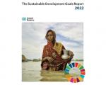
The Sustainable Development Goals Report 2022 provides a global overview of progress on the implementation of the 2030 Agenda for Sustainable Development, using the latest available data and estimates. It tracks the global and regional progress towards the 17 Goals with in-depth analyses of selected indicators for each Goal.
Master's degree in science or Bachelor's degree in engineering or equivalent qualification relevant in the field of study with at least 5 years of experience in teaching / research or professional experience in the field of atmospheric sciences, satellite meteorology, climate change and weather forecast (for candidate with higher qualifications, the minimum experience may be relaxed. High School-level knowledge in mathematics and / or statistics is essential besides the master degree as the base qualification.
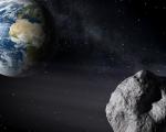
Asteroid Day as observed annually on 30 June is the United Nations sanctioned day of public awareness of the risks of asteroid impacts.
In December 2016 the United Nations General Assembly adopted resolution A/RES/71/90, declaring 30 June International Asteroid Day in order to "observe each year at the international level the anniversary of the Tunguska impact over Siberia, Russian Federation, on 30 June 1908, and to raise public awareness about the asteroid impact hazard."
This is event is available for participation on an ongoing basis
Indian Institute of Remote Sensing (IIRS) under Indian Space Research Organisation, Department of Space, Government of India is a premier Training, Educational and Research Institute established for capacity building in the fields of Remote Sensing and GIS for urban and regional studies and environmental modeling. The Institute is running many on-campus short and long term capacity building programmes.
In this course you will get an overview of the most relevant parameters that have an influence on the radar backscatter signal. You will learn what role the configuration of a radar system and the properties of the Earth surface play in the signal that you see in a pixel of a radar image.
‘Beyond the Visible – Introduction to Hyperspectral Remote Sensing‘.
In this course, you will learn the basics of imaging spectroscopy. No matter if you are a student or a professional or whatever continent you are from, this course was designed for you and we hope to provide some helpful background information, process understanding and applications that relate to your area of interest or expertise.
At the request of the Minister of Emergency Situations of the Republic of Armenia, UN-SPIDER is conducting a Technical Advisory Mission (TAM) to Armenia from 27 June to 1 July 2022. With this mission, UN-SPIDER together with experts aims to assist Armenia in improving disaster risk management and emergency response by the utilization of the space-based technologies and geospatial information, thereby helping to achieve the Sustainable Development Goals (SDGs).
The expert team is comprised of experts from the following institutions:
This is event is available for participation on an ongoing basis
Bhuvan is a Geo-Platform of ISRO launched in 2009 showcasing Multi sensor, Multi-platform and Multi temporal Satellite Imagery from 56m to 1m spatial resolution data for the entire country. It also has rich thematic data - Land Use/Land Cover, Waste Land, Geomorphology, Urban Land Use, Lineaments, Water Bodies, etc. Apart from the above, Bhuvan also provides rich & diverse data like Hydrological Boundaries, Climate and Environment, Disaster, Forestry,Tourism, Water, Urban, Agriculture, etc.