![]()
United
Nations

How can space technology be applied in disaster and risk management?
Where can I access satellite data, products and other resources?
Who are the users of space technology in disaster and risk management?
Which services can UN-SPIDER offer to Member States?
News
")

")
")
")
")

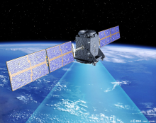
 instrument on 30 June 2009 (Image: ESA)")
")
Upcoming Events


![]()