Belgium

country taxonomy block

In the last days the Copernicus Emergency Management Service was activated by the Philippines affected by the tropical cyclone Koppu, Croatia affected by floods in the Karlovac region and Italy affected by floods and landslides in the Campania region. 

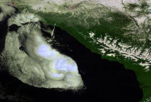
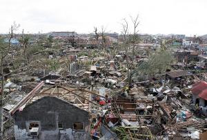
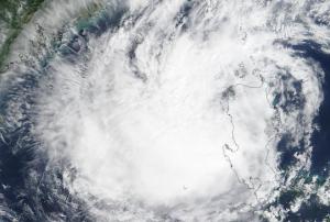
On October 17 the Republic of the Philippines was struck by the powerful tropical cyclone Koppu, causing severe damages in many provinces of the Philippines. The cyclone provoked landslides and floods, damaging trees and houses, forcing thousands of people to evacuate, several casualties had been reported. The Copernicus Emergency Management Service was activated on October 17 requesting delineation maps; two delineation maps had been delivered showing the flood extent.

Since October 15 the Republic of Croatia experiences heavy rainfall in the Karlovac region, causing floods and affecting buildings and roads. The Copernicus Emergency Management Service was activated on October 16 requesting delineation maps; five…

more
Publishing date 21/10/2015

Collaborating with the European Space Agency (ESA), the Network of European Regions Using Space Technologies (NEREUS) has initiated a project working to improve the uptake of Copernicus data by Local and Regional Authorities (LRA) with a series of thematic workshops. The workshops aim to launch a dialog with LRAs and showcase and promote awareness of available satellite-based products, and services.

NEREUS is credited as playing an important role in highlighting the need for the broad use of Copernicus Data and services throughout Europe. The network is an initiative comprised of twenty three regions and forty associate members advocating the use of Earth observation and monitoring Space Based Technologies for the benefit of European citizens with a direct channel to users.

Publishing date 18/06/2014

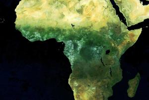
Proba-V was launched in May 2014 and went operational in December. In the just two months of work, the ESA’s vegetation-monitoring Proba-V mini-satellite sent back over 5,000 images, 65 daily global maps and six 10-day global syntheses. 

The satellite measures vegetation growth across the world on a nearly daily basis as it covers 93% of the Earth in one day and 100% in two days. The camera on board was calibrated against measurements from previous satellite missions, so the images can be used immediately. The camera’s resolution was also improved. In comparison to the first generation instrument images which had a resolution of 1 km, this camera has a 333 m resolution.

The output of Proba-V is being processed for ESA by Belgium’s Flemish Institute for technological research. The scientists there have developed a chain of 100m visible and near infrared image…

more
Publishing date 19/02/2014

From 12-13 November 2013, the Global Disaster Alert and Coordination System (GDACS), a cooperation framework under the UN umbrella, met in Brussels to draw up benchmarks that regional crisis centres can use to improve coordination. There are eight regional crisis centres in the world and also two global crisis centres run by the UN, which compile, analyse and share information in the early days of a disaster, sending out alerts and providing needs to aid humanitarian responders and maps of affected areas. However, it is crucial to improve coordination among the centres.

According to officials from the ERCC, global crises and disaster management lacks formal set of rules that regulates the procedures and standards of interaction between national and international authorities during crises. “There are no formal international procedures or standards to ensure how crisis centres would interact in a crisis” Thomas Peter, manager of the ERCC and the GDACS secretariat says, “…

more
Publishing date 03/12/2013

Secure World Foundation (SWF), an NGO that envisions the secure, sustainable and peaceful uses of outer space contributing to global stability on Earth, recently published an updated version of a practical guide on space sustainability.

Satellites provide tangible social, scientific, strategic and economic benefits to billions of individuals throughout the globe. From satellite navigation to weather forecasting, from treaty verification to the management of Earth’s resources, international dependence on the benefits derived from outer space has steadily expanded and will continue to grow. Yet, issues such as space debris, increased crowding in key orbits or radio frequency interference threaten these benefits.

This practical guide to space sustainability provides an introduction connecting our current use and reliance on space, the issues that jeopardize that use, and the historic and ongoing activities underway to help ensure that all humanity can continue to…

more
Publishing date 19/02/2013

The VITO image processing team in collaboration with ESA and Belgian Science Policy announced a new free product in the world of low resolution Earth observation data, the global Envisat-MERIS 10-daily composites at 1 km resolution (EM10). The Envisat-Meris S10 or "EM10" are near-global, 10-daily composite images which are synthesised from the "best available" observations registered in the course of every "dekad" by the orbiting earth observation system Envisat-Meris. VITO ingests all the daytime registrations of ENVISAT-MERIS and further processes them into global, 10-daily synthesis images, very comparable with the S10 of SPOT-VEGETATION.

The EM10 products are available free of charge for non-commercial use and can be downloaded via the on-line catalogue. Currently, products from January 2010 till March 2012 are available in the catalogue; meanwhile VITO is backprocessing all previous years (2002-2012).

MERIS is a programmable, medium-…

more
Publishing date 27/01/2013

On 25 February 2011 and following the approval of Belgium, all Member States of the European Organisation for the Exploitation of Meteorological Satellites (EUMETSAT) committed to the Meteosat Third Generation (MTG) programme.

Consisting of six satellites, MTG will secure Meteosat weather and climate data for Europe for the next 30 years. Operating from geostationary orbit 36,000 kilometres above the Earth’s surface, MTG will continue the uninterrupted collection of data by Meteosat satellites that began in 1977.

Due to advances in technology, MTG will also provide an enhanced service compared to the current Meteosat Second Generation (MSG), bringing significant improvements to the service already provided with an improved imagery mission and introducing the new sounding and lightning missions from geostationary orbit. MTG will operate over a longer period of time and at a slightly lower cost per year of in-orbit lifetime than Meteosat Second Generation (MSG),…

more
Publishing date 03/03/2011

UNOOSA/UN-SPIDER Senior Expert Jörg Szarzynski participated in the High Level Conference “Space for the African Citizen” in Brussels. Organized by the Belgian High Representation for Space Policy under the auspices of the Belgian Presidency of the Council of the European Union, the main goal of the Conference was to demonstrate the relevance of space technologies as a transversal tool to favor development and growth, to facilitate good resource management, and to contribute to the preparation and the implementation of the policies in various fields, such as health, education, agriculture, and transport. Major discussion points during this meeting were 1.) the concept and establishment of an African Space Agency, 2.) a Pan-African University Institute on Space Science, and 3.) current and future projects in Africa such as AMESD, TIGER and especially GMES for Africa. Mr. Szarzynski was also invited to participate in the preceeding High Level Policy Meeting on Space to…

more
Publishing date 21/09/2010
Horizon 2020 is the EU Framework Programme for Research and Innovation for the years 2014-2020 that aims at stimulating growth and creating jobs in Europe. It has a budget of just over €70 billion for that period and has been launched on 1 January 2014. A budget of € 1.42 billion has been earmarked over this 7 year-period to support space activities.
 
Two major international events will provide first-hand information on the content of the coming calls and bring interested actors together for matchmaking. Both events are co-organised by the European Commission and COSMOS2020, the network of National Contact Points (NCP) for Space.
In the core of Europe and the city of the European Commission, Brussels in Belgium, the second Space information day will bring…
more

The Proba-V mission was launched in May 2013 to ensure continuation of the SPOT-VGT 15 years global vegetation time series, bridging the gap to Sentinel-3 for land applications. After more than 4 years of successful operations, while fulfilling all mission core objectives, Proba-V is consolidating its role as key data provider to the Copernicus Global Land Service and as valuable complement to Sentinel-2 and Sentinel-3 suite of optical sensors.

In this context, and with the intention to further promote the scientific and operational exploitation of Proba-V data, the European Space Agency (ESA) in cooperation with the Belgian Science Policy Office (BELSPO) agreed to organize the second “Proba-V Symposium”.


The Proba-V Symposium intends to address the following objectives:

  • Provide an overview on current mission status, data quality and Cal/Val results
  • Gather the Proba-V scientific and user community and foster collaboration
  • Encourage…
more

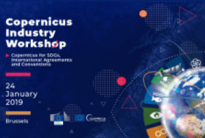
Copernicus organizes a workshop that will help participants to understand the importance of Earth Observation, in particular, Copernicus in monitoring the Sustainable Development Goals agenda of 2030 and international agreements. The event is going to be held in Brussels on January 24th from 9:00 am to 17:00 pm, and is open and free of charge. Applicants can register through the event website.

The workshop will be divided into four sessions: Climate Change, Marine, Land and Inland Waters, and Atmosphere. The objective will be:

  • to display the role of Earth Observation data and information in support of the assessment of the progress to achieve the SDGs, to answer to the needs of international conventions/agreements
  • to present specifically the potential contribution of the Copernicus full, free and open data and services' information products;
  • to present and discuss the potential Copernicus service evolution in the context of SDGs and International…
more

Copernicus is one of the largest Earth observation data providers. Copernicus’ archives are growing data repositories containing a wealth of data and information that is of utmost importance for policy support and many economic and industrial domains.

AI needs vast amounts of data to be developed. AI works by identifying patterns in available data and then applying this knowledge to new data. The larger the data set is, the better AI can learn and discover. Bringing AI technologies that scale at the Petabyte level to Copernicus operations is an opportunity that Europe shall seize to maximise return on investment and to develop a new generation of products and services based on Copernicus data assets.

The European Commission’s Communication ‘Coordinated Plan on Artificial Intelligence’ (COM(2018)795  of 07/12/2018) requires actions to be triggered in order to build the necessary bridges between Copernicus and AI stakeholders, both in the public and private sector.…

more