Global

country taxonomy block

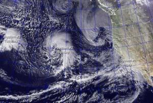
Australia's Bureau of Meteorology predicted that at the end of this year a strong El Nino effect can bring extreme weather around the world. Computer models based on satellite and meteorological observation data made this prediction.

An El Nino comes along about every two to seven years as part of a natural cycle. It is a warming of the Pacific Ocean as part of a complex cycle linking atmosphere and ocean.

To predict an El Nino scientist designed complex computer models that are fed with satellite and meteorological observation data as well as information about the temperature, currents and winds in the tropical Pacific Ocean. Once El Nino has started, models can predict how it might develop over the next six to nine months, with a reasonable level of accuracy.

According to BBC News El Nino is still in its early stages. In the summer it would become clear how strong it is going to be:…

more
Publishing date 18/05/2015

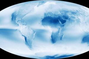
Satellite-based Earth observation as well as images taken by astronauts show that Earth views from space are dominated by clouds. A recent study by NASA has looked at a decade of imagery and estimates that about 67 percent of Earth’s surface is typically covered by clouds.

NASA writes: "Earth’s cloudy nature is unmistakable in this global cloud fraction map, based on data collected by the Moderate Resolution Imaging Spectroradiometer (MODIS) on NASA's Aqua satellite. While MODIS collects enough data to make a new global map of cloudiness every day, this version of the map shows an average of all of the satellite’s cloud observations between July 2002 and April 2015. Colors range from dark blue (no clouds) to light blue (some clouds) to white (frequent clouds)."

Publishing date 15/05/2015

Currently, there are 10 satellites dedicated to monitoring rainfall, but soon this number is likely to fall: four satellites have already passed their design life and others will follow soon. This will strongly affect flood management globally, shows a study published at Environmental Research Letter.

Space-based rainfall observation give high-value opportunities for globally coordinated data services regarding rainfall and resulted floods. Rainfall satellite data provides a good understanding of high-intensity events like monsoon rains, meaning that flood warnings could be communicated and emergency planning swung into action: "Rainfall data is critical for flood modellers to correctly predict the timing and intensity of events," said Patrick Reed from Cornell University, US. "For example, the rainfall…

more
Publishing date 08/05/2015

Ecometrica announced the delivery of the new Cube+. The combination of software and customised cloud computing hardware allows sequential images taken by satellites to be built up layer upon layer, quickly and efficiently, to provide a much more detailed, and in-depth answers to complex queries about changes to agriculture, forests, coasts and urban areas.

The new technology allows government departments and firms to analyse complex data from satellites without the need for supercomputers for the first time. I will provide a more powerful service than those currently available using supercomputers, at around a tenth of the cost.

"This new Ecometrica technology component will allow businesses to efficiently process complex time-space data queries across the globe. It brings complex information retrieval tasks on spatial data that would previously have required supercomputers within the reach of conventional commercial cloud services”,…

more
Publishing date 08/05/2015

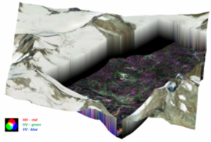
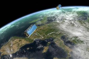
The European Space Agency (ESA) and the Argeninian Space Agency (CONAE) are collaborating to make 3D observations from space using two radar satellites in tandem.

ESA reported: “Following an offer from the Argentinian space agency, Conae, it is one of first ‘small satellite’ concepts to be studied by ESA. The idea is to build a companion satellite for Conae’s Saocom-1b, which is envisaged for launch in 2018–19 and use the satellites together. Saocom-1b will carry an L-band synthetic aperture radar. Saocom-CS would fly in formation with Saocom-1b, capturing its radar echoes as they are reflected from Earth’s surface.”

more
Publishing date 30/04/2015

The Beidou satellite navigation system will be fully operational worldwide by 2020, said Li Jian, deputy director of the Civil Aviation Administration of China (CAAC).

The system has been successfully tested in the general aviation sector, which includes all civil aviation operations other than scheduled air services, as well as by general aircraft including helicopters and private jets.

"We are promoting the Beidou system up to the standards of International Civil Aviation Organization [ICAO], and will gradually apply it to carriers," Li said

more
Publishing date 29/04/2015

The Land-Potential Knowledge System (LandPKS) Project released two mobile applications launched at the Regional Centre for Mapping of Resources for Development (RCMRD) in Nairobi on 22 April 2015 - one of UN-SPIDER's Regional Support Offices in Africa.

After one and a half years of design, development and testing, two of the LandPKS (www.landpotential.org) mobile applications (LandInfo & LandCover) can now be accessed on Google Play. These innovative mobile data collection and analysis tools support local land management and land use planning to optimize food security, land restoration, climate change adaptation and biodiversity conservation programmes.

LandInfo

LandInfo allows users to enter data about soil texture, topography and easily observable soil properties. It provides free Cloud…

more
Publishing date 28/04/2015

Airbus Defence and Space has officially launched its Digital Terrain Model (DTM) based on WorldDEM which is now commercially available. This highly accurate standardized representation of bare Earth elevation can be made available for any point on the globe, and with that addition Airbus Defence and Space can provide both surface as well as terrain elevation information. With that WorldDEM also provides the first global, single-source, high-precision Digital Surface Model and has established a new standard of global elevation models.

According to Airbus Defence and Space the unrivalled quality of the original WorldDEM product combined with a sophisticated editing process guarantees highly precise and consistent terrain information. Furthermore it offers an excellent foundation layer for a wide range…

more
Publishing date 27/04/2015

Based on the findings of a scientific review of the draft SDGs, the experts have presented in the International weekly journal of science, Nature, five main priorities they recommend the scientific community to follow. These are: Devise metrics, establish monitoring mechanisms, evaluate progress, enhance infrastructure and standardize and verify data.

Within the priority of enhancing infrastructure, Earth observation and space-based monitoring play an important role. Together with on-the-ground observation, they could help track changes on…

more
Publishing date 27/04/2015

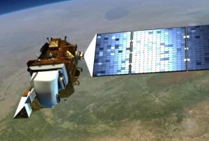
NASA and the U.S. Geological Survey (USGS) have started work on Landsat 9, planned to launch in 2023, to continue the observing programme of Earth’s land cover. Since 1972 one of the eight satellites in the Landsat program has photographed the entire Earth every 16 days and provide accurate measurements of Earth’s surface.  

With this big data, derived from decades of observations, scientists can for example tease out changes in ecosystems like deforestation in South America, the effects of climate change and many other activities that alter the landscape. According to NASA the programme’s open archive also helps fire fighters to assess…

more
Publishing date 24/04/2015

The technological improvements of the past decade have brought into scene a faster and more efficient way of working with Landsat satellite data.

Scientists and students can now spend more time analysing and evaluating instead of compiling and sorting data from satellites. The modernization of the remote sensing research process has occurred thanks to two main factors: the growth of computing power and the public and free availability of Landsat archives from 2009.

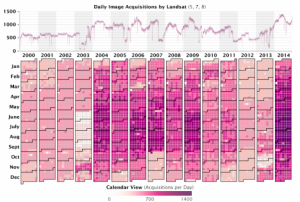
The Landsat record provides the longest continuous view of Earth’s landscape from Space, with at least one image of every location on Earth per season every year. A Landsat satellite flies over every parcel of land on Earth every sixteen days (and sometimes every eight), allowing the detection of even subtle change in the landscape between seasons and between years. 

“With the full Landsat record available, we can finally look at really big problems,” said Jeff Masek, …

more
Publishing date 22/04/2015

Tomorrow, on Earth Day, April 22, NASA and the National Science Foundation (NSF) celebrate 20 years of the Global Learning and Observations to Benefit the Environment (GLOBE) programme. This science and education programme make it possible that students, teachers and scientist work together and participate in science data collection through hands-on science in their local communities.

Since its inception on Earth Day 1995, 114 countries, 28,000 schools and over 10 million students have participated in the GLOBE Programme.

Experience has shown that getting students involved in the project-based investigations encourages them to make connections between their local environment and the entire Earth system, providing a global perspective: “GLOBE provides students and the public worldwide with the opportunity to contribute meaningfully to our understanding of the global environment and climate…

more
Publishing date 21/04/2015

The Esri Landscape Content has announced the integration of the BaseVue 2013 land cover data into the Living Atlas of the World and on the ArcGIS Online content.

BaseVue 2013 is a commercial global product developed by MDA, covering the Earth’s entire land area, excluding Antarctica. BaseVue is independently derived from roughly 9,200 Landsat 8 images and is the highest spatial resolution (30m). The capture…

more
Publishing date 21/04/2015

The Food and Agriculture Organisation (FAO) of the United Nations has signed a partnership agreement with Norway in order to help developing countries assess their forest resources and changes.

Through access to Earth observation data sources and the development of an easy-to-use platform for processing and interpreting this data, the countries will be able to better monitor and report about their forest situation.

"The new platform offers countries a set of efficient tools for monitoring changes in their forest area and carbon stocks, and for developing sustainable forest management regimes", said Eduardo Rojas-Briales, Assistant Director-General of FAO's Forestry Department.

Aware of the difficulties in internet access for some countries, FAO’s new software aims to overcome these problems by avoiding the need to download images locally and by using a "cloud-based" supercomputer instead. In addition, this project does not demand a…

more
Publishing date 20/04/2015

The European Space Agency ESA announced that the Copernicus Masters competition is now open again to accept submissions. Entrepreneurs can submit their ideas for services, business concepts and applications based on satellite Earth observation data.

In its fifth year, ESA and Germany’s Anwendungszentrum GmbH Oberpfaffenhofen are organising this competition to aid entrepreneurs in bringing their innovations to the market. In addition to over €300 000 in cash prizes the winner gets support in bringing the winning idea to market, exclusive data access and the chance to enter the incubation programme of one of Europe’s 11 ESA Business Incubation Centres (BICs).

“Taking part in Copernicus Masters gave us the chance to make some key contacts and gather valuable feedback,” said John Smedegaard, a co-founder of Ceptu, which won the CloudEO Farming Challenge in 2014. “The whole process was a huge help in advancing our idea and developing it…

more
Publishing date 16/04/2015

A study led by scientists at the U.S. Geological Survey (USGS) has shown smartphones and other personal electronic devices could be used as early warning systems for large earthquakes.

This technology would be especially useful for regions that cannot afford the high prices of conventional early warning systems. Despite being less accurate than scientific-grade equipment, the GPS (Global Positioning System) receivers in a smartphone can detect the permanent ground movement caused by fault motion in a large earthquake, according to USGS.

Crowdsourced observations from participating users are an essential part of the earthquake warning system. “Crowdsourced data are less precise, but for larger earthquakes that cause large shifts in the ground surface, they contain enough information to detect that an earthquake has occurred, information necessary for early warning,” said study co-author Susan Owen of NASA’s Jet Propulsion Laboratory, Pasadena,…

more
Publishing date 15/04/2015

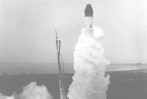
13 April 2015 was the 55th anniversary of the first navigation system reaching the orbit. The Transit 1B satellite was launched by NASA on 13 April 1960.

This satellite was designed to provide positioning for the US Navy’s fleet of Polaris ballistic missile submarines, a task it performed for over 30 years, as Money Week informs.

The Transit system can be considered as the ancestor of the Global Positioning System (GPS). GPS is constantly providing updated digital maps and other essential tools for our daily life.

Beside GPS, which covers the whole world, there are a few other systems aimed to cover large areas, like the China’s BeiDou system or the IRNSS from India. 

more
Publishing date 14/04/2015

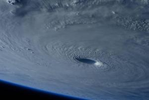
In late March 2015, Typhoon Maysak, known locally as Chedeng, approached the norther Philippines. Typhoon Maysak strengthened into a super typhoon on March 31, reaching Category 5 hurricane status.

Various space technologies captured the storm from Space. The RapidScat instrument aboard the International Space Station captured Maysak's sustained winds reaching 30 m/s around the center and north of center of the storm on 1 April.

The Tropical Rainfall Measuring Mission (TRMM) and Global Precipitation Measurement (GPM) satellites, both co-managed by NASA and the Japan Aerospace Exploration Agency, captured rainfall and cloud data that revealed heavy rainfall and high thunderstorms in the storm.

Publishing date 14/04/2015

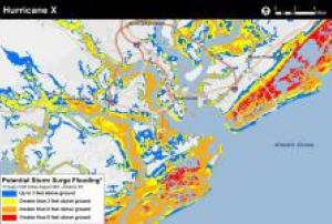
The National Oceanic and Atmospheric Administration (NOAA) is preparing a new application to help people determine at a street-level where water could rise in a storm surge.

This experimental storm surge simulator will let people get a look at what kind of storm surges can take place in their surroundings and which can be the possible damages. The preliminary model is based on Charleston (South Carolina), USA.

"Surveys of the public show there is still a consistent misunderstanding of what the storm surge is, and how deadly it can be. In part this is due to the challenge scientists encounter in trying to simplify the complex physics of hurricanes for the public, and in part this is due to poor misunderstanding of flood zone maps that represent the flooding scenario as it might be viewed from above," reads the introduction to the app, according to

more
Publishing date 13/04/2015

The International Food Policy Research Institute (IFPRI) and the International Institute for Applied Systems Analysis (IIASA) improved and relaunched an interactive website that delivers essential components for ensuring adequate, sustainable food production and food security through satellite-based maps. The website AfricaScienceNews reported: "First launched in 2008 using data from 2000, the website had been updated with new data from 2005, is more interactive, and includes a map gallery and data center."

The website, called Spatial Production Allocation Model (SPAM), also includes maps that were produced using satellite images and then fine-tuned by a global crop mapping community on the ground, who meticulously went through the remote sensing imagery…

more
Publishing date 10/04/2015

The International Centre for Integrated Mountain Development (ICIMOD), UN-SPIDER’s Regional Support Office in Nepal, together with YoungInnovations, is organising a Hackathon: The International Space Apps Challenge in Kathmandu. It will take place this weekend from 11 to 12 April. ICIMOD is organising this event through its SERVIR-Himalaya initiative. SERVIR connects space to villages by generating geospatial information, including Earth observation data from satellites, geographic information systems, and predictive models useful to developing countries.

The event is an international mass collaboration focused on space exploration that takes place over 48-hours in cities around the world. The event embraces collaborative problem solving with a goal of producing relevant open-source solutions to address global needs applicable to both life on Earth and life in space.

According to the organisers, this year there are over 25 challenges in four areas: Earth, Outer…

more
Publishing date 10/04/2015

The European Satellite Navigation Competition is awarding the best services, products, or business innovations using satellite navigation in everyday life.

The aim of the annual award is to provide support to entrepreneurs, start-ups, students, and all participants to get their business off the ground.

This international contest is promoted by Global Navigation Satellite System (GNSS) stakeholders, such as the European GNSS Agency (GSA), the European Space Agency (ESA), the German Aerospace Center (DLR), and the German Federal Ministry of Transport and Digital Infrastructure (BMVI) in association with the Federal Ministry for Economic Affairs and Energy (BMWi). In addition, regional partners worldwide host a regional challenge and provide valuable support.

This year's prize pool is worth EUR 1 million,…

more
Publishing date 03/04/2015

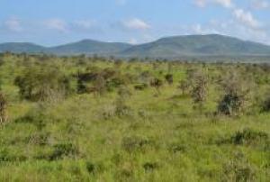
A recent satellite-based study published in Nature Climate Change shows the world is becoming greener despite the high deforestation of some regions.

The researchers have found that a new growth in the drier savannas and shrublands of Africa and Australia, together with recovered forests outside the tropics, is helping to balance the ongoing deforestation in areas such as South America and Southeast Asia.

The research has been developed using a new technique called “passive microwave remote sensing”. It allows to map changes in vegetation biomass using satellite measurements of changes in the radio-frequency radiation emitted from the Earth’s surface, as the authors explained in The Conversation.

The information collected from satellites has been…

more
Publishing date 01/04/2015

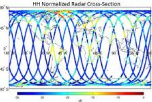
NASA's soil moisture mapper (SMAP) was launched on 31 January to map and detect global soil moisture. These maps will support the understanding of the interlinkages of Earth's water, energy and carbon cycles. The monitoring of SMAP will also promote weather and climate prediction as well as the monitoring of natural hazards.

First images of SMAP have now been made public. They demonstrate the ability of SMAP to provide comprehensive maps with a spinning instrument design. When fully operated, SMAP's antenna is able to cover the entire globe with high-resolution-data every two to three days with a 1,000 km swath from a altitude of 685 km above Earth.

more
Publishing date 13/03/2015

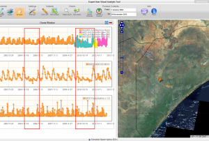
The Multi-sensor Evolution Analysis (MEA) platform supports Earth Observation communities in loading, visualizing and analysing multi-dimensional datasets. Implemented in the framework of the European Space Agency ASIM project, MEA has been recently adopted in the European Commission EarthServer initiative as graphic user interface of the Climate Data Service. MEA is a multi-product satellite data management and exploitation system that allows its users to access to a wide set of satellite-based data (e.g. vegetation indexes, soil moisture, precipitation) and display the temporal evolution of these fields to identify long term trends as well as short term / abrupt changes. The global coverage as well as…

more
Publishing date 19/11/2013