Global

country taxonomy block

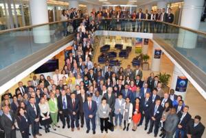
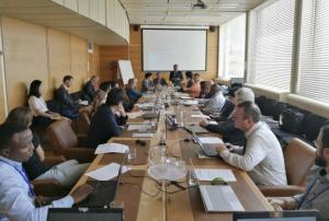
Representatives from the network of UN-SPIDER Regional Support Offices (RSO) convene in Vienna for the 9th Annual RSO Coordination Meeting from 18 to 19 June. Held at the United Nations Offices in Vienna, the meeting provides the 23 RSOs the opportunity to propose concrete ways in which they, respectively, could further collaborate with UN-SPIDER and also with other RSOs. The event is a forum for discussion of innovative approaches to disaster management using space-based technologies.

At the meeting, RSO representatives discussed lessons learned from their respective regional capacity-building and knowledge and awareness-raising activities, and their experiences working with the  International Charter “Space and Major Disasters”. Additional discussions included the development and…

more

Publishing date 18/06/2019

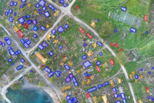
Remote sensing, or obtaining information about the Earth’s surface from afar using satellites or high altitude aircraft, is an important tool for predicting, mitigating, and managing disasters. To obtain a more comprehensive view of the conditions on Earth, remote sensing analysts must often look beyond information that can be immediately extracted from satellite imagery, for example, and use proxies, or indirect measurements based on this information, in order to evaluate other factors.

A recent study, Remote Sensing-Based Proxies for Urban Disaster Risk Management and Resilience: A Review, identifies and evaluates some of these remote sensing proxies used to evaluate both pre- and post- disaster elements, taking into consideration the “built-up” environment, including buildings and transport networks, the…

more
Publishing date 31/05/2019

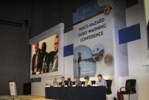
Held on 13 and 14 May in Geneva, the Second Multi-Hazard Early Warning Conference (MHEWC-II) called for further strengthening of multi-hazard early warning systems (MHEWS) as part of disaster risk reduction efforts worldwide. At the event, more than 320 participants from all regions of the world and affiliated to international, regional, national and local public sector, civil society, private sector and academic institutions highlighted the need for better governance, partnerships, communication and science and technology for multi-hazard early warning efforts to translate into early action that saves lives. Establishing effective early warning systems that address intertwined hazards is becoming more urgent by the day against the backdrop of a changing climate and extreme weather events that particularly affect developing countries.

MHEWC-II, which was hosted by the World Meteorological Organization (WMO) at its headquarters in Geneva…

more
Publishing date 23/05/2019

A new publication presents 30 innovation products and approaches for disaster risk reduction, ranging from GIS and remote sensing to community-based disaster risk reduction and indigenous DRR technology. “30 Innovations for DRR” has been published by a group of experts from Keio University, the University of Tokyo, the United Nations University, CWS Japan and IRIDeS of Tohoku University. The collection is the result of a meeting organized by the Association of Pacific Rim Universities (APRU) Multi-Hazards Program at which participants agreed to work to scientific research results relevant to practitioners more accessible and curate products and approaches based on science and technology considered to be effective and innovative.

The Sendai Framework for Disaster Risk Reduction encourages better access and support for innovation and technology as well as increased investment in DRR to…

more
Publishing date 16/05/2019

A new United Nations report calls for urgent action on disaster risk reduction to protect progress towards eradication of poverty and hunger, and action on climate change. The achievement of these and other Sustainable Development Goals (SDGs) could be slowed down or even reversed if governments do not adopt appropriate strategies, the Global Assessment Report on Disaster Risk Reduction 2019 (GAR19) warns.

“The human race has never before faced such large and complex threats. The doubling of extreme weather events over the last twenty years is further evidence that we need a new approach to managing disaster risk if we are to limit disaster losses. Economic losses are making it an uphill battle to hold on to development gains in low and middle income countries,” said Ms Mami Mizutori, Special Representative of the United Nations Secretary-General (SRSG) for Disaster Risk Reduction and Head of the United Nations Office for Disaster Risk Reduction (UNDRR).…

more
Publishing date 16/05/2019

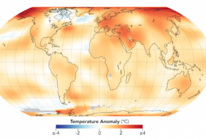
New satellite data from the National Aeronautics and Space Administration (NASA) confirms that 2015 to 2018 were the four hottest years on record. The findings echo the results of recent reports by the European Space Agency (ESA) and the World Meteorological Organization (WMO).

The Atmospheric Infrared Sounder (AIRS) on NASA's Aqua satellite collected the data, which NASA and the National Oceanic and Atmospheric Administration (NOAA) analyzed. Both WMO and NASA’s GISTEMP results originate from a combination of in situ and satellite-derived data, enabling the estimation of temperatures for data-sparse areas such as the poles.

NASA’s AIRS uses 2400 wavelengths of light to create 3D maps of clouds, temperature and humidity throughout the atmosphere. The GISS Surface Temperature Analysis (GISTEMP) is an estimate of global surface temperature change.

The new GISTEMP data closely mirror findings from 2003 to 2017. The AIRS…

more
Publishing date 06/05/2019

The International Network for Multi-Hazard Early Warning System (IN-MHEWS) is convening the Second Multi-Hazard Early Warning Conference (MHEWC-II) on 13 and 14 May 2019 as a pre-event to the sixth session of the Global Platform for Disaster Risk Reduction (GP2019) in Geneva. The conference aims to highlight the role of national governance in the implementation and sustainability of multi-hazard early warning systems that take into account fundamental information on all risk dimensions (hazard, exposure, vulnerability and coping/adaptive capacity), regulatory frameworks and policies, and institutional partnerships, and ensure that warnings are received, well understood and actionable.

The conference, which will take place at the Headquarters of the World Meteorological Organization (WMO), is the second of its kind after the First Multi-Hazard Early Warning Conference (MHEWC-I) in 2017 in Cancun, Mexico.…

more
Publishing date 30/04/2019

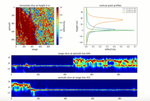
SERVIR, a joint development initiative of National Aeronautics and Space Administration (NASA) and United States Agency for International Development (USAID), and SilvaCarbon, a U.S. government programme working to enhance capacity around the world in monitoring and managing forests, have announced the release of the “Synthetic Aperture Radar (SAR) Handbook: Comprehensive Methodologies for Forest Monitoring and Biomass Estimation.” The publication brings together methods and theoretical background to facilitate the use of  SAR data for forest monitoring and biomass estimation.

The SAR Handbook is available for free as an e-Book on the SERVIR Global website. Each chapter of the Handbook is divided into a theory section, written by a SAR expert, which discusses the scientific background of the chapter topic; a step-by-step tutorial section, which provides…

more
Publishing date 15/04/2019

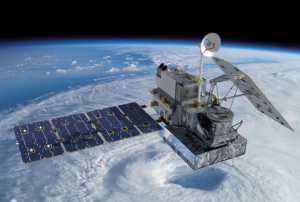
Five years ago, the National Aeronautics and Space Administration (NASA) and the Japan Aerospace Exploration Agency (JAXA) launched the Global Precipitation Measurement (GPM) Core Observatory as a joint satellite. Since then, the instruments on GPM have provided advanced measurements about rain and snow particles within clouds, Earth’s precipitation patterns, extreme weather and precipitation that affects communities around the world.

GPM was engineered to get data to scientists, operational and application users as soon as possible for societal benefits. It obtains data quickly using the Tracking and Data Relay Satellite (TDRS) 12-member satellite constellation, which serves as an information pipeline between Earth-orbiting satellites and NASA ground stations. On average, GPM can take one to three hours to get data into users’ hands, but in emergencies, the average delivery time can be shortened to between 15 and 90 minutes.

GPM’s main…

more
Publishing date 02/04/2019

The International Telecommunication Union (ITU) has published a new report about the use and opportunities of ICT and disruptive technologies for disaster risk reduction and management. The publication was announced during the third ITU Global Forum on Emergency Telecommunications, which took place from 6 to 8 March 2019 in Balaclava, Mauritius.

The study finds that technological advancement and innovation are creating new opportunities for enhancing disaster resilience and risk reduction. Developments in disruptive technologies, such as artificial intelligence, the Internet of Things (IoT) and Big Data, and innovations in robotics and drone technology, among other areas, are transforming disaster risk reduction and management. Disruptive technologies can spread critical information more quickly, improve understanding of the causes of disasters, enhance early warning systems, assess damage in new ways and add to the knowledge base of the social behaviours…

more
Publishing date 25/03/2019

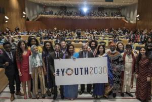
To support the first priority of the 'Youth 2030' strategy, namely "Engagement, Participation and Advocacy to Amplify youth voices for the promotion of a peaceful, just and sustainable world", the United Nations Office for Outer Space Affairs decided to launch the Space for Youth Competition together with the Space Generation Advisory Council (SGAC).

What are the objectives of this competition?

  • To engage youth in the global discussion by gathering examples of space supporting Sustainable Development Goals

  • To amplify the voices of youth in space to the members of the United Nations Committee on the Peaceful Uses of Outer Space

  • To bring the perspectives of youth on how space is supporting Sustainable Development Goals

Do you have an idea on how to use space to…

more
Publishing date 04/03/2019

The  Global Facility for Disaster Reduction and Recovery (GFDRR), a grant-funding mechanism managed by the World Bank, has released a new report that analyzes how machine learning (ML) can be applied in disaster risk management (DRM) projects. The publication provides a concise, demystifying reference that readers - from project managers to data scientists - can easily use. It includes key definitions, case studies and practical considerations for the use of machine learning in disaster risk management.

Machine Learning at a glance

A machine learning (ML) algorithm is a type of computer program that learns to perform specific tasks based on various data inputs or rules provided by its designer. In the context of DRM, machine learning applies predominantly to methods used in the classification or categorization of remotely sensed satellite, aerial, drone and even street-level imagery by capitalizing on a large body of work on image recognition and…

more
Publishing date 26/02/2019

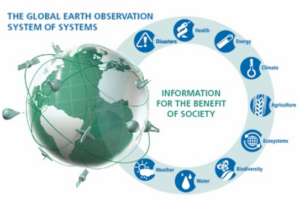
The Group on Earth Observations (GEO) and Amazon Web Services (AWS) have teamed up to offer GEO member agencies and research organizations from developing countries access to cloud services. Selected organizations will receive AWS credits to host, process and analyze big data about the Earth to support sustainable development efforts.

The deadline for applications is 31 March 2019. Applications are welcome for non-commercial projects that address the GEO Work Programme and, in particular, support the implementation of the Sendai Framework for Disaster Risk Reduction, the Paris Agreement and the 2030 Agenda for Sustainable Development.

Background information about the programme as well as criteria for applications can be found here: http://www.earthobservations.org/aws.php

Earth observations, through data obtained from satellites and ground-based measurements, provide…

more
Publishing date 14/01/2019

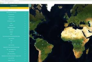
A new tool developed by the Food and Agriculture Organization (FAO) of the United Nations (UN) and the National Aeronautics and Space Administration (NASA) aims to allow users to “systematically inspect” any location on Earth – from glaciers to rainforests - with satellite data. Collect Earth Online (CEO), announced on 12 December 2018, is also expected to be utilized in disaster management.

The web-based platform is free of charge, open to all and it does not require any download or installation. CEO will provide users with access to high-resolution satellite imagery from multiple sources as well as historical imagery and mosaics from NASA’s Landsat network and the European Union’s Sentinel system.

CEO will also allow users to undertake a variety of tasks including the…

more
Publishing date 17/12/2018

The United Nations Office for Outer Space Affairs and the Prince Sultan Bin Abdulaziz International Prize for Water (PSIPW) launched the space4water portal during the eighth edition of the PSIPW award ceremony hosted at the United Nations Headquarters in New York. The new portal will serve as a platform to gather information and strengthen partnerships related to space-based information for water accessibility.

Water scarcity has become a major concern in several countries around the world. The importance of having a common framework to enhance available and sustainable water and to work towards increasing its accessibility is a priority that is addressed within the 2030 Agenda for Sustainable Development. The importance of space technology in helping to manage the issue has led UNOOSA and PSIPW to launch the project, which was being shaped since 2008.

more
Publishing date 04/12/2018

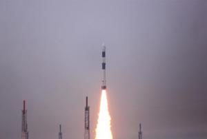
The Indian Space Research Organisation (ISRO) launched the first Indian Hyperspectral Imaging Satellite (HySIS) from Sriharikota on 29 November. The satellite is expected to be used for Earth observation in applications related to agriculture, forestry, geology, assessment of coastal zones, and environmental studies. It was one out of 30 commercial satellites from eight different countries launched that day by the Indian PSLV C43 vehicle.

ISRO chairman K Sivas, in a statement released by the Times of India, said, “HysIS has a state of the art technology which will be used for distinct identification of objects, material or processes on the Earth [...] The satellite will start sending images 5 days after the launch”.

The HySIS technology consists of a combination of digital imaging and spectroscopy. The image obtained has higher contrast as it recognizes light intensity as a function of wavelength. In comparison with other technologies used for Earth observation (imaging…

more
Publishing date 03/12/2018

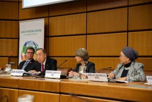
The International Federation of Red Cross and Red Crescent Societies (IFRC), the United Nations Office for Outer Space Affairs (UNOOSA), the Ban Ki-moon Centre for Global Citizens and the Austrian Red Cross presented the 2018 World Disasters Report at the United Nations in Vienna on 12 November. The report addresses the need to fill the gaps in humanitarian assistance coverage to avoid the exclusion of the most vulnerable people. Former United Nations Secretary-General Ban Ki-moon participated in the launch.

The 2018 World Disasters Report "Leaving No One Behind: The international humanitarian sector must do more to respond to the needs of the world's most vulnerable people" identifies five flaws in the humanitarian sector. People who are out of sight, out of reach, out of the loop, out of money and/or out of scope are generally left behind by international…

more
Publishing date 23/11/2018

The United States Geospatial Intelligence Foundation (USGIF) has recently released a new report on “Building Resilient Communities Through Geospatial Intelligence”. The report highlights the importance of raising awareness about the value of space-based information for early warning systems and risk and disaster management. Moreover, it suggests the need for a better definition of GEOINT within the framework of resilience.

The United Nations Platform for Spaced-Based Information for Disaster Management and Emergency Response (UN-SPIDER) contributed a chapter to the study on the role of Geospatial Intelligence (GEOINT) in all phases of risk and disaster management and its value to developing resilient communities.

GEOINT is defined as “the exploitation and analysis of imagery and geospatial information to describe, assess, and visually depict physical features and geographically referenced activities on the Earth.”

Through the perspective of ten experts in the…

more
Publishing date 31/10/2018

A declaration adopted by a wide range of stakeholders at the second United Nations World Data, calls for an increase in financing for better data and statistics for sustainable development. The Dubai Declaration aims to establish a funding mechanism under the mandate of the United Nations Statistics Commission to raise resources to address the data needs for the full implementation of the 2030 Agenda and support national statistical systems. The UN World Data Forum 2018 was hosted by the Federal Competitiveness and Statistics Authority of the United Arab Emirates and took place from 22 to 24 October 2018.

During the three-day forum, 2,000 data experts from more than 100 countries discussed the challenges and opportunities that data needs to address to contribute to a sustainable future. Among the highlights of the Forum were the launch of a guide to towards integration of data from multiple sources for better monitoring and policy-making, discussions on building trust in data…

more
Publishing date 31/10/2018

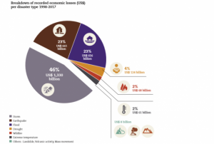
The United Nations Office for Disaster Risk Reduction (UNISDR) and the Centre for Research on the Epidemiology of Disasters (CRED) have released a new report that highlights the global trends in disaster losses in the period between 1998 and 2017.

“Economic Losses, Poverty & Disasters1998-2017” shows the significant increase of economic losses caused by climate-related disasters since 1970. Between 1978 and 1997, the percentage of economic climate-related damage was 68 per cent in relation to the total losses caused by disasters. By the period between 1998 and 2017, the percentage went up to 77 per cent - an increase of 151 per cent between the two periods.

From 1998 to 2017, 4.4 billion people were injured, became homeless, were displaced or in need of emergency…

more
Publishing date 23/10/2018

Disasters cause tremendous loss of lives and assets around the world. Over the last twenty years, more than 1.35 million people have died, while over 4 billion have been displaced, left homeless, injured or in need of emergency assistance as a result of disasters according to a new report by the United Nations Office for Disaster Risk Reduction and the Centre for Research on the Epidemiology of Disasters (CRED). Economic losses rose by 151 per cent compared to those suffered in the period between 1978 and 1997.

To address the challenge posed by disasters, the international community adopted the Sendai Framework for Disaster Risk Reduction 2015-2030 at the Third UN World Conference on Disaster Risk Reduction in March 2015 in Sendai, Japan. The Sendai Framework, which followed the Hyogo Framework for Action (HFA) 2005-2015, calls for a “substantial reduction of disaster risk and losses in lives, livelihoods and…

more
Publishing date 13/10/2018

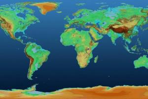
The German Aerospace Center (DLR) has released a 90-metre resolution global elevation model from its TanDEM-X mission for scientific data use. The data is free to download via the new Earth Observation Center (EOC) download service.

Digital Elevation Models (DEM) support disaster management efforts by allowing to map and modell natural hazards and risks that are influenced by topography such as floods or landslides. Elevation information is used, for instance, to assess where water will inundate the landscape. After an earthquake, damage to buildings might not be assessed correctly using…

more
Publishing date 09/10/2018

The United Nations, the World Bank, the International Committee of the Red Cross and prominent technology companies have jointly launched the new Famine Action Mechanism (FAM). The Mechanism uses a range of data including satellite imagery to predict famines, ultimately aiming to prevent them.

Launched on 23 September, the FAM is a still-evolving algorithm that will use analytics to identify areas that are most likely to experience extreme food shortages.

Google, Microsoft and Amazon Web Services and other technology firms are developing a suite of analytical models called “Artemis” to power the FAM. Artemis can process large amounts of data from several different sources, ranging from satellite imagery to mobile phones…

more
Publishing date 01/10/2018

A new online SAR tutorial offered by EO College, a joint education initiative for Radar…

more
Publishing date 21/09/2018

“The state of food security and nutrition in the world”, a 2018 global report by the Food and Agriculture Organization of the United Nations(FAO), International Fund for Agricultural Development (IFAD), United Nations Children's Fund (UNICEF), World Food Programme (WFP) and World Health Organization (WHO),  highlights the negative impacts of climate variability and extremes on food security and nutrition.

The publication also shows how tools and interventions such as climate risk monitoring and Early Warning Systems (EWS) contribute to improving the resilience and achieving the 2030 Agenda for Sustainable Development.

According to the report, three factors are behind the recent trends affecting food security and nutrition in multiple ways and challenging people’s access to food are conflict situations, climate shocks  and…

more
Publishing date 20/09/2018