Malaysia

country taxonomy block

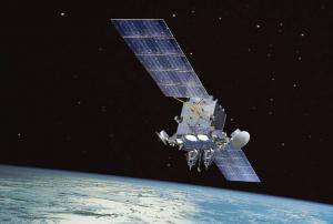
The Deputy Communications and Multimedia Minister of Malaysia announced that the selection of satellite technology to strengthen the country's communications infrastructure during disasters, particularly floods, is likely to be completed this year. It was stated that the government is acquiring superior satellite technology to aid the Meteorological Department and other associated organizations in the event of a disaster.

Several international companies have already submitted their different technological proposals to the ministry, which will undertake a thorough examination considering all relevant factors.

"Through the use of cutting-edge technology, the Communications and Multimedia Ministry (KKMM) will aid in recognizing floods by anticipating their location, size, and other characteristics.”

The minister announced that the utilization of satellite technology, particularly the 5G satellite network, might benefit the management of natural disasters by…

more
Publishing date 31/03/2022

MacDonald Dettwiler and Associates Ltd. (MDA) has obtained three contracts from the Malaysian Remote Sensing Agency (MRSA) related to RADARSAT-2 satellite. The first contract refers to installing a ground station in 2016 for receiving and processing information captured by the satellite; the second to providing RADARSAT-2 data in advance of the station becoming operational; and the third to a training course in order to develop products to support several applications.

The aim of the MRSA with these contracts is to use the information gathered by the satellite for flood monitoring, maritime and agricultural monitoring, natural resource management, and in the development of digital elevation products.

RADARSAT-2 is an Earth Observation satellite launched by the Canadian Space Agency in 2007, equipped with a Synthetic Aperture Radar (SAR) with multiple polarization modes that makes it possible to collect mass data with high precision, independently of weather or…

more
Publishing date 10/07/2015

On 16 January 2014, the Malaysian Deputy Prime Minister Tan Sri Muhyiddin Yassin announced the establishment of a new Centre of Excellence for Research on disaster management and flood mitigation.

The Center will be financed by the Long Term Research Grant Scheme and Fundamental Reserach Grant Scheme to advance research in the fields of disaster management and flood mitigation in the country.

The great importance of the Centre for enhancing disaster management in the country was emphasized Muhyiddin: "Landslides, haze and floods often occur in our country, and there needs to be a comprehensive and effective approach to disaster management."

In particular, the necessity to minimise damages to schools and tertiary institutions was emphasized, due to the widespread destruction caused by recent floods that affected the country.


more
Publishing date 19/01/2015

The Director-general of the Malaysian National Space Agency (Angkasa), Dr Noordin Ahmad, highlighted the importance of satellite technology in the pre- and post-disaster management phases, as well as during the occurrence of an emergency.

In an interview for the Sun, referring to the National Security Council of the Prime Minister Department, Ahmad stated: "We have engaged them on how best to use and promote the use of satellite technology in mitigating disaster. One way will be to use satellite images in the pre- and post disaster process".

He emphasized the importance of employing satellite imagery in the preventive stage of the disaster management cycle as a way to assist the federal government and local authorities in Malaysia to better understand the characteristics and possible impacts of disasters, and to disseminate useful information for mitigation operations before a disaster occurs.

Moreover, Angkasa's Director-general stressed the…

more
Publishing date 08/12/2014
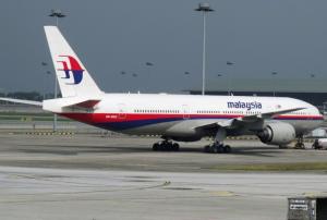
The International Charter: Space and Major Disasters was activated yesterday to provide satellite images and image products in search of the missing Malaysia Airlines Flight MH370. The international mechanism was triggered by China Meteorological Administration, which will also do the project management for the activation.

Malaysia Airlines Flight MH370 disappeared from radar over the South China Sea on 7 March 2014. The jet was carrying 239 people (12 crew and 227 passengers) and has yet to be found despite a multi-national search.

more
Publishing date 12/03/2014

As UN-SPIDER reported yesterday, there have been calls for using satellite data in the search for the Malaysian Airlines Flight which went missing on 8 March. The American company Tomnod has now launched a satellite imagery crowdsourcing platform  to support the search and rescue teams, as IRevolution reported.

The platform is built on Digital Globe images dated 9 March covering over 1,000 square miles. The area is sliced up in many small images which every user can see and tag. This way of processing information has been used before to monitor movements of displaced populations. 

more
Publishing date 11/03/2014

The Beijing-bound Malaysian Airlines flight MH730 disappeared on 8 March 2014 over the South China sea.

GeoSage, a company specialized in developing image fusion and spectral transformation analysis, is suggesting to use Landsat-8 satellite imagery to analyze the surrounding ocean area, where the plane lost contact. 

The experts compiled a list of relevant scenes. The 15-m Landsat-8 images could be used to concentrate the search and rescue to a specific area and exclude others, as the company proposes.

more
Publishing date 10/03/2014

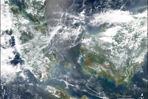
Future.gov reported that the 10 member states of the Association of Southeast Asian Nations (ASEAN) have formally agreed to adopt the haze monitoring system and share satellite data to help locate fires.

The $100,000 monitoring system developed in Singapore will be implemented in Singapore, Malaysia, Brunei and Thailand. By comparing high resolution imagery with land use and concession maps of fire-prone areas, the system will help locate fires.

Publishing date 11/10/2013

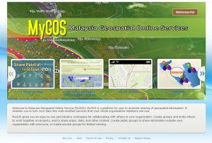
The Malaysian Centre for Geospatial Data Infrastructure (MacGDI) has launched the Malaysia Geospatial Online Service (MyGOS). This portal will host crucial geospatial services and information.

The website futuregov.asia reported that the portal "allows users to create groups and invite others to work together on projects, and to share maps, data, and other content. Furthermore, users can also create public groups so that they can share data outside of their organisation." Information in the portal include: The 1Malaysia map, Air Pollutant Index and Management System, 2013 General Election, hotspots, Malaysian standard geographic information, MyGeoName, and Road Networks.

Access MyGOS here.

more
Publishing date 23/09/2013

Having satellite communication (Satcom) capability is vital for Malaysia for interoperability and as part of any multinational force for the future security of the region.

Lizzie Greenwood, Inmarsat Plc's Director for Government Services in the Asia-Pacific said the Malaysian Navy and Malaysia Maritime Enforcement Agency are of particular note, as they require Satcom capability when out of coastal range and engaged in exercises with other nations. Being the leading provider of global mobile satellite communications services, Greenwood said Inmarsat has had a presence in the Asia Pacific region for many years.

"Working through local partners we are able to service the diverse and specialised needs and requirements of our customers.

"Asia is a core market for our Maritime business and we have been successfully expanding into the land and aeronautical sectors," she told Bernama in an interview.

With its global coverage of 11 Satellites,…

more
Publishing date 27/05/2011

Safe Cities Asia 2015 is the region’s largest and most comprehensive smart resilience conference, bringing together 350 senior professionals. With over 70% of the audience from the public sector including Mayors, Chief Information Officers, Chief Security Officers, Chief Data Officers, Heads of IT and Heads of Police, Fire, Emergency and Disaster Response Safe Cities Asia is unrivalled in its ability to uncover debate and determine where the industry is heading.


COURSE CONTENTS

1. Essentials for Humanitarian Practice

·         Disaster management principles and framework

·         Minimum standards and indicators

2. Response: Assessment and Coordination

·         Essential components of assessments

·         Assessment team roles and responsibilities

·         SPHERE guideline

·         Information Management

·     …

more

This conference will bring together leading technology companies, government bodies and agencies, stakeholders, decision makers, policy makers, researchers, engineers, scientists and public to have an open forum discussion and advance our knowledge in the area of disaster management technology and applications.  

This conference will be an avenue for all participants to share and gain technical knowledge on the availability and usage of engineering technologies and applications in disaster management focusing on prevention, early warning/precaution, onset, rescue & recovery as well as post disaster.

The conference also will reflect lesson learned from past major incidents which had happened and affected the Malaysian society especially and to pursue synergy and ideas of how to prevent or  efficiently address such incidents in future.

more

The APSTCDRR 2020 aims to provide an opportunity to the science, technology, and academia community in Asia and the Pacific to continue the much-needed science-policy dialogue to ensure that implementation of disaster risk reduction measures is based on reliable science, technology and innovation. Successful applications of science and technology in preventing and mitigating risks from different types of hazards including flood, earthquake, drought, health and other climate related hazards will be showcased.

There will be a focus on the application of science, technology and innovation for local and inclusive action to build disaster resilience in the face of growing disaster risks and a changing climate. The application of science and innovation in the development or revision of national and local strategies to meet Target E of the Sendai Framework will also be highlighted. Opportunities will be provided to various organisations and stakeholders, in particular the young…

more

IGRSM 2020 is aimed at disseminating knowledge, and sharing expertise and experiences in geospatial sciences in all aspects of applications. It also aims to buil linkages between local and international professionals in this field with industries. 


Conference Topics: 

  • Remote sensing technologies and applications
  • GIS technologies and applications
  • Geospatial technologies, industries & applications
  • Geospatial for research and management
  • Space borne systems for terrestrial and marine
  • Satellite sensor systems and applications
  • Space borne, airborne, Unmanned Aerial System/Vehicle (UAS/UAV)
  • Lidar techniques and applications
  • Hypespectral techniques and application
  • Geomatic and Surveying Sciences
  • Environmental sciences, mapping, monitoring
  • Climate Change impact assessment, modelling and predictions
  • Forestry and agricultural…
more

IGRSM 2020 is aimed at disseminating  knowledge, and sharing expertise and experiences in geospatial sciences in all aspects of applications. It also aims to build linkages between local and international professionals in this field with industries.

Conference topics include:

  • Remote sensing technologies and applications
  • GIS technologies and applications
  • Geospatial technologies, industries & applications
  • Geospatial for research and management
  • Space borne systems for terrestrial and marine
  • Satellite sensor systems and applications
  • Environmental sciences, mapping, monitoring
  • Climate Change impact assessment, modelling and predictions
  • Forestry and agricultural…
more