Vanuatu

country taxonomy block

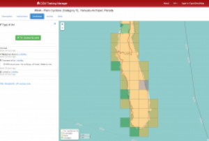
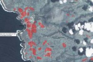
DigitalGlobe's Tomnod programme is asking its crowdsourcing volunteers to map the damage caused by Cyclone Pam in Vanuatu.

Tomnod is a programme using crowdsourcing to identify objects and places in satellite images. Volunteers can use satellite images to help recovering from disasters as the category 5 cyclone in the island nation of Vanuatu, which has destroyed the basic infrastructure leaving thousands of people displaced. Users can switch between pre-event and post-event imagery to help determine the exact situation.

Through its satellite imagery archive, DigitalGlobe has made available the imagery of the region captured from 1 January 2014 to 16 March 2015. 

more
Publishing date 25/03/2015

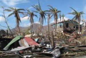
The International Charter: Space and Major Disasters was activated to support response efforts in Vanutua with satellite-based maps. Vanuatu was heavily affected by Cyclone Pam on 13 and 14 March 2015 causing huge devastation. The mechanism was triggered by UNITAR/UNOSAT on behalf of UNOCHA. UNITAR/UNOSAT has already produced and made available several maps, which can be downloaded from the International Charter's website.

The International Charter reported: "Recovery efforts began shortly after the storm passed, and international aid has been arriving in the archipelago. Tens of thousands of people are known to have been left homeless. But the southern islands are of great concern to emergency workers, as communications were severed with them by the storm. The full extent of the situation on these islands is unknown, and flooding from the cyclone has made it difficult or impossible for planes to land on the islands."

more
Publishing date 18/03/2015

Cyclone Pam, which struck Vanuatu last Friday, has affected more than 130,000 people, about half of the population of the country, according to UN estimations. Following a direct hit from the Category 5 storm, at least two deaths have been confirmed and over 30 injured people are being treated in the capital Port Vila.

"Vanuatu is used to disasters but the indications are that Cyclone Pam has caused unprecedented damages," said President Baldwin Lonsdale in a press release issued on his behalf by the UN Office for Disaster Risk Reduction (UNISDR). Several UN Departments are coordinating help or already actively supporting the rescue teams on site, amongst them UNICEF, OCHA and UNDAC.

Additionally, the crowdsource mapping community has already become involved to assist the country in its emergency response efforts....

more
Publishing date 16/03/2015

More than 50 percent of the most exposed cities in the world for natural disasters are located in Philippines, China, Japan and Bangladesh, according to a recent publication by the global risk analytics company Verisk Maplecroft.

The 5th annual Natural Hazards Risk Atlas (NHRA) shows that of the 100 cities with the greatest exposure to natural hazards, 21 are located in the Philippines, 16 in China, 11 in Japan and 8 in Bangladesh. The combined risk of tropical storms and cyclones, floods, earthquakes, tsunamis and severe storms or extra-tropical cyclones, among others, has placed the small capital city of Port Vila, on the isolated South Pacific island nation of Vanuatu, on top as the world's riskiest ones.

The Philippines is the most exposed country with eight cities among the ten most risky at global level due to a high risk of tropical storms, earthquakes and landslides....

more
Publishing date 09/03/2015

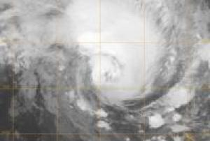
NASA's Aqua satellite passed over strengthening Tropical Storm Jasmine and noticed bands of thunderstorms wrapping into its center as it heads toward Vanuatu and New Caledonia.

Vanuatu and New Caledonia are island nations in the South Pacific Ocean. Vanuatu is about 1,090 miles (1,750 km) east of northern Australia, and 310 miles (500 km) northeast of New Caledonia. New Caledonia is an archipelago and has a land area of 7,172 sq miles (18,576 square km). The current forecast track for Tropical Cyclone Jasmine takes it between the two island nations.

Tropical Storm Jasmine formed on February 4, 2012 in the South Pacific Ocean when the low pressure area called System 95P strengthened. By February 5, Jasmine's maximum sustained winds were near 45 knots (~52 mph/~83 kph). On Monday, February 6, Jasmine had strengthened and had maximum sustained winds near 60 knots (69 mph/111 kph). It is expected to continue intensifying and should reach cyclone strength before weakening...

more
Publishing date 07/02/2012

In 1998, USP approached the Fiji Lands Department to jointly conduct a two days National GIS Conference, which was than extended to a three-day conference in 1999. In 2004, this Fiji Conference was renamed to the "Pacific Islands GIS&RS User Conference" due to the increasing interests of participants that came from Pacific Island countries. In 2005, ISPRS joined the initiative and was part of the first discussion session of the Conference. Today, the Conference is the largest GIS and RS Conference in the Pacific, where Pacific application is dominating the content. There are similar conferences in New Zealand, Australia and Hawaii, however, Pacific islanders are not the dominant factor.

The Conference runs for four days, with over 60 presentations. Day five is reserved for workshops and day four contains the discussion session. The Conference provides a platform where three types of participants meet and interact: (A) Different Pacific island GIS&RS users from...

more