![]()
United
Nations
Incendio
, processed by ESA, CC BY-SA 3.0 IGO.")
Definition
Facts and figures
Further information
UN-SPIDER Regional Support Offices with hazard-specific expertise
Related content on the Knowledge Portal
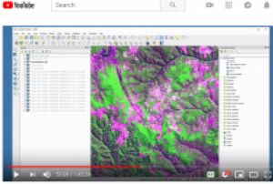
Land cover changes can impact many areas of life. These changes can affect deforestation, ecological communities, wildfire extent, and urban growth. This advanced series focused on using satellite imagery to map changes in land cover. Users will learn change detection methods, including image subtraction and classification. They will also conduct their own change detection analysis. This training will use QGIS, the R statistical program, and the Random Forest algorithm.
This is a free available online course from the program Applied Remote Sensing Training (ARSET) from NASA that includes videos and presentations making this course very interactive.
The learning objectives are:
- Become familiar with Landsat bands and color combinations
- Understand how to visualize change in land cover using Landsat data
- Learn the basic steps for change detection by:
- Conducting image subtraction between two dates using QGIS
- Creating multi-date...
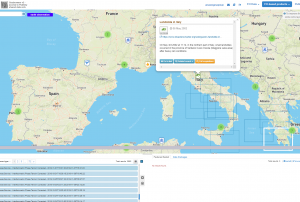 ESA's Earth Observation Thematic Exploitation Platform (TEP) is a browser for satellite imagery and specific products on an environmental topic. The TEP platforms are divided into 7 categories: Coastal; Forstry; Geohazards; Hydrology; Polar; Urban; and Food Security. Each platform is a collaborative, virtual work environment providing access to EO data and the tools, processors and Information and Communication Technology resources required to work with them. TEP aims to bridge the gap between the users and the data and tools.Publishing institution:
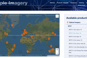 Pleidas, TerraSar-X, SPOT and Elevation data available commercially from airbus, certain sample data sets at various locations available for free.Publishing institution:
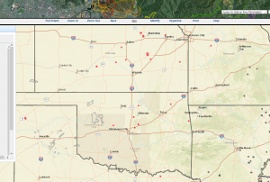 The GEOMAC Wildland Fire Support includes layers on: point-layer of past years fires, fire boundaries/ perimeter, current firest, satellite-based fire detection: MODIS VIIRS HMS, wildland-urban interface,Publishing institution:
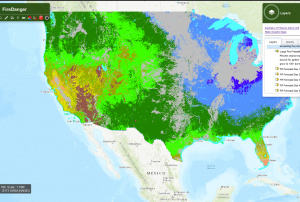 Vegetation-based fire indicators: expected number of fires per predictive service area: number of fires predicted (1000+ acres west, 500+ acres east) or the coming 7 days, with a probability estimate for exceeding the prediction.
Publishing institution: The website: https://www.radiant.earth
Help and Tutorials: https://help.radiant.earth/
Demos & Use Cases: https://demos.radiant.earth/Publishing institution: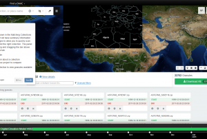 NASA's Earth Observing System Data and Information System (EOSDIS) is a program for archiving and distributing Earth science data from multiple missions to users.Publishing institution:
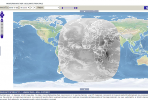 Map Viewer that allows downloading and time series creation of meteosat products.Publishing institution:

Term Parents
UN-SPIDER Regional Support Offices with hazard-specific expertise
![]()