![]()
United
Nations
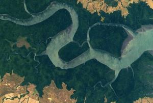
Incendio
, processed by ESA, CC BY-SA 3.0 IGO.")
Definition
Facts and figures
Further information
UN-SPIDER Regional Support Offices with hazard-specific expertise
Related content on the Knowledge Portal
 Publishing institution:
 Publishing institution:
 Publishing institution:
Long term, high quality estimates of burned area are needed for improving both prognostic and diagnostic fire emissions models and for assessing feedbacks between fire and the climate system. We developed global, monthly burned area estimates aggregated to 0.5◦ spatial resolution for the time period July 1996 through mid-2009 using four satellite data sets. From 2001–2009, our primary data source was 500-m burned area maps produced using Moderate Resolution Imaging Spectroradiometer (MODIS) surface re- flectance imagery; more than 90% of the global area burned during this time period was mapped in this fashion. During times when the 500-m MODIS data were not available, we used a combination of local regression and regional regression trees developed over periods when burned area and Terra MODIS active fire data were available to indirectly estimate burned area. Cross-calibration with fire observations from the Tropical Rainfall Measuring Mission (TRMM) Visible and Infrared...
read moreTo ensure remote sensing MODIS hotspot (also known as active fire products or hotspots) quality and precision in forest fire control and management in Thailand, an increased level of confidence is needed. Accuracy assessment of MODIS hotspots utilizing field survey data validation is described. A quantitative evaluation of MODIS hotspot products has been carried out since the 2007 forest fire season. The carefully chosen hotspots were scattered throughout the country and within the protected areas of the National Parks and Wildlife Sanctuaries. Three areas were selected as test sites for validation guidelines. Both ground and aerial field surveys were also conducted in this study by the Forest Fire Control Division, National Park, Wildlife and Plant Conversation Department, Ministry of Natural Resources and Environment, Thailand. High accuracy of 91.84 %, 95.60% and 97.53% for the 2007, 2008 and 2009 fire seasons were observed, resulting in increased confidence in the use of MODIS...
read more Publishing institution:
 Publishing institution:
 Publishing institution:
 Publishing institution:
Term Parents
UN-SPIDER Regional Support Offices with hazard-specific expertise
![]()