Incendio
Definition
Facts and figures
Further information
UN-SPIDER Regional Support Offices with hazard-specific expertise
Related content on the Knowledge Portal
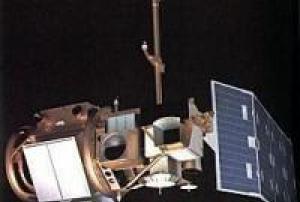
Landsat 4 was launched on July 16, 1982. The Landsat 4 spacecraft was significantly different than that of the previous Landsats, and Landsat 4 did not carry the RBV instrument.
read more
In addition to the Multispectral Scanner System (MSS) instrument, Landsat 4 (and Landsat 5) carried a sensor with improved spectral and spatial resolution, i.e., the new satellites could see a wider (and more scientifically-tailored) portion of the electromagnetic spectrum and could see the ground in greater detail. This new instrument was known as the Thematic Mapper (TM).
Landsat 4 was kept in orbit for housekeeping telemetry command and tracking data (which it downlinked via a separate data path, the S-band) until it was decommissioned in 2001.
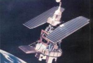
While Landsat 4 was built and launched by NASA, NOAA initially oversaw the operations of the satellite. Landsat 4 operations were contracted out to the Earth Observation Satellite Company (...16/07/1982Landsat 3 was launched on March 5, 1978, three years after Landsat 2.
read more
The Landsat program’s technical and scientific success together with political and economic pressures lead to the decision to commercialize an operational Landsat. To this end, responsibility was slated to shift from NASA (a research and development agency) to the National Oceanic and Atmospheric Administration (NOAA), the agency charged with operating the weather satellites. This was done via Presidential Directive/NSC-54 signed on Nov. 16, 1979 which assigned NOAA “management responsibility for civil operational land remote sensing activites.” (However, operational management was not transfered from NASA to NOAA until 1983).
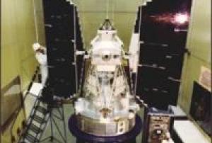
Landsat 3 carried the same sensors as its predecessor: the Return Beam Vidicon (RBV) and the Multispectral Scanner (MSS). The RBV instrument on-board Landsat 3 had...05/03/1978Landsat 2 was launched into space onboard a Delta 2910 rocket from Vandenberg Air Force Base, California on January 22, 1975, two and a half years after Landsat 1. Originally named ERTS-B (Earth Resource Technology Satellite B), the spacecraft was renamed Landsat 2 prior to launch. The second Landsat was still considered an experimental project and was operated by NASA.
Landsat 2 carried the same sensors as its predecessor: the Return Beam Vidicon (RBV) and the Multispectral Scanner System (MSS).
On February 25, 1982 after seven years of service, Landsat 2 was removed from operations due to yaw control problems; it was offically decommissioned on July 27, 1983.Instruments:
read more
Return Beam Vidicon (RBV)
Multispectral Scanner (MSS)
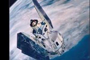
22/01/1975Landsat 1 was launched on July 23, 1972; at that time the satellite was known as the Earth Resources Technology Satellite (ERTS). It was the first Earth-observing satellite to be launched with the express intent to study and monitor our planet’s landmasses. To perform the monitoring, Landsat 1 carried two instruments: a camera system built by the Radio Corporation of America (RCA) called the Return Beam Vidicon (RBV), and the Multispectral Scanner (MSS) built by the Hughes Aircraft Company. The RBV was supposed to be the prime instrument, but the MSS data were found to be superior. In addition, the RBV instrument was the source of an electrical transient that caused the satellite to briefly lose altitude control, according to the Landsat 1 Program Manager, Stan Weiland.
read more
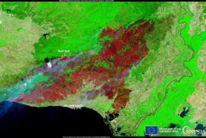
To help understand the data and to explore the potential applications of this new technology, NASA oversaw 300 private research investigators. Nearly one third of these were international scientists...23/07/1972In recent years, wildfires have become a growing global concern, with climate change-driven extreme weather contributing to their increasing frequency and severity. Regions from Canada to Australia and the Mediterranean have seen devastating impacts, including loss of life, destruction of property, and significant atmospheric emissions. As the risk of wildfires intensifies, advanced monitoring systems like the Copernicus Atmosphere Monitoring Service (CAMS) and Copernicus Climate Change Service (C3S) are playing a crucial role in understanding and responding to these fires.
To monitor and assess the impacts of wildfires, one key metric used is Fire Radiative Power (FRP). FRP quantifies the rate at which energy is radiated from a fire, providing valuable insights into the fire's intensity. Satellites equipped with sensors, including NASA's Terra and Aqua satellites, and the Sentinel...
read more16/08/2024The National Oceanic and Atmospheric Administration (NOAA) has recently tested two innovative tools designed to enhance wildfire detection and response. These tools, part of NOAA's Next Generation Fire System (NGFS), were evaluated during a week-long series of simulations at the new Fire Weather Testbed in Boulder, Colorado. The goal: to accelerate and improve the accuracy of wildfire detection and warning capabilities across the United States.
Unveiling the Next Generation Fire System
The NGFS utilizes artificial intelligence to rapidly identify wildfires using data from NOAA’s geostationary satellites. This system can detect fires as small as one acre, allowing for quicker responses during critical early stages. Once a fire is detected, the NGFS provides detailed information about its location and intensity through a comprehensive dashboard. This dashboard integrates satellite imagery with crucial data such as weather outlooks...
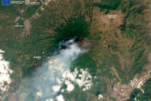
read more25/07/2024On 22 February, 2024, a forest fire started on the slopes of the inactive Agua volcano in Guatemala. The Agua volcano, one of the highest in Guatemala, is approximately 10 kilometres from the colonial city of Antigua, which is a popular tourist destination in the country.
Firefighters and military personnel faught to extinguish the fires, working against thick smoke and dense vegetation around the clock to reduce the risk of escalation. Two helicopters were also used to provide support, dropping water from above to combat the flames. The cause of the fire remains unknown, and the exact amount of burned hectares was not determined. Investigations were carried out to understand the origins of the fire are till ongoing.
There were no reported casualties or evacuations. The fire significantly damaged the vegetation on the upper part of the 3,766-meter-high volcano, which will have an ecological impact on the local ecosystem and biodiversity.
The Agua volcano,...
read moreForeword
This Training Module Handbook is developed in the framework of the project “Copernicus User Uptake in Africa via technical support in the field of Disaster Management and Disaster Risk Reduction” (Short forms: Sentinels-4-African-DRR; S4ADRR). The project is funded through the Framework Partnership Agreement on Copernicus User Uptake (FPCUP Action 2019-2-48) and performed by the German Space Agency at DLR, with the support of the Center for Remote Sensing of Land Surfaces (ZFL) of the University of Bonn, Germany.
The project team collaborates closely with the United Nations Platform for Space-Based Information for Disaster Management and Emergency Response (UN-SPIDER), a program of the United Nations Office for Outer Space Affairs (UNOOSA). Further, there is close collaboration with the teams responsible for the Global Flood Awareness System (GloFAS) and the Global Drought Observatory (GDO) of the Copernicus Emergency Management Service (EMS).
...
read moreIntroduction
In recent decades, communities in Africa have experienced disasters triggered by floods, droughts, landslides, forest fires, Ebola pandemics, and locust plagues that have eroded hard-won development gains. Taking note of advances in space technologies and other technological innovations, the African Union indicated in its 2017 African Space Policy that space represented a unique opportunity for cooperation in using and sharing enabling infrastructure and data towards the proactive management of, inter alia, responses to natural hazards and disasters. In that respect, the African Union aims to promote the use of space applications to improve weather forecasts and to develop a range of early warning systems, as Africa is subject to various extreme weather, climate, ecosystem, and geological events.
Convinced that space technologies can play a vital role in supporting disaster management, the United Nations General Assembly (UNGA) established the United...
read more

