![]()
United
Nations
Sentinel 3 (ESA)
| Data provided by: | European Space Agency (ESA) |
| Data accessibility: | Exportar datos |
| Link to the data: | |
| Data type: | Datos satelitales o imágenes aéreas |
| Hazard: | Forest Fire, Drought, Volcanic Eruption, Tsunami, Flood, Severe Storm, Extreme Temperature, Pollution |
| Disaster cycle phase: | Gestión des Riesgo por Desastres, Respuesta, Recuperación |
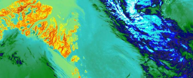
| Space-based Information: | The main objective of the SENTINEL-3 mission is to monitor sea and land surface temperature, sea surface topography and ocean and land surface colour with high accuracy and reliability. The high resolution data is meant to support ocean forecasting systems, environmental monitoring and climate monitoring. ESA and EUMETSAT will jointly operate the SENTINEL-3 mission and bothy institutions provide access to the processed data. Sentinel 3 carries four main instruments: the OLCI, SLSTR, Altimetry and a MWR Microwave Radiometer. |
| Satellites and Sensors: | Sentinel-3A |
| Spatial coverage: | Global |
| Spatial resolution: | 300m, 500m, 1km |
| Temporal coverage: | Casi en tiempo real |
| Content dates: | 20 Oct 2016/ 5 July 2017 depending on products - Present |
| Technical Specifications: | |
| Costs: | Gratis |
| Contact: | Contact ESA |
| Tutorials on the use of data: | Learn-access-use-sentinel-3-data/, RUS Webinar: Ocean colour monitoring with Sentinel-3 - OCEA04, Sentinel-3 Toolbox Snap |
| Restrictions/ Citation of the dataset: |
Provider
![]()