Implementing science to save lives: A Decade of the Copernicus Emergency Management Service
The Copernicus Emergency Management Service (CEMS) celebrates a decade of operation as a world leader in emergency mapping, early warning tools and open-access disaster information.
For the past ten years, CEMS has provided a global service as a fully operation emergency mapping service at no cost to users and with open access data.
Some highlights on the contribution of CEMS in global disaster risk management activities:
- 576 Rapid Mapping Activations with 5,500+ maps delivered
- Designed and implemented the world’s first Global Flood Monitoring tool
- Ten years of wildfire forecasts up to ten days into the future
- Average of 200+ flood and 500+ flash flood notifications to Member States and authorised users each year
- Offers a current and historical database of 7,000+ drought episodes since 1950
Disaster management professionals require timely, unbiased and accurate data on forecasted and ongoing disaster to make effective decisions. CEMS offers this through geospatial products based on satellite and ground-based measurements that forecast, monitor and analyse disasters.
The European Commission’s Joint Research Centre is entrusted with the technical and administrative management of the service. This scientific ecosystem, supported by research and industrial partners, enables CEMS to deliver timely and quality-controlled products to disaster risk reduction and emergency management operators across the globe.
Comprehensive data and tools for disaster and risk management
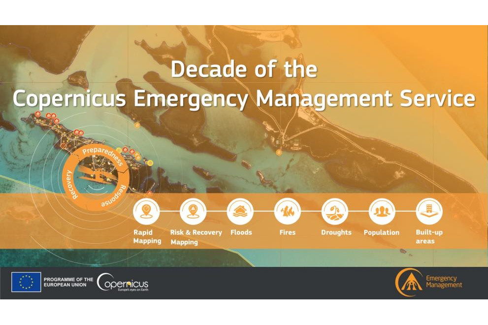
First responders, humanitarian actors, and civil protection mechanisms have a wide range of needs when addressing the many types, and often compounding effects, of disasters. CEMS offers 9 service components to address each phase of the risk and disaster management cycle along with capacities to analyse nearly any type of disaster. Most components of CEMS operate 24 hours a day, 7 days a week, all year round.
CEMS components include:
- Rapid Mapping, which delivers ready-to-print maps and geospatial digital data sets within hours following a disaster to rapidly visualise the extent and impact of an event.
- Risk and Recovery Mapping, which supports the preparedness, prevention and restoration of affected areas.
- The European Flood awareness system and the Global Flood awareness system, which provide flood hazard and impact forecast information for Europe and the rest of the world. It addresses riverine floods as well as flash floods, while also providing continuous global flood monitoring.
- The European Forest Fire Information System, which forecasts and monitors wildfire risk and activity in near real-time and supports wildfire management authorities.
- The European and Global Drought Observatories, which provide relevant information and early-warnings for droughts along with forecasts for both Europe and the rest of the world.
- The Global Human Settlement Layer, which provides data, tools and analytics to understand and quantify population presence and activity.
- The Validation component, which ensures the quality of CEMS products and fosters the continuous improvement of CEMS services.
This text is an excerpt of the Joint Research Centre's news announcement: Implementing science to save lives: A Decade of the Copernicus Emergency Management Service, 21 June 2022. Read the full article here.