Earthquake
Definition
Facts and figures
Further information
UN-SPIDER Regional Support Offices with hazard-specific expertise
Related content on the Knowledge Portal
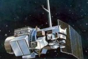
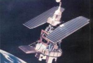
Landsat 5 was launched from Vandenberg Air Force Base in California on March 1, 1984, and like Landsat 4, carried the Multispectral Scanner (MSS) and the Thematic Mapper (TM) instruments. Landsat 5 delivered Earth imaging data nearly 29 years - and set a Guinness World Record For 'Longest Operating Earth Observation Satellite', before being decommissioned on June 5, 2013.
read more
The Landsat 5 satellite orbited the the Earth in a sun-synchronous, near-polar orbit, at an altitude of 705 km (438 mi), inclined at 98.2 degrees, and circled the Earth every 99 minutes. The satellite had a 16-day repeat cycle with an equatorial crossing time: 9:45 a.m. +/- 15 minutes. Landsat 5 data were acquired on the Worldwide Reference System-2 (WRS-2) path/row system, with swath overlap (or sidelap) varying from 7 percent at the Equator to a maximum of approximately 85 percent at extreme latitudes.
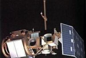
Landsat 5 long outlived its…01/03/1984Landsat 4 was launched on July 16, 1982. The Landsat 4 spacecraft was significantly different than that of the previous Landsats, and Landsat 4 did not carry the RBV instrument.
read more
In addition to the Multispectral Scanner System (MSS) instrument, Landsat 4 (and Landsat 5) carried a sensor with improved spectral and spatial resolution, i.e., the new satellites could see a wider (and more scientifically-tailored) portion of the electromagnetic spectrum and could see the ground in greater detail. This new instrument was known as the Thematic Mapper (TM).
Landsat 4 was kept in orbit for housekeeping telemetry command and tracking data (which it downlinked via a separate data path, the S-band) until it was decommissioned in 2001.
While Landsat 4 was built and launched by NASA, NOAA initially oversaw the operations of the satellite. Landsat 4 operations were contracted out to the Earth Observation Satellite Company (…16/07/1982Landsat 3 was launched on March 5, 1978, three years after Landsat 2.
read more
The Landsat program’s technical and scientific success together with political and economic pressures lead to the decision to commercialize an operational Landsat. To this end, responsibility was slated to shift from NASA (a research and development agency) to the National Oceanic and Atmospheric Administration (NOAA), the agency charged with operating the weather satellites. This was done via Presidential Directive/NSC-54 signed on Nov. 16, 1979 which assigned NOAA “management responsibility for civil operational land remote sensing activites.” (However, operational management was not transfered from NASA to NOAA until 1983).
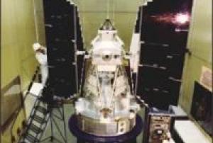
Landsat 3 carried the same sensors as its predecessor: the Return Beam Vidicon (RBV) and the Multispectral Scanner (MSS). The RBV instrument on-board Landsat 3 had…05/03/1978Landsat 2 was launched into space onboard a Delta 2910 rocket from Vandenberg Air Force Base, California on January 22, 1975, two and a half years after Landsat 1. Originally named ERTS-B (Earth Resource Technology Satellite B), the spacecraft was renamed Landsat 2 prior to launch. The second Landsat was still considered an experimental project and was operated by NASA.
Landsat 2 carried the same sensors as its predecessor: the Return Beam Vidicon (RBV) and the Multispectral Scanner System (MSS).
On February 25, 1982 after seven years of service, Landsat 2 was removed from operations due to yaw control problems; it was offically decommissioned on July 27, 1983.Instruments:
read more
Return Beam Vidicon (RBV)
Multispectral Scanner (MSS)
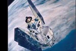
22/01/1975Landsat 1 was launched on July 23, 1972; at that time the satellite was known as the Earth Resources Technology Satellite (ERTS). It was the first Earth-observing satellite to be launched with the express intent to study and monitor our planet’s landmasses. To perform the monitoring, Landsat 1 carried two instruments: a camera system built by the Radio Corporation of America (RCA) called the Return Beam Vidicon (RBV), and the Multispectral Scanner (MSS) built by the Hughes Aircraft Company. The RBV was supposed to be the prime instrument, but the MSS data were found to be superior. In addition, the RBV instrument was the source of an electrical transient that caused the satellite to briefly lose altitude control, according to the Landsat 1 Program Manager, Stan Weiland.
read more
To help understand the data and to explore the potential applications of this new technology, NASA oversaw 300 private research investigators. Nearly one third of these were international scientists…23/07/1972The U.S. Geological Survey (USGS) and its partners have unveiled a new capability within the ShakeAlert Earthquake Early Warning System, designed to rapidly characterize large earthquakes and provide faster notifications. This enhancement incorporates satellite-based sensors to detect earth-surface movements, complementing the system's existing network of over 1500 seismic sensors.
The integration of real-time Global Navigation Satellite System (GNSS) sensors allows for quicker and more accurate determination of earthquake magnitude and shaking area. Unlike seismic sensors, which measure the speed of ground shaking, GNSS sensors track the ground's displacement. This dual-sensor approach aims to enhance public safety by providing faster alerts for protective actions such as Drop, Cover, and Hold On.
Currently operational in California, Oregon, and Washington, ShakeAlert can deliver alerts…
read more11/06/2024The Asia-Pacific Space Cooperation Organization (APSCO) organized from 23 to 25 October 2023 the International Workshop on Aerospace Application of Earthquake Early Warning and Quick Response in Istanbul, Türkiye. The workshop brought together around 110 participants from Bangladesh, Belgium, the People’s Republic of China, Cuba, the Islamic Republic of Iran, Italy, Mongolia, Pakistan, Peru, the Russian Federation, Thailand, the Republic of Türkiye, and the United States. In addition, experts from the Copernicus programme and UN-SPIDER were invited to participate in the workshop.
Experts from several organizations and national institutions made presentations on the use of space and in-situ technologies to monitor earthquake precursors, space technologies for disaster management, and aerial technologies for quick response in case of earthquakes. Participants took note of on-going research to detect precursors using in-situ measurements of radon activity, dedicated satellites…
read more30/10/2023In the early hours of 6 February 2023, a major earthquake of magnitude 7.8 struck the sourthern region of Türkiye. The epicentre was located 23 kilometres east of Nurdagi (Gaziantep Province). The earthquake also affected neighbouring Syria and was followed by very strong aftershocks.
The space community is contributing to provide critical information and support disaster response efforts. Through the activation of the International Charter on Space and Major Disasters, and the Copernicus Emergency Management Service, the space community is playing an important role in the response and recovery efforts. Other space agencies are also contributing to map the areas affected by the earthquake.
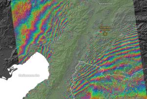
One of the products that can be elaborated processing radar imagery before and after an earthquake is an interferogram that depicts the displacement of the surface triggered by such an earthquake. The European Space Agency carried out an analysis of satellite imagery to…
read more

