Flood
Definition
Facts and figures
Further information
UN-SPIDER Regional Support Offices with hazard-specific expertise
Related content on the Knowledge Portal
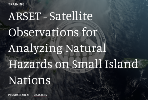
Small island nations are highly vulnerable to climate change and natural disasters, such as hurricanes, cyclones, and other storms, which can lead to severe flooding, landslides, and result in the loss of life and property. In addition, a rise in the global mean sea level places island nations at a higher risk for permanent submersion of land, coastal erosion, coastal ecosystem loss or change, salinization, and impeded drainage.
This three-part training series will focus on small island nations while introducing the data, methods, and tools useful for monitoring natural hazards. Case studies will be used to demonstrate methodologies applying satellite and model data and open access tools to analyze storm impacts, sea level rise, and landslides on small island nations.
Course Format:
- Three 2-hour parts
- Each part will be offered at two different times of day, once in English and once in Spanish.
- Time: 11:00 to 13:00 ET (…
África del Sur está expuesta a amenazas hidrometeorológicas, geológicas, costeras y biológicas. En los últimos años la región ha sufrido los impactos de sequías, inundaciones y plagas de langosta. La tormenta tropical Idai provocó inundaciones severas en Mozambique, Malawi y Zimbabue en marzo del año 2019 y en el año 2020 varios países tuvieron que afrontar la plaga de langosta. Desafortunadamente, COVID-19 sigue impactando a todos los países de esta región.
Para continuar promoviendo el uso de tecnologías espaciales en actividades relacionadas on la gestión para la reducción de riesgo de desastres, la preparación, la respuesta y la recuperación en caso de desastres, ONU-SPIDER y el Centro de Percepción Remota de Superficies Terrestres de la Universidad de Bonn (ZFL por sus siglas en inglés) unieron esfuerzos para organizar la Reunión Regional Virtual de Expertos para África del Sur: "Soluciones Espaciales para Gestión de Riesgo y Respuesta en caso…
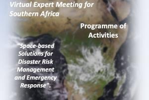
read moreRegional Support Offices mentioned:19/07/2021Southern Africa is exposed to hydrometeorological, geological, coastal and biological hazards. The region has been hard hit by droughts in recent years. Tropical cyclone Idai triggered massive floods in Mozambique, Malawi, and Zimbabwe in March 2019, and in 2020 several countries experience a severe locust outbreak. And unfortunately, COVID-19 continues to impact all countries in this region.
To continue efforts to promote the use of space technologies in disaster risk management, emergency response and recovery efforts, UN-SPIDER and the Centre for Remote Sensing of Land Surfaces of the University of Bonn (ZFL) joined forces to organize the UN-SPIDER / ZFL Regional Virtual Expert Meeting for Southern Africa "Space-based Solutions for Disaster Risk Management and Emergency Response" from 13 to 15 July 2021. This regional expert meeting contributed to the efforts conducted by UN-SPIDER on disaster risk reduction, preparedness, early warning…
read moreRegional Support Offices mentioned:19/07/2021Introduction
Space-based applications related to Earth Observation and geospatial data play an important role in supporting disaster risk reduction, response, and recovery efforts through providing accurate and timely information for decision-makers. Monitoring floods, drought conditions and water resource environments using satellite remote sensing (RS) technologies have become more essential recently in particular for developing countries.
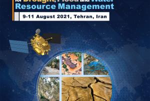
This workshop will address the use of space technologies (remote sensing, telecommunication and global navigation satellite systems) for various applications in natural disaster managements that can provide sustainable social and economic benefits. Current and planned projects/research that use space-based technologies for both practical applications and scientific explorations will be presented. Cooperative efforts and international partnerships for capacity-building, training and research will be discussed.…
read moreSpace-based applications related to Earth Observation and geospatial data play an important role in supporting disaster risk reduction, response and recovery efforts through providing accurate and timely information for decision-makers. Monitoring floods, drought conditions and water resource environments using satellite remote sensing (RS) technologies have become more essential recently, in particular for developing countries.
The workshop will be held in Tehran, Iran, from 9 to 11 August 2021, in a virtual format, and will be hosted by the Iranian Space Agency (ISA). The workshop will explore how current space technologies help identify and monitor the effects of a changing climate – including the onset of drought, flash floods, and general water resources conditions as a result of global climate change, in particular on an international and regional scale. The discussions at the workshop will also be linked to the 2030 Agenda for…
read moreRegional Support Offices mentioned:14/06/2021- Publishing institution:
- Publishing institution:
Like many countries in Latin America, Peru is exposed to a variety of natural hazards that have triggered disasters in previous decades. Disaster preparedness, response and recovery efforts are coordinated by the National Civil Defense Institute (INDECI). In recent years, INDECI has benefited from the advisory support provided by Peru’s National Commission for Aerospace Research and Development (CONIDA). Taking advantage of this advisory support, INDECI developed and launched at the end of 2018 its Agenda for Applied Research for the period between 2018 and 2021, addressing the preparedness, risk, and recovery phases of…
read moreRegional Support Offices mentioned:03/05/2021- Publishing institution:
The European Space Agency is organising the 10th International Workshop on Science and Applications of SAR Polarimetry and Polarimetric Interferometry, POLINSAR 2021.
Date(s)
The workshop will take place online from 26 to 30 April 2021.
Objectives
- Provide a forum for scientific exchange
- Present the latest exploitation results from full-pol airborne and spaceborne systems and assess the state-of-the-art
- Review retrieved bio-geophysical parameters and their accuracy
- Make recommendations for algorithm development and new products
- Support the preparation for ESA and Third Parties full-pol missions exploitation (BIOMASS, NOVASAR-S, RCM, SAOCOM, TerraSAR-L etc.)
- Present innovative polarimetric applications and ideas for future polarimetric mission concepts Report on the status of POLinSAR 2019 recommendations
Sessions…
read more

