Landslide
Definition
Facts and figures
Further information
UN-SPIDER Regional Support Offices with hazard-specific expertise
Related content on the Knowledge Portal
El Centro Asiático para la Reducción de Desastres (ADRC) y la Oficina de Asuntos del Espacio Ultraterrestre de las Naciones Unidas (UNOOSA) firmaron el 4 de Junio de 2009, con ocasión de la 52ª sesión de la Comisión sobre la Utilización del Espacio Ultraterrestre con Fines Pacíficos (COPUOS), el acuerdo de cooperación para el establecimiento de la Oficina Regional de Apoyo (RSO) de ADRC UN-SPIDER.
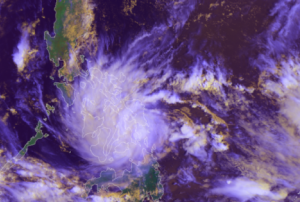
Tropical Storm Nalgae (known as Paeng in the Philippines) unleashed floods and landslides in the Philippines, killing at least 45 people.
Provinces and cities in the south were hit the hardest by the storm. The Bangsamoro Autonomous Region in Muslim Mindanao (BARMM) was put under a state of emergency due to severe flooding.
Authorities reported that close to 185,000 people across the country were affected by the storm.
UNOOSA/UN-SPIDER requested the activation of the International Charter Space and Major Disaters on behalf of the Philippine Space Agency (PhilSA) and the National Disaster Risk Reduction and Management Council (NDRRMC).
read moreOrganization Title …Tropical Storm Megi (also known as Agaton) passed over the Philippines on 10 April, causing landslides and floods in its wake.
The storm struck the east and south coasts of the archipelago, particularly affecting Western Visayas, Eastern Visayas and Craga regions.
35,000 people were evacuated before the storm arrived, and it is estimated that as many as 200,000 have had to leave their homes since then to move to safer locations. Estimates suggest almost a million people may be affected by the disaster.
76 people have been reported killed due to floods and landslides, after rivers burst their banks and debris from hills was washed down, and villages near Baybay City have been badly affected.
UNOOSA/UN-SPIDER requested the activation of the International Charter Space and Major Disasters on behalf of the Philippine Space Agency (PhilSA) and the Philippine National Disaster Risk Reduction and Management Council (NDRRMC)
… read moreThis article is a republished news article, created and originally published by the International Centre for Integrated Mountain Development (ICIMOD) under a Creative Commons license. Read the original article here.
Author: Utsav Maden, Knowledge Management and Communication Officer, ICIMOD
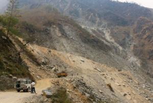
Nepal faces a double whammy of floods and landslides every year. Often considered a secondary hazard, landslides are usually triggered by incessant rainfall falling upon hilly and unstable slopes in Nepal’s predominantly mountainous terrain. As Nepal lies at the cusp of the Indian and Tibetan tectonic plates, it is more susceptible to earthquakes and resulting landslides. Unplanned road building and construction along unstable mountain slopes on…
read more24/01/2023Implementing science to save lives: A Decade of the Copernicus Emergency Management Service
The Copernicus Emergency Management Service (CEMS) celebrates a decade of operation as a world leader in emergency mapping, early warning tools and open-access disaster information.
For the past ten years, CEMS has provided a global service as a fully operation emergency mapping service at no cost to users and with open access data.
Some highlights on the contribution of CEMS in global disaster risk management activities:
- 576 Rapid Mapping Activations with 5,500+ maps delivered
- Designed and implemented the world’s first Global Flood Monitoring tool
- Ten years of wildfire forecasts up to ten days into the future
- Average of 200+ flood and 500+ flash flood notifications to Member States and authorised users each year
- Offers a current and historical database of 7,000+ drought episodes since 1950
…
read more22/06/2022


