Kenya

country taxonomy block

The Kenya Space Agency recently announced the launch of TAIFA-1 (“one nation” in Swahili), Kenya's first operational Earth Observation satellite, on April 11, 2023. The 3U Earth Observation satellite was developed by engineers from the Kenya Space Agency. The launch is set to be aided by the Space Exploration Technologies Corporation (SpaceX) from California, USA.

TAIFA-1 aims to provide timely and accurate data in a diverse array of fields, such as disaster management, agriculture and food security, environmental monitoring, and natural resources management.

Furthermore, the launch of TAIFA-1 showcases Kenya’s clear stride in advancing satellite manufacturing capacities to develop applications for social and economic benefits. As the Kenya Space Agency's Acting Director mentioned, “the mission plays a pivotal role in putting Kenya on the global map because of its contributions to the growth of satellite development, data analysis and...

more

Publishing date 06/04/2023

At the end of 2019, countries in the Horn of Africa began to suffer the impacts of locust swarms. Later, the locust migrated to regions in Southwest Asia. Unfortunately, the impacts on farmers are devastating. Furthermore, the combined impact of these locust plague and COVID-19 is having a toll of the livelihoods of many farmers in these regions. The Food and Agriculture Organization of the United Nations (FAO) has indicated that 42 million people are facing severe acute food insecurity because of this plague.

Since the end of 2019, the Aerospace Information Research Institute (ARI) of the Chinese Academy of Sciences (CAS) has been tracking the temporal and geospatial dynamics of the locust plague in the Horn of Africa, Eastern Africa, the Middle East and Southwest Asia. To track this plague, experts from the Vegetation Remote Sensing & Pest and Disease Application Research Team of ARI developed the Vegetation Pests and Diseases...

more
Publishing date 13/08/2020

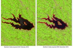
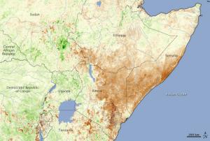
The problem of drought has been worsening in Kenya since last year and it has been declared a national disaster by the Kenyan president on 10 February 2017. The country has felt the effects of drought in many ways, ranging from crop failure, wildlife and herdsmen conflicts, people in need of food to water rationing. Given these conditions, Nairobi county has implemented a water rationing programme in January 2017, as the city’s main source of water, Ndakaini dam, has reduced significantly.

The Regional Centre for Mapping of resources for Development (RCMRD) has assessed the impact of the drought to Ndakaini dam using space technology. They took Sentinel 2 satellite data and analyzed two sets of images from February 2016 and December 2016 to see how the water in the dam has shrunk in the last year. The images show reduction in the surface area of approximately 93ha, which is nearly 35%. These findings are quite alarming, because if the drought continues, the Nairobi...

more
Publishing date 07/03/2017

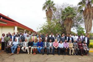
In this year’s Forum of the Monitoring for Environment and Security in Africa (MESA) from 31st August – 4th September 2015 in Kenya, participants discussed the use of Earth Observation data for policy, planning and decision making processes in Africa, provided by the MESA project. 

The Commissioner for Rural Economy and Agriculture of the African Union Commission, H.E. Tumusiime Rhoda Peace highlighted that MESA incorporates a variety of stakeholders, such as African decision-makers, experts, service providers and the user community, which enables comprehensive communication and interaction in different fields of expertise.  

Prof. Judi Wakhungu, Cabinet Secretary of the Ministry of Environment and Natural Resources and Regional Development Authority of the Republic of Kenya explained her experience with MESA: "Before this, my office and team members had to travel physically to protected areas which took several days and incurred huge costs. Thanks to the MESA...

more
Publishing date 15/10/2015

On Thursday June 4th a one-day workshop on the “Use of Modis Data for Early Warning, Disaster Risk Reduction (DRR) and Environmental Monitoring” was held in Kasarani (Nairobi) by the Regional Centre for Mapping of Resources for Development (RCMRD), UN-SPIDER's Regional Support Office in Kenya.

The stakeholders workshop’s aims were the following ones:

  • The creation awareness of the data streams received and products generated through the Moderate Resolution Imaging Spectro-radiometer (MODIS) antennae;
  • The demonstration of the role of near real-time data synthesis and product dissemination;
  • Focus on a product on near real-time fire detection; dissemination of the service; crop and pasture; and flood forecasting.

This workshop is the result of a project between RCMRD and Google Foundation, SERVIR Africa, NASA and USAID in order to procure, install, and build capacity for MODIS direct readout...

more
Publishing date 10/06/2015

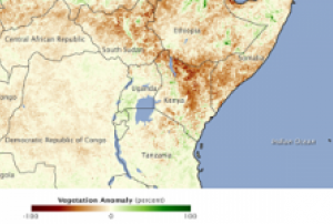
Satellite technology helps to monitor drought in Kenya providing detailed information about the strength, location, spatial extent and duration of the drought.

The spatial information allows an analysis of the drought situation in the country and in some of the most affected regions such as Wajir, Marsabit, Isiolo and Garissa. This allows for better disaster management and facilitates the request for donor support. In 2011 Kenya had one of the worst droughts in recent times. It was difficult for the country to implement appropriate preparedness measures. The use of satellite technology could improve these processes.

"We used to get conflicting and misleading information from arid and semi-arid areas. Some regions are generally very dry and when rains fail for some time, they say they are in extreme drought. Now we can plan, detect drought early and advise even at policy level on what measures to take," said Luigi Luminari, a technical advisor at Systems for...

more
Publishing date 23/03/2015

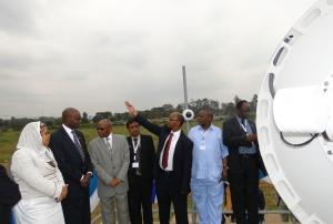
RCMRD, the Regional Centre for Mapping of Resources for Development, and host of UN-SPIDER's Regional Support Office in Kenya, recently installed and launched a new satellite receiving station. The station is capable of receiving data from Moderate Resolution Imaging Spectro-radiometer (MODIS) sensor on the US American Aqua and Terra satellites, as well as other Earth Observation satellites.

With their Earth Observing System-Front End Server, RCMRD manages all the automation and management tools needed to control the ground station antenna enabling RCMRD to track and monitor real-time status, and to ingest and demodulate multiple Earth Observation satellites. The Director for Remote Sensing Dr. Tesfaye Korme said: "We have started receiving data from MODIS Aqua and Terra, NPP, METOP, Fengyoung3, NOAA18...

more
Publishing date 15/07/2014

UN-SPIDER's Regional Support Office in Kenya, the Regional Centre for Mapping of Resources for Development (RCMRD), hosted the East African Global Land Cover Workshop from 10 to 14 March 2014. The workshop was organized in partnership with the Interior International Technical Assistance Program of the U.S. Department of the Interior and the U.S. Geological Survey (USGS).

The workshop enhanced the capacity of developing country partners to improve techniques to generate and/or update existing land cover information using satellite imagery. During the workshop land cover mapping experts from Sudan, Uganda, Rwanda, Burundi, Tanzania, Malawi, Mozambique, Swaziland, Lesotho, and Kenya actively participate in a review of the USGS 30 meter Land Cover dataset and methodologies.

more
Publishing date 24/03/2014

From 3 to 7 March 2014, UN-SPIDER carried out a Technical Advisory Mission (TAM) to Kenya in order to assess the current state and the potential of using space-based information for disaster risk management and emergency response in the country. The Mission was conducted upon the invitation of the Government of Kenya through the National Disaster Operations Centre (NDOC) and National Space Secretariat (NSS).

The mission team comprised nine experts from UN-SPIDER, as well as national experts from governmental and research institutions in the United States, Ireland, Nigeria, South Africa, France, Austria and China. The team visited a total of 19 national and regional institutions, NGOs and United Nations agencies. These meetings provided insight in the role of each organisation in disaster management and in the use of space-based and geospatial information.

Additionally, a one-day workshop was organised on the premises of...

more
Publishing date 12/03/2014

UN-SPIDER's network of Regional Support Offices is currently developing Recommended Practices on the use of space-based information for disaster risk management and emergency response. The practices deal with a variety of topics such as droughts, floods, agricultural monitoring or land degradation and include detailed information on the data and methodologies used as well as step-by-step instructions.

Six practices have already been submitted by Regional Support Office with others to follow. These practices will be discussed at the upcoming 5th UN-SPIDER RSO-Meeting on 13 and 14 February 2014 in Vienna, Austria, and will be disseminated through the UN-SPIDER Knowledge Portal once final.

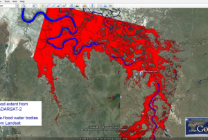
Flood Mapping: This practice is devoted to the use of SAR satellite imagery for flood mapping. The practice shows the use of ESA NEST software for pre-processing and processing of SAR imagery using a threshold method for deriving the flood extent. QuantumGIS is used...

more
Publishing date 03/02/2014

At the invitation of the Government of Kenya, the UN-SPIDER Programme will conduct a Technical Advisory Mission (TAM) to Kenya from 3 to 7 March 2014. UN-SPIDER is currently seeking international experts from the space, disaster management and disaster risk management communities who would like to volunteer for participating in this TAM. If required, UN-SPIDER will sponsor the travel and the stay of the expert to Kenya. The host institutions are the Kenya National Space Secretariat and the National Disaster Operations Centre.

TAMs are part of UN-SPIDER’s Technical Advisory Support, one of the core activities of the programme. During the mission, TAM experts will meet with key institutions involved in disaster management and authorities using space-based information for disaster-risk management and emergency response complementing national disaster management...

more
Publishing date 12/12/2013

The Regional Center for Mapping of Resources for Development (RCMRD) and the United Nations Office for Outer Space Affairs (UNOOSA) signed a cooperation agreement on the occasion of the UN-SPIDER Regional Workshop – “Building Upon Regional Space-based Solutions for Disaster Management and Emergency Response for Africa” in Addis Ababa on Wednesday, 7 July 2010.

This makes RCMRD the ninth member of the network of Regional Support Offices which support the implementation of the activities of the UN-SPIDER programme in their respective regions in a coordinated manner by taking advantage of the expertise and capabilities being offered.

(RCMRD) was established in Nairobi, Kenya in 1975 under the auspices of the United Nations Economic Commission for Africa and the then Organization of African Unity, today African Union. It is an inter-governmental organization and currently has 15 contracting Member States in the Eastern and Southern Africa Regions namely; Botswana,...

more

This training aims to develop the capacity of professionals working in Disaster Risk Reduction and Climate Change Impact and Adaptation to design, manage, evaluate and undertake improvements in people-centered early warning systems for hydro-meteorological & geological hazards and extreme events. It builds upon Indepth Research Services (IRES) experience in building capacities on use of GIS, Remote Sensing and space based technologies in disaster risk management for disaster management institutions, disaster management practitioners and communities. The participants will learn how to:

  • Integrate scientific and technical inputs into early warning dissemination and communication system
  • Interpret scientific information products into user friendly formats and prepare & communicate tailor made early warning information products
  • Undertake risk assessment and design of multi-hazard early warning systems for disaster risk reduction
  • Evaluate and...
more

Geographic information systems (GIS) play a vital role in disaster risk assessment and management. They support planning, response and recovery efforts and improve situational awareness. Unplanned population growth and rapid urbanization combined with extreme climatic events are some of the challenges that increase the vulnerability of a community. To address these challenges there is need to create awareness among disaster managers regarding the usefulness of GIS in disaster risk management.

The focus of the course will be on the use of data during pre- and post- disaster management such as in early warning systems and hazard, vulnerability, risk and damage assessments as well as in the design of risk reduction measures.

Objectives of the course

  • Describe and utilize spatial data, geographic information systems (GIS) and remote sensing in disaster risk assessment and management
  • Utilize existing sources of historical disaster information...
more

RCMRD International Conference's main theme for 2018 is "Space Science for Sustainable Development". The objective of the conference is to facilitate the exchange of ideas on fast-tracking applications of earth observation and geospatial technologies in decision making. It will explore the possibilities of using earth observation data and information to effectively address issues that impact livelihoods in Africa and beyond. The thematic areas of the conference include: agriculture and food security, weather and climate (disaster risk management and disaster risk reduction), water and hydro-climatic disasters, land-use and ecosystems, land management and surveying and cross-cutting themes.

more

A training on Information and Communication Technologies (ICTs) through the use of Geographical Information Systems (GIS) for hazard mapping and modeling will take place from 13 to 23 November in Nairobi, Kenya. The training will also discuss the use of web-based data sources to facilitate research on disaster management, and the use of searchable databases for hazard information.

This course aims to strengthen practical skills on how to use GIS to overcome the major challenges faced in all phases of disaster management. After the training, the participants will be able to describe and utilize spatial data through manipulating it before, during and after disasters.

This five-day-long training is intended for professionals working in DRM-related fields.

Training content

Disaster management concepts and institutional framework

Basic GIS concepts and terminologies in the context of...

more

Registration for RCMRD 2019 International Conference for Earth Observation is open

The African Regional Centre for Mapping of Resources for Development (RCMRD) organizes its third International Conference focusing on “Earth Observation for Evidence-Based Decision Making”. The three-day event will take place from August 14th to 16th in Nairobi, Kenya.

The registration for participants is now open with an early bird fee of 50 USD. The people interested in doing a presentation may submit the abstract to the event site.

For more details, you can visit the RCMRD website.
 

more

The workshop offers intensive training that will cover the fundamental concepts and tools for DRR. People-centered early warning systems empower communities to prepare for and confront the power of natural hazards and measurement of the systems in terms of lives saved and reduction in losses, which is directly related to the execution of an anticipated response by the people and institutions once a warning is issued.

Some of the learning objectives are the understanding of disaster risk reduction concepts and DRR conceptual frameworks and institutional mechanisms, the identification and understanding of the causes and impacts of various hazards locally, regionally and globally, and the identification of disaster risk reduction strategies and opportunities in...

more

El Centro Regional de Cartografía de Recursos para el Desarrollo (RCMRD) y la Oficina de las Naciones Unidas para Asuntos del Espacio Ultraterrestre (UNOOSA) firmaron un acuerdo de cooperación con motivo del Taller Regional de ONU-SPIDER - "Building Upon Regional Space-based Solutions for Disaster Management and Emergency Response for Africa" en Addis Abeba el miércoles 7 de julio de 2010.

Esto convierte a la RCMRD en el noveno miembro de la red de Oficinas Regionales de Apoyo que apoyan la ejecución de las actividades del programa ONU-SPIDER en sus respectivas regiones de forma coordinada aprovechando los conocimientos y capacidades que se ofrecen.

RCMRD se creó en Nairobi, Kenia, en 1975 bajo los auspicios de la Comisión Económica para África de las Naciones Unidas y la entonces Organización para la Unidad Africana, hoy Unión Africana. Es una organización intergubernamental y actualmente cuenta con 15 Estados miembros contratantes en las regiones de África...

more

The Global Flood Partnership (GFP) has announced that their annual conference will be held this year in Nairobi, Kenya. Registration for the even has now been opened. The subject of this years conference will be "EW4ALL: Strengthening resilience against flooding - Know, Monitor, Communicate, Respond!" and will include sessions covering the four pillars of Early Warnings for All (EW4ALL), including sessions on risk knowledge, monitoring and warning, communication and dissemination, and response and recovery. 

This five (5) days training course explores how new information-, communication- and mapping technologies can be practically used to respond to disasters, augment situational awareness, improve relief coordination and much more. This course looks at a variety of real world examples from organizations working in the field and analyzes some of the key challenges related to access, implementation, scale, and verification that these new technologies can present. 

Some of the objectives of the training are: manage specific software platforms and utilize various technological tools for responding to and managing crises; design dynamic and effective strategies for using technology platforms and tools to respond to challenges in the field; and develop confidence and...

more

There is a great need to utilize disaster risk information in planning for effective coping mechanisms of disaster risk reduction. For this, there is a significant need to create awareness among the disaster management professionals regarding the importance of GIS and Remote Sensing.

This course is job oriented and aims to impact practical skills on how to use GIS and RS ,to overcome the major challenges faced in ,pre-disasters during disaster and post-disaster management such as during early warning, hazard, vulnerability and risk assessment, damage assessment, as well as in the design of risk reduction measures.

The training is aimed at helping participants and their respective organizations to design and implement Early Warning Systems (EWS). The course will help participants develop an EWS and risk management plans tailored to the needs of their respective organizations.

Participants will be introduced to various aspects of early warning and disaster management. This training is designed to increase the audience's awareness of the process of EWS, leading to better performance in disaster preparedness and response.

more

This course blends academic study with experiential learning of best practice to teach you about disaster preparedness and response and creates professionals who are ready for action.

Some of the course's objectives are gaining knowledge required to pursue a career or work on emergency planning and management; examining theory and practice in a range of countries, benchmarking approaches in their respective countries of origin/work and generally build relevant experience in the industry; developing an early warning system and risk management plan tailored to the needs of their organization; and examining the kinds of tools and products that are available or could be developed to integrate information into forms most useful for them to make decisions at various levels.

more