Nigeria

country taxonomy block

The National Space Research and Development Agency (NASRDA), UN-SPIDER and the Centre for Remote Sensing of Land Surfaces (ZFL) of the University of Bonn organized a 3-day interinstitutional workshop to improve disaster preparedness in case of very large floods in Nigeria. The workshop, held in Abuja from 12 to 14 September 2022, addressed the use of space-based information provided by emergency mechanisms such as the International Charter Space and Major Disasters and services by the Copernicus programme such as the Global Flood Awareness System (GLOFAS) to take note of potential floods.

The Organizing Committee also included the National Emergency Management Agency of Nigeria (NEMA), the Nigeria Hydrological Services Agency (NIHSA), the Nigerian Meteorological Agency (NiMet) and the National Disaster Management Organization of Ghana (NADMO). The workshop brought together more than one hundred participants from several government agencies, UN agencies and other…

more
Publishing date 15/09/2022

UN-SPIDER and its Regional Support Office in Nigeria, the National Space Research and Development Agency (NASRDA), conducted an online training on the UN-SPIDER Recommended Practice on Flood Mapping and Damage Assessment Using Sentinel-1 SAR Data in Google Earth Engine. Staff from NASRDA as well as from the National Emergency Management Agency (NEMA) of Nigeria participated in the training, which consisted of three two-hour-long online sessions between 21 and 23 October.

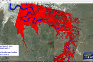
The training aimed overall at highlighting the importance and usefulness of remote sensing and satellite data as a decision-making tool in risk and disaster management. In particular, it intended to strengthen the understanding of the characteristics of synthetic aperture radar (SAR) imagery and its use for flood mapping in order to support emergency response efforts in Nigeria,…

more
Publishing date 24/10/2020
Regional Support Offices mentioned:

The Edo State Polytechnic, Usen, has concluded preparations to unveil the Centre for Geospatial Information Science (CGIS), a research and teaching unit that will utilize computer software and tools such as geographic information systems among others, to gather information for use in mining, agriculture, urban planning and health care.

CGIS will provide training and consulting services in the area of geographic information system (GIS) and other remote aerial technology sensors to gather geographic information.

The rector of the institution, Prof. Abiodun Falodun, unveiled, during an interview, that CGIS will train specialists to produce maps, tables, reports and other such materials using GIS technology. It will also offer extended courses on deployment of advanced technology in mapping and managing geographic information organizations and short introductory programmes for secondary school students..

During the 3rd Public…

more
Publishing date 27/02/2019
Regional Support Offices mentioned:

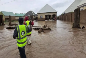
Due to heavy seasonal rain falls within the last months, Nigeria, Niger, Burkina Faso and Sierra Leone have been affected by floods. Overall more than 300,000 people have been impacted and 39 casualties reported. 

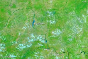
Since August 30, approximately 206,000 people in Nigeria have been affected by floods in Adamawa State. The floods were triggered by spillage due to damage at the Dadin Kowa dam in Gombe State, which in turn caused an overflow at Kiri Dam located downstream in Adamawa State. Further heavy rainfall worsened the flooding. The National Emergency Management Agency (NEMA) has been responsible for the response, humanitarian partners conducted rapid assessments in five Local Government Areas focusing on shelter, food security, sanitation, health and education. 

Since the beginning of the rainy season in June, floods and strong winds affected eight regions of Burkina Faso. Numbers for September counted eight casualties, 54 people wounded and further 28,781…

more
Publishing date 26/10/2015
Regional Support Offices mentioned:

Nigeria plans to develop, manufacture and launch its own satellite by 2030, according to Dr. Spencer Onu, the Center for Satellite Technology Development’s (CSTD) Director. He also added that the components needed for building the space artifact are presently being developed.

However, he also admitted that Nigeria still suffers from shortages in the application of space technology, specifically from the lack of space education in the country’s academic curricula: “Only Nigerian university has aerospace engineering—their program has been approved by the Council but has not yet started. Kogi State Polytechnic also had its own approved curriculum, but that department is yet to be initiated.”

Professor Mohammed Sheidu, the Director-General, National Space Research and Development Agency (NASRDA), is confident in Nigeria’s capacity to build the satellite: “The…

more
Publishing date 29/06/2015
Regional Support Offices mentioned:

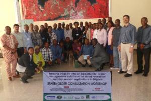
UN-SPIDER's Regional Support Office in Sri Lanka, the International Water Management Institute IWMI, conducted a training on "Earth Observation Technologies for Flood-risk Mapping and Forecast Rating Curve for Flood Recession Agriculture in Nigeria". At the same occasion, the participants were briefed on the findings of a recent research project on "Turning tragedy into an opportunity: water management solutions for flood recession and dry season agriculture in Nigeria” supported by Federal Ministry of Agriculture and Rural Development (FMARD). The workshop and training took place from 5 to 7 May 2015 and were organized jointly by IWMI, FMARD and UN-SPIDER's Regional Support Office in Nigeria, NASRDA.

Approximately 30 experts participated in the event and were trained on the use of space technology for flood risk reduction from FMARD, NiMET, NIHSA, NASRDA and academic institutes.

more
Publishing date 27/05/2015

A study carried out by the University of Leicester has shown the amount of rainfall many African areas receive has drastically changed in the last ten years. It is an essential factor for vegetation, which plays a vital role in African livelihoods.

The international team of researchers has mapped the entire African continent south of the Sahara regions using satellite mapping technology. The analysis of  the rainfall and greenness of plants in African regions suggests that "some parts of the Congo, Nigeria and Madagascar appear to receive much less rainfall now compared to 10 years ago," said Professor Heiko Balzter, Director of the Centre for Landscape and Climate Research at the University of Leicester and co-author of the study.

The analysis of 10 years of satellite data has been conducted together with the Joint Research Centre of the European Commission, the Institute of Electromagnetic Sensing of Environment of the National Research Council of Italy…

more
Publishing date 09/03/2015

On 1 December 2014, the Nigerian Minister of Science and Technology, Dr Abdu Bulama, announced the launch of the first indigenous Nigerian satellite by 2018.

The mission is part of the broader national initiative of developing a strong science and technology apparatus to advance the pace of socio-economic development and infrastructure in the country.

Dr Bulama emphasized the need for Nigeria to develop its own "time and technology" as well as to apply science and technology to the country's economy.

He said that the Ministry was devoting significant efforts to guiding Nigeria into the new developmental model by disseminating a culture of science, technology and innovation among the nation.

"By this, Nigeria in the nearest future will be an acknowledged member of the fast developing scientific and technologically progressive nations of the world," he stated.

more
Publishing date 11/12/2014

The Federal Government of Nigeria has launched a National Digital Flood Model. The development of the model was a consequence of the severe flooding in 2012, which caused tremendous economic damages.

According to the Nigerian Tribune, Minister of Environment, Mrs. Laurentia Mallam said the National Digital Flood Model was specifically developed for improved monitoring and forecast nationwide, to ensure effective environmental governance and prompt response to impending flood disaster. She said “the model permits interaction between predicted hydro-meterorological data and earth surface conditions such as land-use and soil type to derive runoff which displays in 3- dimension GIS environment”.

more
Publishing date 29/08/2014

The National Space Research and Development Agency of Nigeria (NASRDA), host of a UN-SPIDER Regional Support Office, has provided relevant satellite datasets for resource monitoring, socio-economic and intelligent mapping across Nigeria and other parts of the globe, as the website Leadership has reported.

NASRDA Director General, Mr Seidu Mohammed, said that NASRDA satellites imagery were being used by 18 universities, six MDAs and more than 100 academic researchers across Nigeria, Africa, Europe, Asia and other parts of the world.

“We will leverage on the progress made through the development, launch and utilisation of Nigeria Sat-2 and Nigeria Sat-X products to advance space technology in the sustainable development of our beloved country, Nigeria,” he said.
Publishing date 26/08/2014
Regional Support Offices mentioned:

The Africa Geospatial Forum, scheduled to take place in Lagos, Nigeria on 19 and 20 August 2014, had to be postponed due to the Ebola outbreak in the region, as the organizers announced: "Considering the wellbeing of our participants, exhibitors and sponsors, Geospatial Media and Communications and Lagos State Government are re-scheduling Africa Geospatial Forum to 9 - 10 December, 2014 at the same venue, when organising such a gathering will yield maximum benefits for all stakeholders involved."

Since it first took place in 2006, the Africa Geospatial Forum (formerly known as Map Africa) has played a significant role in bringing together the geospatial community of Africa. Its participants discuss key issues such as the current usage of geospatial technologies across the continent, technology trends and the future of the geospatial industry in the region in order to ensure the…

more
Publishing date 18/08/2014

The Nigerian National Space Research and Development Agency (NASRDA) - one of UN-SPIDER's Regional Support Offices - announced on 28 May 2014 that it will develop and build a “Made in Nigeria” satellite by 2018 and accomplish a launch from a Nigerian launch pad by 2030. The announcement was made by Prof. Seidu Mohammed Director General of NASRDA during an interview in Abuja with the News Agency of Nigeria (NAN).  

In keeping with Nigeria’s socio-economic development goals, “the mission and vision of NASRDA is to build indigenous competence in the development, design and building of appropriate hard and software in space technology. The spinoff of electronic, software and commercial space industries allied with the program would be for the benefit of the Nigerian people.” said Prof. Seidu Mohammed.   

The agency is currently building the legal framework of the Nigerian Space Programme in order to enhance the countries…

more
Publishing date 03/06/2014
Regional Support Offices mentioned:

British and Chinese satellite imaging and tracking technology will be deployed to Nigeria to help Nigerian authorities to support them in the search of the abducted Nigerian school girls.

"President Goodluck Jonathan Wednesday requested and received a commitment from Britain to deploy its intelligence gathering resources in support of Nigeria’s security agencies currently engaged in the search and rescue operation," presidential spokesman Reuben Abati said in a statement.

A month ago militants from the Boko Haram group abducted an unknown number of schoolgirls from their school. The search is still ongoing. Chinese Prime Minister visited Nigeria and reassured the Nigerian authorities that the Chinese government will provide satellite and intelligence technology to support the search.

more
Publishing date 12/05/2014

UN-SPIDER's network of Regional Support Offices is currently developing Recommended Practices on the use of space-based information for disaster risk management and emergency response. The practices deal with a variety of topics such as droughts, floods, agricultural monitoring or land degradation and include detailed information on the data and methodologies used as well as step-by-step instructions.

Six practices have already been submitted by Regional Support Office with others to follow. These practices will be discussed at the upcoming 5th UN-SPIDER RSO-Meeting on 13 and 14 February 2014 in Vienna, Austria, and will be disseminated through the UN-SPIDER Knowledge Portal once final.

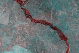
Flood Mapping: This practice is devoted to the use of SAR satellite imagery for flood mapping. The practice shows the use of ESA NEST software for pre-processing and processing of SAR imagery using a threshold method for deriving the flood extent. QuantumGIS is used…

more
Publishing date 03/02/2014

UNSPIDER's Regional Support Office (RSO) in Nigeria (National Space Research and Development Agency - NASRDA) participated in the 2013 annual consultation of the regional committee for disaster management in West Africa (GECEAO). The event was held in Abuja – Nigeria from 4th to 6th of June 2013. The forum was organised by the Economic Community of West African States (ECOWAS), the National Emergency Management Agency, the International Federation of Red Cross and Red Crescent Societies, and The United Nations Office for the Coordination of Humanitarian Affairs (UNOCHA).

The objectives of the forum were to examine the lessons learnt from 2012 disasters, preparation status for 2013 rainy season and development of recommendations (with a focus on cross-border cooperation). Participants included representatives from disaster management organization and civil protection services from the West African States. A session was organised by the UN-SPIDER RSO in Nigeria during…

more
Publishing date 18/06/2013
Regional Support Offices mentioned:

To strengthen the preparedness and response capacities of West African countries to natural disasters, the ECOWAS secretariat in Abuja, the Nigerian capital city, Tuesday began hosting a three-day consultative meeting of the Regional Committee for Disaster Management in West Africa (GECEAO).

Opening the meeting, the Nigerian Minister of Environment, Mrs. Hadiza Mailafia, charged the participants from the ECOWAS sub-region and its multilateral partners “to find ways and means of providing a mechanism for regional risk assessment, mitigation, preparedness and response.”

Also speaking at the meeting, the Director-General of the Nigerian National Emergency Management Agency (NEMA), Alhaji Muhammad Sani Sidi, alerted countries in the West African Sub-region of the increasing incidences of disaster across the zone, advising the governments to take disaster management more seriously in order to promote safety and development.

According to Sidi, developing strategic…

more
Publishing date 07/06/2013

The website Thidaylive.com reported that the Nigerian National Emergency Management Agency (NEMA) had carried out mapping of all the communities likely to be affected by the predicted 2013 flood as part of its preparedness against disaster occurrence in the country.

"NEMA’s Director General, Alhaji Mohammad Sani Sidi, explained that the agency’s action plan during a meeting with the Kogi State Governor, Capt. Idris Wada, in Abuja. He said the organisation had also carried out vulnerability capacity assessment of seven communities to determine the existing capacity in each community and its level of resilience.

Nigeria Metrological Agency (NIMET) had predicted rainfall with a possible flooding in some low plain areas. Based on this report, some states in the North-west region such as Sokoto, Kebbi, Zamfara and virtually all the South-south states have also been designated flood prone areas.

Wada informed the Director General that the state had marked out…

more
Publishing date 27/05/2013

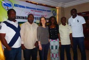
The UN-SPIDER Regional Support Office (RSO) in Nigeria participated in a Project Managers Training for the International Charter: Space and Major Disasters in Abuja, Nigeria. The project managers’ training was conducted from 8th to 10th April 2013.

The training was facilitated by Miss Adina Gillespie from DMC International Imaging (DMCii) Limited of the UK with support from the National Emergency Management Agency of Nigeria (UN-SPIDER National Focal Point in Nigeria). Six officers from the UN-SPIDER Regional Support Office in Nigeria, National Space Research and Development Agency, participated in the intensive training programme. The officers include: Mr. Bayo Omoyajowo, Mr. Laide Aderoju, Mr. Ademuyiwa Oyewumi, Miss. Esther Ibrahim Shupel, Mr. Shomboro K. Dauda, and Mr. Isah Ahmed Abdukareem.

At the end of the training, participants were able to manage mock charter…

more
Publishing date 29/04/2013
Regional Support Offices mentioned:

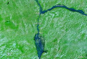
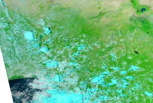
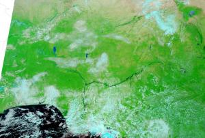
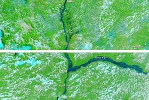
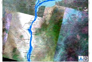
Nigeria continues to be heavily affected by floods. The country’s National Emergency Management Agency reported that floods had killed 431 people and displaced 1.3 million more. Floods had also wiped out 152,575 hectares (377,020 acres) of farmland, and Nigerians could expect rapidly rising food prices as a result. On 25 September 2012, the International Charter "Space and Major Disasters" was activated to produce maps of the flooding of the Niger and Benue River close to the city of Lokoja.

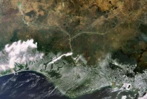
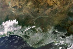
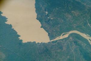
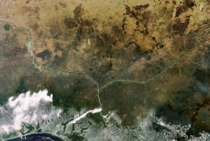
The Moderate Resolution Imaging Spectroradiometer (MODIS) on NASA's Aqua satellites captured an image of the confluence of the Niger and Benue Rivers in southern Nigeria on October 11, 2012. The comparison to an images acquired October 8, 2010 shows the extent of the floods. Both images use a combination of visible and infrared light to better…

more
Publishing date 15/10/2012

The International Charter "Space and Major Disaster" was activated twice last week for floods in Africa: Chad and Nigeria.

UNITAR/UNOSAT on behalf of UNICEF activated the mechanism for Chad on 10 October 2012. Heavy rains which started in early August had caused continuing floods in Chad. Hundreds of thousands of people have been affected by the floods, with damage to both property and agriculture. In the Rig Rig District of the Kanem Region, 220 houses were destroyed and 3000 people were displaced. In the Sila Region, more than 13,000 houses were affected and the flood waters blocked major humanitarian supplies. In Guera, an estimated 850 people were in need of emergency support. And floods have also been reported in the capital, N'Djamena. In September the flood waters were still present, and had affected an estimated 466,000 people, and killed 34. 96,000 houses were reported destroyed and 255,000 hectares of crops lost.

In Nigeria, the Nigerian National…

more
Publishing date 15/10/2012

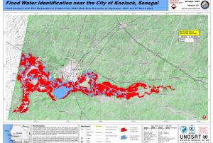
The International Charter: Space and Major Disasters has been activated three times in the past two days to provide satellite imagery and maps regarding floods in Niger, Senegal and Nigeria. West African nations experience torrential rains during their annual rain season, but this season has been reported as the worst in 50 years.

In Niger, the Direction Générale de la Sécurité Civile et de la Gestion des Crises (COGIC) activated the Charter on 28 August after heavy flooding over the last few weeks caused by a severe rain season and the River Niger bursting its banks. It left 65 dead and over 100,000 homeless. The capital city of Niamey was struck by the flood waters from the River Niger, and Agadez City in the centre of Niger has also been affected. The Dosso region has suffered the worst effects of the floods, however, with an estimated ten thousand homes destroyed. Relief and international aid is being provided to help with the recovery.

more
Publishing date 29/08/2012

At the 47th Annual General Meeting of the Institution of Surveyors in Ilorin, Nigeria, Nigeria's Vice President, Muhammad Namadi Sambo said the Nigerian federal government would do everything possible to map its geographical landscape to address disaster management in the country. For this purpose, the vice president said, the office of the Surveyor-General of the Federation has been positioned for the task. Sambo called on state governments to also take up the challenge. "This essentially is what maps and its attribute products enable us to do. The government of Nigeria will do everything possible to ensure that our geographical space is properly and comprehensively mapped".

Publishing date 13/07/2012
Regional Support Offices mentioned:

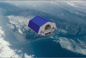
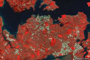
Nigeria's latest Earth observation satellites have returned their first pictures. The spacecraft, launched on 17 August, give the African nation a powerful new capability to map its own lands and other parts of the globe. NigeriaSat-2 and NigeriaSat-X will also assist the Disaster Monitoring Constellation. This UK-managed fleet of spacecraft is used to picture regions of the Earth gripped by natural calamities. These might be catastrophic floods or a big earthquake. Images sent down from space will often be critical to organising an effective emergency response.

The first picture released from the Nigerian pair is of New Zealand's biggest city, Auckland. It was acquired by NigeriaSat-X, and reveals the buildings and the landscape surrounding this major urban centre. It is just possible to see the wakes of ships passing under the harbour bridge that joins downtown Auckland with North Shore City. The satellite is equipped with a multi-spectral imager for general mapping,…

more
Publishing date 29/08/2011

On June 24 -- Nigeria has concluded plans to launch into orbit two satellites from Russia on July 7, a top government official with the country's National Space Research and Development Agency (NASRDA) has said.

Director General of the agency Seidu Mohammed told a news conference in Abuja on Thursday that the earth observation satellites, NigeriaSat-2 and NigeriaSat-X, would be launched at 8 a.m. local time on July 7.

"We are once more on the path to greasing the wheels of our success story, as the stage is now set for the launch of our third and fourth satellites code named NigeriaSat-2 and NigeriaSat-X," Mohammed told reporters.

The satellites would be launched simultaneously using the Dnepr launch vehicle which has successfully launched more than 55 satellites into the orbit, he said, adding that the exercise would be broadcast live.

The two spacecraft and their launch vehicles have been adequately insured in line with the global practice,…

more
Publishing date 27/06/2011

THE National Space Research and Development Agency (NASRDA), will launch two satellites into the orbit before the end of this month to complement the existing NigeriaSat-1. Known as NigeriaSat-2 and NigeriaSat-X, the satellites will be launched before the end of June and would be a follow-up to the NigeriaSat-1 which was launched few years ago.
The agency’s Head of Corporate Affairs, Mr. Felix Ale, stated this, weekend, at a lecture delivered at OSRC Chapel of the Nigeria Union of Journalists (NUJ) in Akure. Ale said the satellites would provide a high resolution system to map Nigeria once in every four months.
According to him, “the satellites would support the National Geospatial Data Infrastructure (NGDI) programme of the government by providing high quality data and enhance human resources in the use of satellite data.” The satellite, which according to him, was designed for seven years, “will meet demand for high resolution…

more
Publishing date 06/06/2011