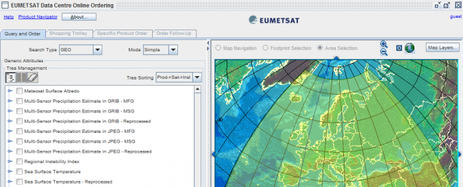
EO Portal (EUMETSAT)

| Data accessibility: | export data |
| Link to the data: | |
| Data type: | satellite data or aerial image |
| Disaster cycle phase: | Disaster Risk Management, Response, Recovery |
| Space-based Information: | Meteosat 10 (SEVIRI-MSG), Meteosat 9 (SEVIRI-MSG), Meteosat 8 (SEVIRI-MSG), Meteosat 7 (MVIRI-MTP), Meteosat 6 (MVIRI-MTP), Meteosat 5 (MVIRI-MTP), Meteosat 4 (MVIRI-MTP), Meteosat 3 (MVIRI-MTP), Meteosat 2 (MVIRI-MTP), Metop (IASI), Metop (GOME-2), Metop (ASCAT), Metop (AMSU-A), Metop (MHS), Metop (AVHRR), Metop (GRAS), Metop (HIRS), Metop (A-DCS), Metop (SARSAT), Metop (SEM) |
| Satellites and Sensors: | Meteosat-8 (SEVIRI), MetOp (AMSU-A), MetOp (ASCAT), MetOp-A, MetOp (GOME -2), MetOp (MHS) |
| Spatial coverage: | Global |
| Spatial resolution: | 1000.00 |
| Temporal coverage: | Archive |
| Content dates: | 1977 - present |
| Technical Specifications: |
|
| Costs: | free |
| Contact: | Contact EUMETSAT |
| Tutorials on the use of data: | How to order Data from the Data Centre |
| Restrictions/ Citation of the dataset: | EUMETSAT Data Policy. |

