English
Español
Français
United
Nations
Office for Outer Space Affairs
UN-SPIDER Knowledge Portal
Search
Home
About Us
What is UN-SPIDER?
About UNOOSA
Publications
Jobs
Meet the Team
Contact
Space Application
Satellite Technology
Emergency Mechanisms
Recovery Mechanisms
International Asteroid Warning Network
Space Mission Planning Advisory Group
International Space Weather Initiative
Space Technologies in the UN
User Stories
Links & Resources
Data Applications
Disaster Recovery
Data Sources
GIS and Remote Sensing Software
Online Learning Resources
Institutions
Risks & Disasters
Disaster Risk Management
Early Warning Systems
Emergency and Disaster Management
Natural Hazards
Sendai Framework
The UN and Disaster Risk Management
The UN and Early Warning
The UN and Disaster Management
Advisory Support
Advisory Missions
Emergency Support
Virtual Advisory Support
Recommended Practices
Training Activities
Practical Uses
Network
Regional Support Offices
GP-STAR
MHEWS
IWG-SEM
Projects
SPEAR
SEWS-D
EvIDENz
Flood GUIDE
CommonSpace Initiative
Tonga Pilot Project
News & Events
News
Events Calendar
UN-SPIDER Events Archive
UNU-INWEH joins the UN-SPIDER RSO Network
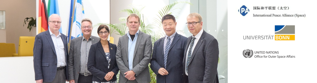
UN-SPIDER welcomes UNU-INWEH as New Regional Support Office
Regional Charter Training in South Africa
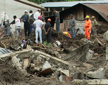
Advancing Disaster Preparedness and Response
University of Bonn, IPA Space and UNOOSA Sign Partnership to Strengthen Global Space Capacity
UN-SPIDER Knowledge Portal Survey 2025
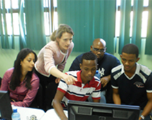
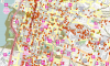
Help Shape the Future of the UN-SPIDER Knowledge Portal
UN-SPIDER's Disaster Response to the Nigeria Flooding (July 28, 2025)
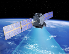
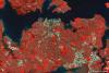
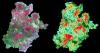
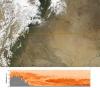
Satellite-based monitoring of Kiri and Dadin Kowa Dams following the Nigeria floods
Explore the Knowledge Portal
How can space technology be applied in disaster and risk management?
Where can I access satellite data, products and other resources?
Who are the users of space technology in disaster and risk management?
Which services can UN-SPIDER offer to Member States?
Stay Up to Date
News
7 Sep 2011
OpenStreetMap’s New Micro-Tasking Platform for Satellite Imagery Tracing
2 Sep 2011
International Charter develops geographic tool to provide information about satellite data used for activations
2 Sep 2011
Plans for Technical Advisory Mission to Sri Lanka taking shape
2 Sep 2011
Review article on using Satellite Communication for Disaster Management will be published soon
31 Aug 2011
Asteroid Impact on Earth: Experts Review Global Response and Mitigation Steps
31 Aug 2011
Satellite Monitoring Data Should Be Widely Available
29 Aug 2011
Nigerian satellites are picture perfect
25 Aug 2011
Landsat image maps aid fire recovery efforts
24 Aug 2011
Dust and Pollution Rise Before the Monsoon
24 Aug 2011
NASA’s Hurricane Webpage: A Resource for Worldwide Tropical Cyclones
Pagination
First page
« First
Previous page
‹‹
…
Page
251
Page
252
Page
253
Page
254
Current page
255
Page
256
Page
257
Page
258
Page
259
…
Next page
››
Last page
Last »
Upcoming Events
10
-
21 Nov 2025
Belém,
Brazil
30th UN Climate Change Conference (COP30)
17
-
21 Nov 2025
Accra,
Ghana
AfricaGIS 2025 and UN-GGIM: Africa XI Joint Conference
17
-
21 Nov 2025
Frascati,
Italy
6th Very High-resolution Radar & Optical Data Assessment (VH-RODA) Workshop
19
-
20 Nov 2025
Vienna,
Austria
UNOOSA Space Law Conference
19
-
21 Nov 2025
Ispra,
Italy
Human Planet Forum 2025
Connect to the Community
Our Regional Support Offices