Europe

country taxonomy block

The Copernicus Marine Environment Monitoring Service (CMEMS) has published a number of new free online tutorials on how to use the information services provided by it.

35 video tutorials covering a variety of topics from beginner to advanced level have been uploaded and can now be accessed by anyone interested in marine environment monitoring. Among them are videos on a range of satellite products with which it is, for instance, possible to learn more about sea surface temperature observation or ocean colour.

Furthermore, a new series of introductory videos on the Copernicus programme and its services is now available on YouTube. The…

more
Publishing date 17/10/2017

The Government of Turkey hosted the European Forum for Disaster Risk Reduction (EFDRR) Open Forum in Istanbul from 26 to 28 March 2017. EFDDR is Europe’s regional platform for disaster risk reduction and brings together multiple stakeholders across all sectors through its Open Forum meetings to discuss and advance on disaster risk reduction issues and to shape the implementation and monitoring of the Sendai Framework in Europe. In the form of the Istanbul Outcomes, it formulated a perspective on disaster risk reduction in Europe in preparation for and as a contribution to the 2017 Global Platform for Disaster Risk Reduction.

The Istanbul Outcomes call for an inclusive approach to disaster risk reduction which recognizes vulnerable people as vital participants in the formulation of national and local strategies. It recalls the severe earthquake in Central Italy in 2016 and commits national institutions to ensuring that strategies are implemented adequately through the…

more
Publishing date 01/04/2017

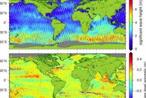
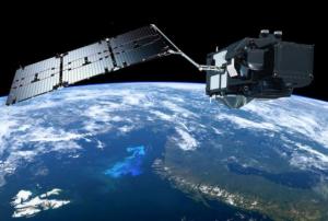
ESA’s Earth observation satellite Sentinel-3A has on its board a new instrument measuring sea surface height and wave height. The Synthetic Aperture Radar Altimeter (SRAL) delivers accurate measurements and provides the Copernicus ocean forecasting systems with data for monitoring the sea level change. The data come with two different time stamps-Near real time (NRT) and Short Time Critical (STC). European Organization for the Exploitation of Meteorological Satellites (EUMETSAT) started to release also the Non-Time Critical data, which are more accurate and thus provide more precise information used in geophysical studies, ocean modeling and sea level monitoring. 

more
Publishing date 02/03/2017

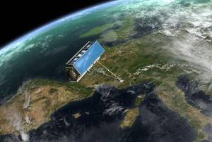
The Sentinel-3A, one of the most complete Copernicus missions, has advanced instruments to measure the temperature on oceans, land, ice and atmosphere. After going through testing and improvements since its launch on February 2016, it has released high quality information from the Ocean and Land Colour Instrument in October this year.

This satellite is currently offering information from its Sea and Land Surface Temperature Radiometer.  This data can be used for ocean and weather forecasting activities by helping in the creation of global maps of sea-surface temperature.  In the case of land, this tool can perceive heat stress in order to improve agricultural practices and monitor urban heat islands, a major concern as urban expansion continues.

The radiometer includes measuring fire channels, a remarkable feature that will assist to assess damage and estimate recuperation of burned areas.  

Transforming information into ocean- and land- surface…

more
Publishing date 01/12/2016
Juan Carlos Villagran of UN-SPIDER at the UN talks. , Minister Lersch-Mense of North Rhine Westphalia visiting the UN-SPIDER stand , Visitors of all ages stop by the stand
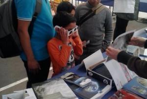
The United Nations commemorated its 20th anniversary since its establishment in Bonn, Germany in June 1996.  Taking into consideration the recent launch of the Sustainable Development Goals, the theme for this anniversary celebration was “Shaping a Sustainable Future”.    UN-SPIDER joined the festivities on 28 and 29 October 2016. During the UN Talks held in the evening of 28 October, the Head of the UN-SPIDER Bonn Office focused his remarks on the role of space-based information in disaster risk reduction as essential when addressing sustainable development.  His comments were rooted on the fact that disasters are eroding hard-won development gains in developing countries.  At the UN fair on 29 October 2016, UN-SPIDER’s stand offered visitors more information on the work carried out by this programme of the United Nations Office for Outer Space Affairs (UNOOSA) and the role of space-based technologies including Earth observation,…
more
Publishing date 03/11/2016

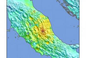
The COPERNICUS Emergency Management Service Mapping was activated on 26 October 2016 due to a 5.4 earthquake affecting Italy's central region. Although there are no fatalities the tremor has left destruction and people sleeping on the street or improvised shelters, reported RT. For more RT information, click here.

The Guardian informed that approximately 200 replicas were felt during the night. The epicenter was close to Visso, a town in central Marche. More details from this daily, click here

more
Publishing date 27/10/2016

Radar Satellite images offer precise 3D pictures of earth. The Crises Control Team of the German Aerospace Center puts together radar imagery on natural disasters like floods or earthquakes. This information is essential for emergency services to know where people are in danger or where help is required. To watch the complete video click here

Publishing date 19/10/2016

In the early morning of the 24 August 2016 an earthquake of magnitude 4.5 occurred in the central area of the Italian Republic, affecting the regions of Lazio, Abruzzo and Umbria.  

More than 4,300 rescuers have been called to come to the assistance of the population. The Copernicus Emergency Management Service has been activated. The Italian Civil Protection is operating at the moment while the death toll rose to 247 on the 25 of August, including many children.

Click here for the Copernicus EMS activation website and to have access to all the maps generated. 


Publishing date 25/08/2016

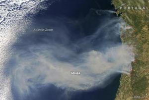
The Moderate Resolution Imaging Spectroradiometer (MODIS) on the Terra satellite of the National Aeronautics and Space Administration (NASA) detected and captured images of numerous fires occurring in the western region of Portugal on the 6th of August.

Strong winds spread the flames on the west coast and hundreds of fires were then noticed on the 11th of August. Three people died in the city of Funchal in Madeira Island and thousands have been displaced (http://www.telegraph.co.uk/travel/advice/wild-fires-in-france-and-portugal-europe-travel-holiday-advice/).

The government of Portugal believes most of the fires have been set by arsonists. Several suspects have been detained by the authorities.

The South of…

more
Publishing date 12/08/2016

Skopje, the capital city of the Republic of Macedonia, was impacted by heavy rains on the 7th of August which led to floods in various parts of the city especially in the northern suburbs.

The COPERNICUS programme of the European Union gathered some information about the floods and provided maps of the flooded area. Around 157 hectares of the city are flooded and the most affected areas are the villages of Stajkovci and Haracinovo, as well as Skopje's suburbs of Butel, Cento and upper Lisice.   22 fatalities were confirmed by the authorities and more than 1000 residents were displaced. The water level reached 1.5 meters above its normal level in some areas.

The EU Civil Protection Mechanism has been activated on the 8th of August and a team has been deployed to Skopje to assist in response operations. 

Publishing date 09/08/2016

Massive floods recently affected Europe and the United-States. In the case of the United States, the Integrated Multisatellite Retrievals for GPM (IMERG) system - using data from the National Aeronautics and Space Administration (NASA) and from the Japan Aerospace Agency (JAXA) - recorded rainfalls triggered by tropical depression Bonnie. 

Excessive rainfall affected different regions of Texas, Oklahoma and South Carolina in the United States. On the 31st May 2016, the International Charter on Space and Major Disasters was activated at the request of the U.S. Geological Survey on behalf of the Texas Division of Emergency Management. This tropical cyclone caused the death of at least nine persons and flooded hundreds of homes. 

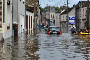
For the European continent, the emergency management system Copernicus, which is funded by the European Union (EU), was activated. Many regions of Belgium, France and Germany…

more
Publishing date 13/06/2016

The German Aerospace Center (Deutsche Zentrum für Luft- und Raumfahrt, DLR) has developed a system called PHAROS (Project on a Multi-Hazard Open Platform for Satellite Based Downstream Services) to support crisis managers, operation managers and relief workers during disaster response operations. This system collects and shares data to various crisis tasks forces and has been sponsored for three years under the EU’s 7th Framework Program for Research and Technical Development (2007-2013). It also includes several partners from DLR y and other European institutes.

Thanks to its holistic approach and its modularity, PHAROS can be adapted to different disaster scenarios using new modules and additional sources of information can be added when needed. To demonstrate PHAROS, DLR selected a type of disaster which occurs frequently in Europe.

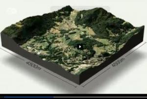
In early March, three forest fires were ignited in a controlled manner in Solsona, Spain, to test PHAROS and the local task…

more
Publishing date 20/05/2016
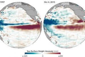
During a news conference in Geneva on 16 November 2015, the Secretary-General of the United Nations World Meteorological Organization (WMO), Mr. Michel Jarraud, commented that the “Severe droughts and devastating flooding being experienced throughout the tropics and sub-tropical zones bear the hallmarks of this El Niño, which is the strongest for more than 15 years.” He further emphasized that “We are better prepared for this event than we have ever been in the past.”
 
During the next months, El Niño is expected to strengthen to become one of the three strongest reported El Niño events within the last 65 years. Most affected countries are already taking national preparation efforts in agriculture, fisheries, water and health, as well as disaster management, to enlighten population, save lives, and to reduce the risk of economic damage, based on advice from National…
more
Publishing date 17/11/2015
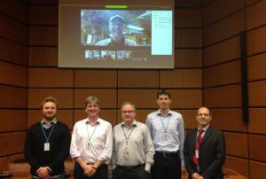
On 9 and 10 November 2015, UN-SPIDER hosted the autumn meeting of the International Working Group on Satellite-based Emergency Mapping (IWG-SEM). The meeting included representatives of the German Aerospace Center (DLR); the European Commission’s Joint Research Centre (JRC); the UN Cartographic Section; the Service Régional de Traitement d'Image et de Télédétection (SERTIT); the Information Technology for Humanitarian Assistance, Cooperation and Action (ITHACA); the Human Rights Watch (HRW) organization; the Humanitarian OpenStreetMap Team (HOT); the University of Bonn; the Pacific Disaster Center (PDC); the Bonn International Center for Conversion (BICC) and the United States Geological Survey (USGS). 
 
In their biannual meeting, the group discussed several topics including map metadata standardization, GeoRSS services, clarifications and procedures related to…
more
Publishing date 10/11/2015

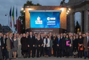
These days, the Champs-Elysées in Paris hosts a Climate Cube presenting information on the contribution of space for studying climate change, right before the upcoming COP21 climate change conference in Paris from 30 November to 11 December 2015.

The Climate Cube presents a high-resolution satellite image of Paris and surroundings, screens display a series of videos on space and climate and other screens give an overview of European satellite missions measuring the ‘essential climate variables’. 

All information demonstrate the importance of satellites and their role in understanding climate change and provide answers on how space is playing a major role in climate research and climate change mitigation.

The Climate Cube is located on the Champs-Élysées, in front of the Grand Palais. The nearest metro station is Champs-Elysées – Clemenceau. The…

more
Publishing date 27/10/2015

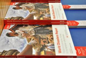
On October 5 2015 the International Federation of Red Cross and Red Crescent Societies (IFRC), the Austrian Red Cross, the United Nations Office for Outer Space Affairs and the Norwegian Embassy launched the 2015 World Disasters Report in Vienna. 

The annual World Disasters Report addresses current and future challenges, trends and innovations in disaster risk reduction and crisis management, by using evidence-based research. This year, the report focalizes on difficulties and challenges experienced by local actors in times of humanitarian response. The report calls for a "localization" of humanitarian aid, as well as a closer and equal relationship between international and local actors. 

more
Publishing date 23/10/2015

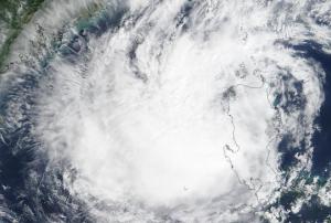
In the last days the Copernicus Emergency Management Service was activated by the Philippines affected by the tropical cyclone Koppu, Croatia affected by floods in the Karlovac region and Italy affected by floods and landslides in the Campania region. 

On October 17 the Republic of the Philippines was struck by the powerful tropical cyclone Koppu, causing severe damages in many provinces of the Philippines. The cyclone provoked landslides and floods, damaging trees and houses, forcing thousands of people to evacuate, several casualties had been reported. The Copernicus Emergency Management Service was activated on October 17 requesting delineation maps; two delineation maps had been delivered showing the flood extent.

Since October 15 the Republic of Croatia experiences heavy rainfall in the Karlovac region, causing floods and affecting buildings and roads. The Copernicus Emergency Management Service was activated on October 16 requesting delineation maps; five…

more
Publishing date 21/10/2015

On 14 October at the World Humanitarian Summit Global Consultation in Geneva, the satellite operators Eutelsat, Hispasat, Inmarsat, Intelsat, SES, Thuraya and Yahsat signed the Crisis Connectivity Charter in partnership with the UN Office for the Coordination of Humanitarian Affairs (OCHA) and the Emergency Telecommunications Cluster (ETC).

In the past years global natural disasters showed an increasing need for safe communication in the face of crisis. Therefore the Crisis Connectivity Charter formulates terms and protocols to enhance emergency response through the access of satellite-based communications. In times of crisis, satellite-based communication serves as a first instance to organize and facilitate logistics, medical care and emergency relief.

The principles of the charter focus on the access to satellite-based communication for humanitarian assistance during disaster management and the access to pre-positioned satellite equipment. Further the…

more
Publishing date 16/10/2015

Airbus Defence and Space and ESA have signed an agreement that enables Copernicus Data Warehouse to continue receiving TerraSAR-X satellite information until the end of 2020. This space artifact offers data used for addressing emergency and security related issues, reliable monitoring needs, and land cover change with high reliability and accuracy to European public institutions.

TerraSAR-X, launched in 2007, is an Earth observation satellite developed by the German Aerospace Center (DLR) and EADS Astrium. Airbus Defence and Space owns the commercial distribution rights for the satellite's imagery and has been collaborating with ESA since 2008. The new contract includes datasets in the area of maritime monitoring, as well as additional datasets for further maritime applications, particularly sea ice monitoring.

The Copernicus Data Warehouse is a portal that provides access to all users to data gathered by the Copernicus missions through a single harmonized interface…

more
Publishing date 30/07/2015

EuroGeographics has signed a four-year agreement with the European Commission to provide geospatial information to the European Union’s statistical office, Eurostat. Thus, the company gives access to the European Commission’s staff to information through its geographical information service, GISCO.

The geographic data will support policy making related to protection against natural hazards, agricultural and environmental monitoring, transport, and economic growth at a regional and national level, according to Ekkehard Petri, Team Leader ‘Geographical Information’ at Eurostat.

The data includes administrative units and statistical regions as well as 1:250 000 scale topo-geographic information from National Mapping, Cadastral and Land Registry Authorities, such as EuroBoundaryMap and EuroRegionalMap. 

“Confidence that the information provided is consistent and comparable — regardless of its national source — is key. We…

more
Publishing date 29/07/2015

A Memorandum of Understanding was signed on July 15 between the European Space Agency (ESA) and the European Environmental Agency (EEA) in order to share scientific expertise and technical data in the fields of Earth Observation and environmental monitoring through satellite imagery.

One of the novelties is the agreement on the employment of the brand-new Sentinel-2A satellite, developed and launched by ESA, for the Copernicus Land Monitoring Service, which is coordinated by EEA. The space artifact is the second satellite of the European Union’s Copernicus programme and is specifically designed for environmental monitoring by providing colourful high resolution imagery in 13 spectral bands.

Not only does it offer data for the traditional…

more
Publishing date 23/07/2015

Arianespace will be in charge of the first launch services for the Meteosat Third Generation (MTG) series of geostationary satellites after the signature of a contract with EUMETSAT.

The agreement has been signed few days following the successful launch of MSG-4. It has fixed the launches of MTG-I1 and MTG-S1 and proposed the option of MTG-I2 for the time period 2019-2023.

Arianespace will use the Ariane 5 ECA launchers placed in the Guiana Space Center, Europe’s Spaceport in Kourou, French Guiana, to set into space the Meteosat Third Generation (MTG) program.  It will significantly improve the services of forecasting high impact weather over Europe and Africa, currently delivered by the Meteosat Second Generation series.

The MTG satellites, developed in cooperation between EUMETSAT and the European Space Agency (ESA), will represent the highest level of complexity and innovation existing among the operational…

more
Publishing date 21/07/2015

European Space Agency’s (ESA) latest weather satellite has been successfully launched and put into orbit from Ariane 5 launcher at the Kourou Space Station (French Guiana) on July 15. The space artifact, called MSG-4, is part of the Meteosat Second Generation series that offers meteorological information over Europe and Africa every 15 minutes and a ‘rapid scan’ imagery over Europe every five minutes.

Forty minutes after the launch, the satellite separated from the launcher and was set into orbit, but it would take 10 days until it will be raised into a geostationary orbit some 36 000 km above the equator, where its speed matches Earth’s rotation.

The satellite was designed, developed and put into orbit by ESA, but will be operated by its owner, the European Organisation for the Exploitation of Meteorological Satellites (Eumetsat).

Johann-Dietrich Woerner, ESA’s Director General, stated that “Tonight’s launch allows the…

more
Publishing date 16/07/2015

China has signed an agreement with the European Union to enhance collaborative research in the field of remote sensing.

During the 17th bilateral summit between the European Union and the People's Republic of China that took place on Monday 29 June in Brussels, officials representing Europe’s Joint Research Centre (JRC) and the Chinese Academy of Sciences’ Institute of Remote Sensing arranged a deal to closely cooperate in the area of remote sensing.

“Under this new agreement, the co-operation will be reinforced and extended to promising areas, such as air quality, human settlement detection and characterisation, land and soil mapping, land cover mapping, digital earth sciences and agricultural monitoring,” JRC announced.

Among the collaborative activities included in this arrangement are the exchange of…

more
Publishing date 02/07/2015

Deimos-2, Spain’s first Very High Resolution Earth Observation satellite launched on the 24th of June 2014, celebrates its first successful year in orbit. It has travelled more than 230 million km and recorded 18,000 images, covering an area of 3.2 million square km.

Its imagery can be applied to several activities, mainly to agricultural and environmental monitoring, water administration and disaster risk reduction and emergency response.

This satellite was developed and owned by the Spanish Elecnor and participates in the European Commissions´ Copernicus Emergency Management Services. Its data is included in the Copernicus data Warehouse and serves to carry out a sub-metric mapping of Europe.


more
Publishing date 25/06/2015