![]()
United
Nations
Drought
 instrument aboard ESA’s Envisat satellite. Image: ESA, CC BY-SA 3.0 IGO.")
Definition
Facts and figures
Further information
UN-SPIDER Regional Support Offices with hazard-specific expertise
Related content on the Knowledge Portal
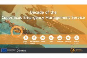
Implementing science to save lives: A Decade of the Copernicus Emergency Management Service
The Copernicus Emergency Management Service (CEMS) celebrates a decade of operation as a world leader in emergency mapping, early warning tools and open-access disaster information.
For the past ten years, CEMS has provided a global service as a fully operation emergency mapping service at no cost to users and with open access data.
Some highlights on the contribution of CEMS in global disaster risk management activities:
- 576 Rapid Mapping Activations with 5,500+ maps delivered
- Designed and implemented the world’s first Global Flood Monitoring tool
- Ten years of wildfire forecasts up to ten days into the future
- Average of 200+ flood and 500+ flash flood notifications to Member States and authorised users each year
- Offers a current and historical database of 7,000+ drought episodes since 1950
…
read more22/06/2022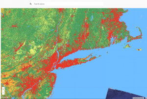 Publishing institution:
-
Publishing institution:
Extensive time-series on vegetation and wealth of operational satellites from space provides ample opportunities to monitor vegetation developments and more and more accurate yield forecast. This MOOC provides an introduction to “Droughts”, answers questions on how it can be quantified, how it can be assessed and monitored from space. The role of cloud computing and (easy) access to satellite will also get attention. No prior knowledge to Earth Observation (EO) is required. The MOOC provides a ‘smooth’ introduction for agricultural scientist, water resources specialist and others who are interested in water and food security and the role EO plays nowadays related to this theme. Every week a new set of movie and short quizzes will be released. The MOOC will be open till the end of November 2022.
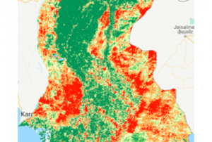
UN-SPIDER's Regional Support Office of Pakistan (SUPARCO) has provided a new Recommended Practice, using Google Earth Engine to identify the drought extent and severity by calculating different indices.
Drought is a slow on-set disaster which affects agriculture and associated livelihood in many parts of the world. It causes stress to vegetation; hence the extent of a drought can be reflected by changes in the vegetation condition. Geospatial scientists have developed drought indices based on remote sensing data to effectively detect drought conditions.
Droughts make considerable effects on agricultural and agro-pastoral areas due to their substantial dependency on rainfall. Agricultural drought monitoring is very important to maintain food security in the world. Satellite remote sensing is widely used for vegetation health monitoring and has become a powerful…
read moreRegional Support Offices mentioned:20/05/2022
On 10 May 2022, the United Nations Office for Outer Space Affairs (UNOOSA), the University of Energy and Natural Resources of Ghana, and the Prince Sultan Bin Abdulaziz International Prize for Water (PSIPW) inaugurated the 5th International Conference on the Use of Space Technology for Water Resources Management. The conference, held in Accra from 10 to 13 May 2022, aims to promote the use of space technology in water management in developing countries.
During the opening segment of the conference, high ranking authorities noted that there have been many success stories related to the Sustainable Development Goals (SDGs), but unfortunately some of these were eroded by the COVID 19 pandemic. They remarked that Ghana is hosting this conference to see how best to foster new partnerships to address the SDGs, and to facilitate a constructive discussion on two key issues essential to sustainable development: Space technologies and sustainable use of water…
read more12/06/2022- Recommended Practice: Agriculture Drought Monitoring and Hazard Assessment using Google Earth Engine
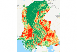 Drought is slow on-set disaster which affects agriculture and associated livelihood in many parts of the world. Drought causes stress to vegetation; hence the extent of a drought can be reflected by changes in the vegetation condition. Geospatial scientists have developed drought indices based on remote sensing data to effectively detect drought conditions. The Normalized Difference Vegetation Index (NDVI) is the normalized difference between near-infrared (NIR) and red reflectance. Simple and effective, it is one of the most widely used indices for detecting drought conditions. More recently…Regional Support Offices mentioned:
 ")
Natural disasters are becoming more frequent and intense across the globe. Enhancing resilience to increasing hazards, exposure, and vulnerability therefore requires leveraging of advanced geospatial technologies for better disaster mitigation and management. With continuous improvements in satellite data sensor acquisition parameters together with geo-computational approaches, geospatial technologies have emerged as the most powerful technology for all phases of disaster management. The course on advanced geospatial technologies for Disaster Risk Reduction (DRR) is scheduled from April 18 - 29, 2022 .
Course Content
- Overview of remote sensing & Geographic Information System
- Application of satellite communication technology for disaster mitigation
- Overview of UAV for disaster monitoring and mitigation
- Emerging geo computation, online GIS & Geo-web services for DRR
- Advanced application of Geospatial…
, March 6, 2021 - February 5, 2022")
On the Iberian Peninsula Portal and Spain are facing a severe drought, that started in November 2021 and worsened in the following months. Officials in Portugal were forced to limit the use of hydroelectric dams for power production and irrigation, as some reservoirs started reaching significant lows.
The extreme dimension of this event gets revealed on a pair of Landsat 8 OLI (Operational Land Imager) images, operated by NASA and USGS, comparing the state of the Alto Rabagão and Alto Lindoso reservoirs in northern Portugal from March 2021 to February 2022.
read more21/02/2022 Publishing institution:
Term Parents
UN-SPIDER Regional Support Offices with hazard-specific expertise
![]()