• English
  • Español
  • Français

United
Nations


Office for Outer Space Affairs
UN-SPIDER Knowledge Portal

  • Home
  • About Us
    • What is UN-SPIDER?
    • About UNOOSA
    • Publications
    • Jobs
    • Meet the Team
    • Contact
  • Space Application
    • Satellite Technology
    • Emergency Mechanisms
    • Recovery Mechanisms
    • International Asteroid Warning Network
    • Space Mission Planning Advisory Group
    • International Space Weather Initiative
    • Space Technologies in the UN
    • User Stories
  • Links & Resources
    • Data Applications
      • Disaster Recovery
    • Data Sources
    • GIS and Remote Sensing Software
    • Online Learning Resources
    • Institutions
  • Risks & Disasters
    • Disaster Risk Management
    • Early Warning Systems
    • Emergency and Disaster Management
    • Natural Hazards
    • Sendai Framework
    • The UN and Disaster Risk Management
    • The UN and Early Warning
    • The UN and Disaster Management
  • Advisory Support
    • Advisory Missions
    • Emergency Support
    • Virtual Advisory Support
    • Recommended Practices
    • Training Activities
    • Practical Uses
  • Network
    • Regional Support Offices
    • GP-STAR
    • MHEWS
    • IWG-SEM
  • Projects
    • SPEAR
    • SEWS-D
    • EvIDENz
    • Flood GUIDE
  • News & Events
    • News
    • Events Calendar
    • UN-SPIDER Events Archive

Breadcrumb

  • Home
  • Taxonomy Pages
  • Taxonomy Pages

Earthquake

Based on data from the Sentinel-1A satellite, this image shows how and where the land uplifted and sank from the 7.8-magnitude earthquake that struck Nepal on 25 April 2015. The image was generated by the German Aerospace Center (DLR) Earth Observation Center (EOC) using data acquired by Sentinel-1A before and after the earthquake event. Image: DLR/EOC

Definition

Sudden movement of a block of the Earth’s crust along a geological fault and associated ground shaking (IRDR Glossary).

Earthquake can be defined as the shaking of earth caused by waves moving on and below the earth's surface and causing: surface faulting, tremors vibration, liquefaction, landslides, aftershocks and/or tsunamis (WHO).


Facts and figures

The size or magnitude of earthquakes is determined by measuring the amplitude of the seismic waves recorded on a seismograph and the distance of the seismograph from the earthquake. These are put into a formula which converts them to a magnitude, which is a measure of the energy released by the earthquake. For every unit increase in magnitude, there is roughly a thirty-fold increase in the energy released. Earthquake magnitude was traditionally measured on the Richter scale. It is often now calculated from seismic moment, which is proportional to the fault area multiplied by the average displacement on the fault (Australian Government).

There are four different types of earthquakes: tectonic, volcanic, collapse and explosion.

  • A tectonic earthquake is one that occurs when the earth's crust breaks due to geological forces on rocks and adjoining plates that cause physical and chemical changes.
  • A volcanic earthquake is any earthquake that results from tectonic forces which occur in conjunction with volcanic activity.
  • A collapse earthquake are small earthquakes in underground caverns and mines that are caused by seismic waves produced from the explosion of rock on the surface.
  • An explosion earthquake is an earthquake that is the result of the detonation of a nuclear and/or chemical device.


Further information

USGS Earthquakes
PreventionWeb Earthquakes

UN-SPIDER Regional Support Offices with hazard-specific expertise

Title: Asian Disaster Reduction Center (ADRC)
Title: ERATOSTHENES Centre of Excellence
Title: Germany Regional Support Office
Title: Greece Regional Support Office
Title: Indonesia Regional Support Office
Title: International Centre for Integrated Mountain Development (ICIMOD)
Title: Pakistan Regional Support Office
Title: United States of America Regional Support Office

Related content on the Knowledge Portal

  • Emergency mechanisms provide mapping products for Indonesia earthquake and tsunami
    Copernicus Emergency Management Service (© 2018 European Union), [EMSR317] Palu - Indonesia, Grading Map.

    The International Charter “Space and Major Disasters” and the Copernicus Emergency Management Service Mapping have been activated on 29 September after a 7.5 magnitude earthquake in the central Indonesian Island of Sulawesi.

    At least 844 people have been killed and 64,000 displaced according to reports.

    The cities of Palu and Donggala are the worst affected areas by the earthquake and a tsunami with waves as high as six metres.

    The International Charter was activated by the Asian Disaster Reduction Centre (ADRC) on behalf of the Indonesian National Institute of Aeronautics and Space (LAPAN). Both institutions are UN-SPIDER Regional Support Offices (RSO). Mapping products made available under the activation are available on the…

    read more
    Regional Support Offices mentioned:
    Asian Disaster Reduction Center (ADRC), Indonesia Regional Support Office
    01/10/2018
  • Large‐Area Morphological Characterization of Urban Environments for Exposure Modelling
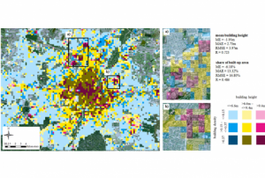
    Mapping of built-up height and share of built-up area for the example of the city of Munich. The estimated average built-up height features a mean absolute error (MAE) of 2.7 m (i.e., less than one floor) and the share of built-up area could be estimated with a MAE of 13.3 %, when compared to a reference data set.
    Publishing institution:
    1. German Aerospace Center (DLR)
  • GDACS - Map of disaster alerts in the past 4 days
    Derived products from various satellites processed by agencies in the field of disaster mapping.
    Publishing institution:
    1. UNITAR Operational Satellite Applications Programme (UNOSAT)
    2. United Nations Office for the Coordination of Humanitarian Affairs (OCHA)
  • Rapid response mapping in support of rescue and relief effort
    ,

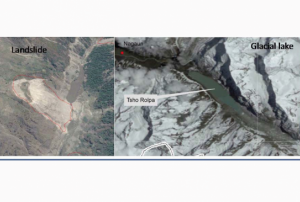
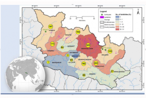
    Close to 2000 landslides were mapped using a high-resolution image of the post 2015 Nepal Earthquake made available through International Charter for Space and Major Disaster, and Sentinel Asia. The images were geo-referenced if not done prior to visual scanning for a fresh scar from landslide and rockslide. Cross-checking with pre-event images most of which are available on Google Earth helped confirm whether or not the event is related to the earthquake. There are many large glacial lakes in and around the earthquake affected region, which was regularly monitored using multi-temporal high-resolution satellite data to pick up signs of potential failure. Mapping of landslide and monitoring of glacial lake using earth-observation data provided much needed situational awareness on the geo-hazard situation.


    Publishing institution:
    1. International Centre for Integrated Mountain Development (ICIMOD)
  • UN‐SPIDER Technical Advisory Mission (TAM)
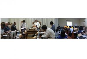
    After the TAM was conducted in Myanmar, innovative impacts were completed following a recommendation. “Emergency Operation Centre (EOC)”, which is comprised of four units including “Remote Sensing Unit” and “Risk Assessment and Emergency Response Unit” was established in the Ministry of Social Welfare, Relief & Resettlement (MSWRR). The capacity building of MSWRR and other related institutes in remote sensing and GIS were strengthened. The Disaster Management Training Centre now conducts courses in remote sensing/GIS. Myanmar has also become the first country in ASEAN to apply for universal access to the International Charter. Myanmar government is aware of the National Spatial Data Infrastructure (NSDI) and one map policy that has been initiated by the Ministry of Education is very crucial.
     
    read more
    Publishing institution:
    1. United Nations Office for Outer Space Affairs (UNOOSA)
  • UN‐SPIDER Knowledge Portal
    ,

    In order to encourage the targeted retrieval of space-based information and data by disaster risk reduction practitioners, content on the Portal is systematically enriched with metadata. For instance, data sources are marked up with data about their file type, satellite/sensor and spatial coverage and whether they relate to the disaster risk management or emergency response phase. The tool features a range of filters that draw on the metadata, thereby allowing users to narrow down their search, for example, filtering available GIS software by hazard type. This ensures that users efficiently find the content that is most relevant to them. At the same time, the Portal encourages the discovery of resources related to those accessed by the user, by providing links to them on the same page. This allows for contextualisation and highlights links between resources…

    read more
    Publishing institution:
    1. United Nations Office for Outer Space Affairs (UNOOSA)
  • UNOSAT Operational Satellite Mapping Service
    ,

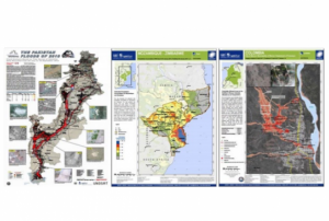
    Based on optical and radar images of different resolutions, UNOSAT products are also enriched with the available baseline GIS datasets and crowdsourcing data. Satellite-derived analysis performed by UNOSAT is delivered in the form of GIS Data, Static Maps, Live Web Maps, and Reports, and is then shared with a wide range of end-users such as UN Agencies, International Organizations, and Governments.

    Publishing institution:
    1. UNITAR Operational Satellite Applications Programme (UNOSAT)
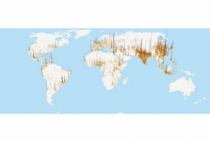
  • Global Human Settlement Layers Open data to measure global exposure in time
    , Global Population Map

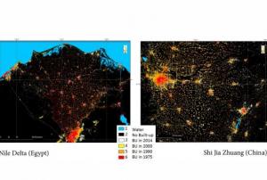
    The Global Human Settlement (GHS) framework produces global open source spatial information about the human presence on the planet over time. This is in the form of built up maps, population density maps and settlement maps. This information is generated with evidence-based analytics and knowledge using new spatial data mining technologies. The framework uses heterogeneous data including global archives of fine-scale satellite imagery, census data, and volunteered geographic information. The data is processed fully automatically and generates analytics and knowledge reporting objectively and systematically about the presence of population and built-up infrastructures. 

Pagination

  • First page « First
  • Previous page ‹ Previous
  • …
  • Page 12
  • Page 13
  • Page 14
  • Page 15
  • Current page 16
  • Page 17
  • Page 18
  • Page 19
  • Page 20
  • …
  • Next page Next ›
  • Last page Last »

UN-SPIDER Regional Support Offices with hazard-specific expertise

Title: Asian Disaster Reduction Center (ADRC)
Title: ERATOSTHENES Centre of Excellence
Title: Germany Regional Support Office
Title: Greece Regional Support Office
Title: Indonesia Regional Support Office
Title: International Centre for Integrated Mountain Development (ICIMOD)
Title: Pakistan Regional Support Office
Title: United States of America Regional Support Office

Footer menu

  • Contact
  • Terms of Use

User account menu

  • Log in