Pollution
UN-SPIDER Regional Support Offices with hazard-specific expertise
Related content on the Knowledge Portal
The National Aeronautics and Space Administration (NASA), the European Space Agency (ESA) and the Republic of Korea are working together on a global satellite constellation of three space-based instruments that could track global pollution on an hourly basis. These air quality satellites will measure pollutants, including ozone, nitrogen dioxide, formaldehyde and tiny atmospheric particles called aerosols in order to enhance our understanding of air quality and air pollution. To date, air quality satellites have collected data only once a day. These three new instruments will provide hourly, highly detailed and near-real-time data that will improve air quality science and forecasting around the world, in particular around the most densely populated areas of the Northern Hemisphere.
Collecting data hourly will…
read more30/03/2020- Publishing institution:
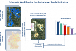
To meet the global challenges, the United Nations adopted several framework agreements, including the Sendai Framework for Disaster Risk Reduction at the Third United Nations World Conference on Disaster Risk Reduction (2015-2030). The framework builds the international reference point for disaster preparedness and focuses on reducing existing and future disaster risks as well as enhancing disaster resilience. In the Sendai framework, seven global targets have been agreed to measure global progress in implementing the framework through quantifiable indicators and to present, compare and evaluate the status and progress uniformly worldwide. The recording of the status and degree of target achievement using the agreed indicators requires the use of various data sources, which must be consistent and comparable in time and space in order to ensure global monitoring.
Publishing institution:Sentinel Hub, together with the European Earth Observation programme Copernicus and the European Space Agency, are looking for new and innovative ideas and scripts for Sentinel data processing and visualization. The contest will run until 5 May 2019 and all the entries will be judged by a jury of experts on functionality and usefulness, as well as possible commercial value.
The EU Earth Observation Browser and similar services are made possible through open data policies, which allow everyone to access and use satellite data. Thanks to these policies a wide variety of fields are creating applications for satellite data, however, they need support to make use of the data for these applications. Custom scripts are an easy and quick way to add value to already available data and rapidly test new algorithms.
The Sentinel Hub Custom Script Contest is a remotely run hackathon engaging data…
read more23/04/2019- The Tanzania Commission for Science and Technology (COSTECH), in partnership with the Revolutionary Government of Zanzibar (RGoZ), has launched an initiative to produce detailed aerial imagery maps of the islands of Zanzibar. The cooperative project is called the Zanzibar Mapping Initiative (ZMI). This initiative has drawn global attention because the mapping is done entirely with drones; the ability to map is now available widespread at a local level. The maps produced are of exceptional spatial resolution. Additionally, their free and open source data sets includes a comprehensive compilation of available vector and raster data covering the whole of Tanzania. Users can find not only aerial imagery produced from drones, but everything from census data to land use layers.
More information can be found on the ZMI project website: http://www.zanzibarmapping.com/Publishing institution: - ESA's Earth Observation Thematic Exploitation Platform (TEP) is a browser for satellite imagery and specific products on an environmental topic. The TEP platforms are divided into 7 categories: Coastal; Forstry; Geohazards; Hydrology; Polar; Urban; and Food Security. Each platform is a collaborative, virtual work environment providing access to EO data and the tools, processors and Information and Communication Technology resources required to work with them. TEP aims to bridge the gap between the users and the data and tools.Publishing institution:
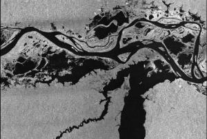
This webinar provides the basics of image processing for oil spill mapping. It demonstrates how to access the RUS Service and how to download, process, analyse and visualize the free data acquired by the Copernicus satellites. The ESA SNAP Sentinel-1 Toolbox will be employed to demonstrate the methodology to map an area affected by this type of pollution.


