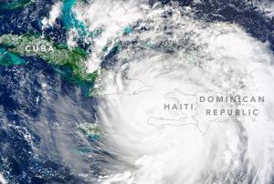
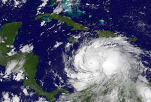
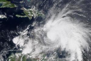
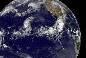
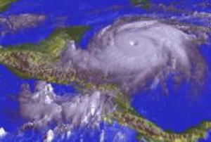
The storm, which has already affected other Caribbean countries like the Dominican Republic and Cuba, triggered floods, landslides and fatalities. According to Euronews the storm, now on its way to the Bahamas and the USA, is weakening and has been reduced from a category four to a three hurricane. More information is available here.
América Latina / Caribe
country taxonomy block
On 5 October 2016 the International Charter Space and Major Disasters was activated in the Dominican Republic. Floods, evacuated people, and four deaths are among the reasons for the activation.
The activation of the Charter was requested by the National Emergency...
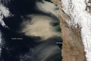
On the beginning of July 2016, airborne dust reached the coast of Chile. This phenomenon hardly ever occurs in the west coast of South America, according to atmospheric researchers.
The Moderate Resolution Imaging Spectroradiometer (MODIS) on the Terra satellite of the National Aeronautics and Space Administration (NASA) captured some natural-color images of the event on the 8 of July.
The dust source seems to be located between the Andes mountain range in South America and the Pacific coast, especially from an elevated slope allowing the dust to be transported that far.
The storm which brought the dust over Chile was accompanied by wind, rain and snow, reducing the visibility in nearby cities and leading to the...
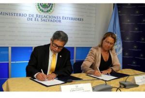
moreMs. Simonetta Di Pippo, Director of UNOOSA, carried out an official visit to El Salvador, which was arranged by the Ministry of Foreign Affairs and the Permanent Mission of El Salvador to the United Nations Office at Vienna as a follow-up to the recent incorporation of El Salvador as a member of the Committee on the Peaceful Uses of Outer Space. He mission to El Salvador served to provide visibility to the on-going efforts conducted by UNOOSA and the Committee on the Peaceful Uses of Outer Space to define the 2030 Space Agenda through the UNISPACE+50 process.
Two key activities in her visit included presentations to high ranking officers in government ministries and technical staff on the role and activities conducted by UNOOSA and the on-going UNISPACE+50 process. In addition, the opportunity was used by the Ministry of Foreign Affairs of El Salvador and UNOOSA to sign an memorandum of agreement as a...
moreUN-SPIDER published a new recommended practice in its Knowledge Portal outlining detailed step-by-step procedures to support drought monitoring. The practice was developed by researchers from the Federal University of Santa Maria in Brazil (UFSM). The procedure has been used to elaborate drought-related maps for Brazil in recent years.
With this recommended practice, one more milestone was reached within the Strengthening Early Warning Systems for Droughts (SEWS-D) project. The SEWS-D project aims to contribute to the institutionalization and the improvement of EWS dedicated to drought through the incorporation of the routine use of satellite information, specifically by promoting the use of FAO’s ASIS system and the use of information derived from other indexes generated using satellite imagery. Such indexes focus on the impacts caused by droughts on the vegetation and complement...
moreThe ongoing El Niño event is already classed as one of the strongest in recent decades. El Niño usually peaks around Christmas and has in the past been known to cause prolonged droughts and extreme rainfall events in several regions of the world. These consequences have further negative effects on food security, infrastructure, water availability, and people’s livelihoods. Because El Niño is a recurring event and because of past experiences, areas that are usually hit the hardest have now taken actions to mitigate its effects.
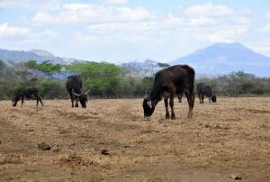
Latin America is already experiencing a number of extreme weather events during the last recent months. Several areas in Central America have been hit by drought, affecting around 3.5 million people and leaving more than 2 million people needing food aid. The situation is aggravated due to the lack of rainfall since 2014. Other areas affected by the same event include communities in Colombia, Venezuela and northeastern Brazil. As a result, a...
moreUN-SPIDER and its Regional Support Office IGAC conducted a Regional Expert Meeting in Bogota, Colombia from 12 to 14 August within the International Geomatic Week carried out by the Geographic Institute Agustin Codazzi (IGAC). The meeting brought together around 20 participants from the Caribbean, Central America and South America.
The Regional Expert Meeting benefitted from the participation of regional and international experts from the Regional Centre for Space Science and Technology Education for Latin America and the Caribbean (CRECTEALC), the International Research Centre on El Niño Phenomena (CIIFEN), the Federal University of Santa Maria in Brazil (UFSM) and the Central American Agriculture and Livestock Committee (CAC). At the national level, the Expert included participants from the Ministry of Environment of the Dominican Republic; the Ministry of the Presidency and the National Contingencies Commission (COPECO) of Honduras; the National Coordinating Agency...
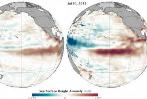
moreScientists at NASA’s Jet Propulsion Laboratory have found that the ocean levels in Central and Eastern Pacific have increased between March and July 2015, which bears a resemblance to the conditions of the potent El Niño event of 1997-98. The research was carried out through altimetry measurements captured by the OSTM/Jason-2 satellite.
The scientists display a map where sea surface height is measured. Red colour indicates an increase in height due to higher temperatures compared to the average ones (thermal expansion), while blue shows a decrease in sea level because of temperatures lower than average (water contraction). White indicates normal sea level conditions.
They also compare the current situation with sea surface height in the Pacific during July 1997, which was captured by the former TOPEX/Poseidon mission. By analyzing the maps, they found out that the current situation seems even more intense than in 1997, when warming brought...
moreNearly fifteen years ago, space agencies established the International Charter Space and Major Disasters as a way to contribute to disaster response efforts in countries affected by large disasters. In 2012, the Charter introduced its Universal Access principle, allowing national disaster management authorities around the world to submit requests to the Charter for its activation in case of disasters.
The Argentinean National Space Commission (CONAE) and UN-SPIDER have joined forces in recent months to reach out to National Emergency Operation Centres operated by national disaster management authorities in Latin American countries to make them aware of the Charter and to engage them to register as authorized users.
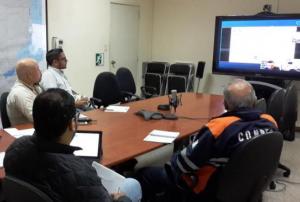
Through video conferences, CONAE targets directors and staff of these Emergency Operation Centres to make them aware of the Charter, its assistance, the way in which the Charter is activated and is following up with...
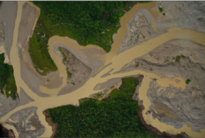
moreThe Agustín Codazzi Geographic Institute (IGAC) through its Research and Development in Geographic Information - CIAF, is developing a methodology to support the identification of illegal areas of opencast mining activities in the north-east of Antioquia Department, Colombia, by using remote sensing and geographic information systems.
According to reports of Colombian Ministry of Mines and Energy in 2011, 63% of the mines do not have legal permits. This makes it very difficult to control, monitor and regulate, which generates environmental and social risks at all levels. The situation greatly affects local communities.
The methodological design of the approach is based on the processing of remote sensing images such as RapidEye, Ultra CAMD and LDCM Landsat 8, visual interpretation, Object-Oriented Image Processing and radar interferometry. The results could enable the environmental authorities to develop a management tool based on remote sensing and geographic...
moreIGAC, the Agustín Codazzi Geographic Institute, UN-SPIDER's Regional Support Office in Colombia, as part of the celebration of its 80 year anniversary, is presenting the sixth edition of the International Geomatics Week. This time the event will take place between 10 and 14 August of 2015 at the Wyndham Hotel Bogota, Colombia.
International Geomatic Week 2015 will focus on "Geospatial information for building peace" and include conferences, workshops, poster sessions, panels and trade shows, all focusing on technological innovations related to Geomatics technologies. The event will include the observation of the International Year of Soils and the Forum of Colombian Spatial Data Infrastructure - ICDE, with a special programme.
Topics will include:
- Spatial Data Infrastructures (SDI).
- Unmanned aerial systems (UAS) and their applications in agriculture, geology, urban uprisings, cartographic update.
- Hyperspectral imaging.
- Radar and Lidar...
Honduran and Colombian authorities participated in an exchange of knowledge to reduce disaster risk. Representatives from national and municipal authorities from both countries did a study visit in Colombia, preparatory sessions and workshops to share their experience.
As Honduras is one of the countries that is most affected by climate change and disasters triggered by natural hazards the Honduran government wants to adopt a more proactive disaster risk management (DRM) approach, and therefore increase their knowlegde and capacity on how to incorporate risk reduction and prevention into overall development.
Colombia, on the other hand, has established itself as a role model in implementing a comprehensive DRM strategy, including technical assistance to municipalities. The South-South exchange provides a substantial increase in the knowledge and skills on how to consolidate policy and institutional frameworks with an integral emphasis on natural hazards.
... moreEl Instituto Geográfico Agustín Codazzi (IGAC) de Colombia y UNOOSA firmaron en el año 2011 un acuerdo de cooperación para establecer la Oficina Regional de Apoyo en Colombia. IGAC promueve en Colombia el uso de información obtenida desde el espacio para distintos propósitos y ha apoyado a ONU-SPIDER en sus actividades conducidas en América Latina y el Caribe. Como Oficina Regional de Apoyo, IGAC continúa ofreciendo expertos a ONU-SPIDER para su Asesoría Técnica a países de la región con el objetivo de contribuir en los esfuerzos de fortalecimiento de capacidades en la región.
L'Institut Géographique Agustin Codazzi (IGAC) de Colombie et l'UNOOSA ont signé un accord de coopération pour établir un Bureau Régional de Soutien de UN-SPIDER en 2011. L'IGAC encourage l'utilisation d'informations spatiales en Colombie à diverses fins et soutient ONU-SPIDER dans les activités menées en Amérique Latine et dans les Caraïbes. En tant que BRA, l'IGAC continue de fournir des experts pour le soutien consultatif technique de ONU-SPIDER aux pays de la région et de contribuer aux efforts de renforcement des capacités dans la région.
The Agustin Codazzi Geographic Institute (IGAC) of Colombia and UNOOSA recently signed a cooperation agreement making IGAC the newest UN-SPIDER RSO. IGAC has been promoting the use of space-based information within Colombia for a variety of purposes and has also been supporting UN-SPIDER in activities conducted in Latin America and the Caribbean. As an RSO, IGAC will continue to provide support in terms of experts towards the provision of technical advisory support to countries within the region and will contribute to capacity building efforts in this region.
