India

country taxonomy block

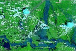
The Government of India has established 176 flood forecasting stations across the country which would help to monitor river flooding during monsoons. The stations use information captured by Indian satellites, including near-real time flood inundation maps provided by the National Remote Sensing Centre.

The Central Water Commission (CWC), belonging to the Ministry Water Resources, is in charge of predicting floods in major rivers and their tributaries through rainfall-runoff models provided by the India Meteorological Department. CWC has also used remote sensing imagery and geographical data for monitoring water bodies in the Himalayan region.

Uma Bharti, Minister of Water Resources, stated that "it (Ministry) has set up 176 flood forecasting stations in the country where flood forecasts are issued in every monsoon whenever water level or the inflow in a river exceeds the predefined criteria."

more
Publishing date 14/08/2015

The Indian Space Research Organisation (ISRO) will map 500 cities in September this year. Urban planners' work is to be supported by this information and nearly 50 million people are expected to benefit from the outcome.

Satellite images are going to be used by the National Remote Sensing Centre (NRSC) to illustrate several features of cities with an average of 100 thousand inhabitants each.

The director of NRSC, V.K Dadwal, highlights the importance of the project for the future, done in cooperation with the Indian government: “the urban development ministry and Isro are working on a master plan formulation of these cities so that a vision document can be made on how the city is to be developed”. The initiative is to support the Atal Mission for Rejuvenation and Urban Transformation (AMRUT), launched in June.

AMRUT aims to focus on water supply, sewerage, storm water drains, pedestrian facilities and public transport; as well as to improve...

more
Publishing date 13/08/2015

The International Water Management Institute, UN-SPIDER’s regional Support Office, organised together with the CGIAR research program on Climate Change, Agriculture and Food Security (CCAFS) a day long workshop in Patna, India, to present a new project on the development of the Index‐Based Flood Insurance (IBFI) on August 1.

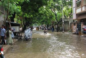
Due to the constant floods India is facing every year and the huge losses these events produce, the IBFI project aims to implement the use of space technologies such as remote sensing images and geographic information systems (GIS) in order to improve the insurance's payout processes. Along with flood hazard models, these technologies can help developing reliable flood parameters for insurances, speed the compensation and therefore reduce harms for low-income communities from flood prone areas.

“Through this project we want to increase the agriculture resilience of the vulnerable farmers in flood prone regions. This is a first of its...

more
Publishing date 06/08/2015
Regional Support Offices mentioned:

The International Centre for Integrated Mountain Development (ICIMOD), UN-SPIDER’s Regional Support Office (RSO), has developed a programme in order to prevent and manage forest fires through the SERVIR-Himalaya Small Grants Programme, and in conjunction with the South Asian Forum for Environment (SAFE). The project includes a platform based on remote sensing information to understand how land use affects forest fires, and awareness campaigns among the local communities of Northeast India.

The platform is a one-window tool that offers data on hazard zones, vulnerable areas, accessibility, affected settlements, mitigation options, and future predictions to support disaster preparedness. According to Nilayam Tam, Director of the State Forest Research Institute in Tawang District of Arunachal Pradesh, ”GIS and remote sensing are such important and empowering tools that they must be integrated into...

more
Publishing date 03/08/2015

The Indian advanced weather satellite INSAT-3D has already completed two years of successful activity after its launch on July 26, 2013.

The INSAT-3D mission's main aim is to provide meteorological observations through the monitoring process of land and ocean surfaces and the generation of vertical profile of the atmosphere in terms of temperature and humidity for weather forecasting and disaster warning, among others.

As the Indian Space Research Organisation (ISRO) explains in its website, “INSAT-3D is an exclusive mission designed for enhanced meteorological observations and monitoring of land and ocean surfaces for weather forecasting and disaster warning. INSAT-3D is the first Indian geostationary satellite, equipped with sounder instrument that provides frequent good quality atmospheric profiles (temperature, humidity) over Indian...

more
Publishing date 30/07/2015

The Indian Ministry of Earth Sciences in collaboration with the Department of Space of the National Remote Sensing Centre, and the Center for Ocean and Atmospheric Prediction Studies (Florida State University), has found a more precise parameter for predicting rainfalls during monsoons. It is called Ocean Mean Temperature (OMT) and  is a better indicator than the currently used Sea Surface Temperature (SST). Scientists state that the SST does not represent the heat energy available to the atmosphere on many occasions as it only takes into account the sea-surface skin, while OMT focuses on the whole upper layer of the ocean.

According to Dr. M Rajeevan, researcher at the Ministry of Earth Sciences, "besides improving the understanding of the physics of the challenging problem of predicting monsoons, it is necessary to evaluate the efficiency of the input parameters used in models. The atmosphere interacts with the upper layer of the ocean rather with the sea-surface...

more
Publishing date 14/07/2015

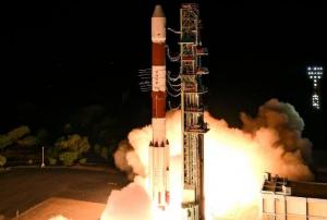
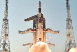
The Indian Space Research Organisation (ISRO) launched on Friday, July 10, three 1 meter resolution optical Earth observation satellites as part of the PSLV-C28 / DMC3 Mission from Satish Dhawan Space Centre, Sriharikota (SDSC-SHAR), the spaceport of India.

The three identical DMC3 satellites were built by the British company Surrey Satellite Technology Limited (SSTL), and have been launched from the Polar Satellite Launch Vehicle (PSLV), in its thirtieth flight (PSLV-C28). These three Earth observation satellites will form the DMC3/TripleSat Constellation.

As explained in ISRO’s website, the DMC3 constellation, comprising of three advanced mini-satellites DMC3-1, DMC3-2 and DMC3-3, is designed to address the need for simultaneous high spatial resolution and high temporal resolution optical Earth Observation. Launched into a single Low-Earth Orbit plane and phased with a separation of 120° between them, these satellites can image any target on the Earth...

more
Publishing date 13/07/2015

The Indian National Centre for Ocean Information Services (INCOIS) is working on the creation of 3D Geographic Information System (GIS) maps to ease the evacuation of people from vulnerable areas at risk of tsunami or other natural disaster.

The INCOIS team has been focusing on a multi-hazard vulnerability mapping of the coastal as well as the inland areas of Puducherry town which will bring as result 3D GIS maps of the vulnerable areas. These maps will support the local and disaster management agencies to better plan the evacuation process when a natural disaster warning is issued.

“The multi-hazard vulnerability mapping of around 3,600 square kilometres of coastal areas are being planned, out of which nearly 500 kilometres have been mapped so far,” said the INCOIS Director, Satheesh C. Shenoi, according to The New Indian Express. 

more
Publishing date 07/07/2015

The National Mission for Clean Ganga (NMCG), carried out by the Government of India, will monitor the pollution of river Ganga using geospatial and crowd-sourcing technologies.

The National Mission for Clean Ganga (NMCG) of the Ministry of Water Resources, River Development and Ganga Rejuvenation has signed an agreement with the National Remote Sensing Centre (NRSC) of the Indian Space Research Organization in order to use geospatial and crowd-sourcing tools for pollution monitoring in river Ganga.

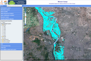
To support Clean Ganga Mission on decision making and planning, the Bhuvan Ganga mobile application and the Bhuvan Ganga web portal have been launched. The mobile app allows users to collect and report information related to pollution sources affecting the water quality of river Ganga.

The web portal provides geospatial...

more
Publishing date 30/06/2015

UNESCO Category 2 Centre on World Natural Heritage Management & Training for the Asia-Pacific Region is organizing the “International Workshop and Training on The Role of Natural World Heritage Sites in Disaster Risk Reduction”, which will be held in the headquarters of the Wildlife institute of India, in Dehradun, between the 24th and 28th of August.

UN-SPIDER is also participating in the workshop, as well as UNISDR, IUCN-DRR, UNESCO, FAO, NDMA, ICIMOD, TISS-JTCDM and IIRS, in order to discuss, deliberate and train on the mitigation strategies to be adopted for Natural World Heritage sites and Protected Areas in the Asia-Pacific region.

The objectives of the training are: i) to identify and assess natural and man-made disaster risks at World Heritage properties in the Asia-Pacific Region; ii) to raise awareness about the need to integrate...

more
Publishing date 26/06/2015

India has prepared a concept note of the new SAARC satellite (tentatively called SAARC SAT) to the other members of the South Asian Association for Regional Cooperation (SAARC), in preparation of a special meeting this week. SAARC is an economic and geopolitical organisation of eight countries that are primarily located in South Asia or Indian subcontinent.

The main areas of application for SAARC SAT include telemedicine, emergency communication in disaster situations, intergovernmental and business networks, online skill development and even television broadcasting.

SAARC SAT was proposed by the Indian PM Norendra Modu last year and will be a two ton communication satellite for the whole region. It will be funded by India and launched using the Indian Space Research Organization’s (ISRO) launch vehicle at the spaceport of Sriharikota....

more
Publishing date 22/06/2015

The National Aeronautics and Space Administration (NASA) and Indian Space Research Organisation (ISRO) are working together on a project to monitor earth changes in high detail.

The project is called NASA-ISRO Synthetic Aperture Radar (Nisar) mission and will be launch into Earth’s orbit in 2020. The mission will study the consequences of climate change by continuously monitoring changes occurring on the Earth’s surface, even ice-sheet movements, said Dr Mylswami Annadurai, director of ISRO's satellite centre in Bengaluru in India.

At the same time the mission is expected to support India’s earthquake early warning system. Therefore India is also developing the Indian Regional Satellite Navigation System (IRNSS), a regional navigation system in order to replace the Global Positioning System (GPS), which is a space-...

more
Publishing date 03/06/2015

The state government of India is using satellite technology to keep an eye on the progress of water conversation schemes across more than 30,000 sites of Jalyukta Shivar Scheme in Maharashtra. 'Jalyukta Shivar Abhiyan' is the flagship programme of Chief Minister Devendra Fadnavis who has set a target to rid Maharashtra of drought within a period of five years.

All projects are supervised by the Maharashtra Remote Sensing Application Center (MRSAC), whose office is in Nagpur. The state is monitoring the progress in order to complete the work before monsoon sets in.

In a first phase the government has choosen 6,000 villages out of 20,000 which are in drought prone areas. “More than 30,000 water conservation projects are in progress in the selected 6,000 villages," Fadnavis told reporters. "Maharashtra Remote Sensing Application Center has recorded the longitude and latitude of each project which is undertaken by Jalyukta Shivar Yojna...

more
Publishing date 21/05/2015

The Vietnamese Ministry of Natural Resources and Environment and the Indian Department of Space will promote cooperation in remote sensing and outer space technology via joint projects in human resources training and in applying remote sensing technology.

According to an article in Vietnamplus, the two sides made the joint decision during working sessions between a delegation of the Vietnamese ministry, which made a three-day visit to India recently, and officials from India’s Ministry of External Affairs, Department of Space, and Space Research Organisation. 

Both are making preparations for establishing a centre for satellite tracking, data reception and processing for the Association of Southeast Asian Nations (ASEAN). The center will be located in Vietnam where...

more
Publishing date 18/05/2015

An agreement signed by all South Asian Association for Regional Cooperation (Saarc) states (Afghanistan, Bangladesh, Pakistan, Sri Lanka, Maldives, Nepal, Bhutan and India) is underway to promote a rapid response to natural disasters.

A Saarc monitoring system including tools for early warning system and risk mitigation could ease the humanitarian and technical assistance in member states when affected by natural disasters, facilitating for instance disaster relief or information on potential risks.

India is taking a leading role in setting up the system and is committed to provide technical assistance to all member states, besides manpower and financial support, as The Times of India informed.

"New Delhi was signatory to an agreement in Jakarta this January to develop a standard operating procedure for the region," said Santosh Kumar, director of Saarc Disaster Management Centre and executive director of the National Institute of Disaster Management.

more
Publishing date 29/04/2015

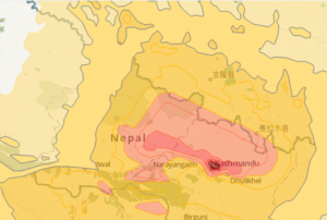
On Saturday, 25 April 2015 a 7.8 magnitude earthquake hit Nepal, India, Bangladesh, and India with several aftershocks following on Saturday and Sunday. GDACS estimates that 6.5 million people are affected. Several actors from the satellite and mapping communities have become active in supporting response efforts in the region; particularly in Nepal, which was most severely affected.

  • Copernicus Emergency Mapping Service (EMS) was activated by EC Services|DG ECHO. Maps are available at the EMS webpage. Regular updates on mapping products are also available via subscription to the Copernicus EMS RSS feed.
  • The International Charter on Space and Major Disasters...
more
Publishing date 27/04/2015

The International Charter: Space and Major Disasters was activated to support response efforts in Jammu and Kashmir State with satellite-based maps. The region is experiencing flooding and resulting landslides following several days of heavy rain. 

16 people were killed after an unpredictable landslide crushed two houses in Chadoora. In the affected area several hundred people have been evacuated, inhabitants of the less dangerous regions have been advised to move to higher ground until the situation ends. The rain already stopped and the flood waters have started receding, but since forecasts suggest there maybe more rain in the near future, the situation is not yet over.

The mechanism was triggered by the Indian Space Research Organisation ISRO. The project management of the activation will be handled by India's National Remote Sensing Centre (NRSC). The maps will be ...

more
Publishing date 02/04/2015

UN-SPIDER is planning to conduct two training programmes in April. 

From 5 to 9 April 2015, the programme is jointly organizing the five-day course "Earth observation technologies for disaster damage and loss assessment" in Dhaka, Bangladesh with the Department of Disaster Management (DDM) in Bangladesh.

It aims to strengthen damage and loss assessment by teaching the use of satellites images to contribute to damage and loss assessment. It will allow DDM and important stakeholder departments with easy, rapid and accurate ways of assessing damage and loss during disasters using satellite remote sensing. It more specifically aims to impart skills on using satellite remote sensing for multi-hazard risk assessment, damage assessment of important sectors like agriculture, housing, road infrastructure and demography. Experts from the following organisations are contributing to the training by conducting lectures and hands-on sessions: National Disaster...

more
Publishing date 01/04/2015

As announced in the beginning of March, the Indian Space Research Organisation (ISRO) successfully launched its fourth regional navigation satellite IRNSS-1D on 27 March from Sriharikota, Andhra Pradesh, India. The satellite, launched onboard the Polar Satellite Launch Vehicle (PSLV-C27), was already in orbit 21 minutes after take-off.

IRNSS-ID is part of the Indian Regional Navigation Satellite System (IRNSS), which is currently created by ISRO. Once completed, it will consist of 7 satellites and provide navigation, tracking and mapping services on a regional level (South Asia). The Standard Positioning Service will be open for public, more advanced services however will be encrypted and accessible only for authorized users, such as the military.

Publishing date 01/04/2015

The Indian Space Research Organisation (ISRO) anounced the launch of its fourth regional navigation satellite at the end of March, after deferring the planned launch on 9 March.

The Indian Regional Navigation Satellite System (IRNSS-1D) was supposed to be launched on March 9 by the Indian rocket Polar Satellite Launch Vehicle (PSLV-XL), however the launch had to be postponed due to one of the telemetry transmitters not working properly. 

M.Y.S. Prasad, director of the Satish Dhawan Space Centre (SDSC), stated: “We are planning to launch the satellite by the end of this month. The replacement transmitter is getting ready and will be brought from our centre in Bangalore.”

The fourth regional navigation satellite will be part of a constellation of seven satellites to provide accurate position information service to users across the country and the region, extending up to an area of 1,500 km. The entire IRNSS constellation of seven satellites is...

more
Publishing date 12/03/2015

The private company Trimble India developed a new instrument for improved earthquake early warning and volcano monitoring. The intergrated Global Navigation Satellite System (GNSS) reference receiver, broadband seismic recorder and a force-balance triaxial accelerometer for infrastructure and precise scientific applications can provide real-time GNSS positioning and seismic data for disaster preparedness as well as for infrastructure monitoring for buildings, bridges, dams as well as other natural and manmade structures.

In a press release, Trimble India stated: "Announcing the launch, Ulrich Vollath, General Manager Infrastructure Division who also heads the Earth Systems at Trimble Navigation said that this product will be a game changer, bringing best of two worlds of high resolution seismic observations (through accelerometer) and high frequency geodetic measurements (through GNSS) together that resonates with Indian market."

more
Publishing date 19/02/2015

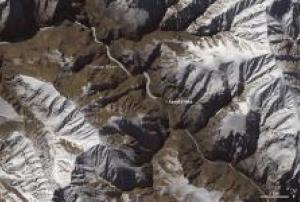
The Indian Space Research Organization (ISRO) analysed satellite images collected from the CartoSat-2 satellite in order to evaluate the damages caused by a landslide in the Indian states of Jammu and Kashmir.

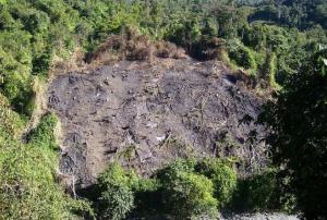
The landslide, which occurred on 31 December 2014, is blocking the Tsarap River which may lead to a damaging flood downstream. According to ISRO's evaluation, the earthen dam is about 600 meters long and about 60 meters high.

CartoSat-2 satellite imagery show that the artificial lake that formed behind the mound of debris blocking the river is nearly 8 kilometers long and covered about 55 hectares.

While the chance of a catastrophic flood is lower with the lake frozen, the risk will increase when temperatures rise in the spring. As a consequence, precautionary measures will be adopted by Indian authorities...

more
Publishing date 27/01/2015

The Indian Space Research Organization (Isro) is preparing the launch of four navigation satellites in order to finalize the seven-satellites constellation of the the Indian Regional Navigation Satellite System (IRNSS).

The IRNSS satellites will be put into orbit in 2015 to complete the constellation of navigation satellites that provides accurate position information service to users in India as well as the region extending up to 1500 km from its borders.

IRNSS-1D will be the first satellite to be launched during the year and it will enhance the accuracy and efficiency of the IRNSS. “The launch campaign for IRNSS 1D has come, which starts on January 16. Within two months, all components from other ISRO labs have to reach Sriharikota. The launch is likely after March 15,” a senior ISRO official stated.

Among the applications of IRNSS are terrestrial, aerial and marine navigation, disaster management, vehicle tracking and fleet management, integration...

more
Publishing date 15/01/2015

The Centre for Space Science and Technology Education in Asia and the Pacific (CSSTEAP) has recently announced its 20th Post Graduate Course in Remote Sensing and Geographic Information Systems. The Course will take place at the Indian Institute of Remote Sensing (IIRS), ISRO, Dehradun, India from July 1, 2015 to March 31, 2016. CSSTEAP is now accepting applications from qualified candidates.

So far, CSSTEAP, which is affiliated to the United Nations, has conducted 18 Post Graduate Courses in Remote Sensing and GIS (nineteenth course is presently ongoing), 9 courses in Satellite Communications, 8 courses each in Satellite Meteorology and Space Sciences (ninth course is ongoing) and several short terms courses/workshops. 1389 participants from 34 countries of Asia-Pacific have benefitted from these programmes.

More information on the programme and on the application process is available from the...

more
Publishing date 13/01/2015

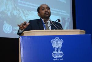
The "Roundtable Meetings on Innovations in Technologies for Disaster Rescue Efforts amongst ASEM countries" took place on 4 and 5 December 2014 in New Delhi, India. ASEM is the Asia-Europe Meeting. Shirish Ravan of UN-SPIDER co-chaired a session on Technology Transfer: Joint ventures among ASEM Countries and presented the topic "Consideration for Effective Use of Space-based Information for Emergency Response".

The main objective of the meetings was to focus the attention of ASEM member countries on how technology innovations can be utilized to save lives and reduce effective response time by Governments. Participants also addressed how ASEM countries can contribute to capacity building both in Asia and Europe through the sharing of best practices. Another goal of the meetings was to facilitate partnership building among interested ASEM countries and their industry. This...

more
Publishing date 15/12/2014